Newaygo State Park Campground
Community Reviews
Been here? Share the conditions.
Reviews, ratings & photos are added in the free Snoflo iOS app — rate a spot, tag the conditions, and your visit is verified by location. Add or manage your reviews from the app.
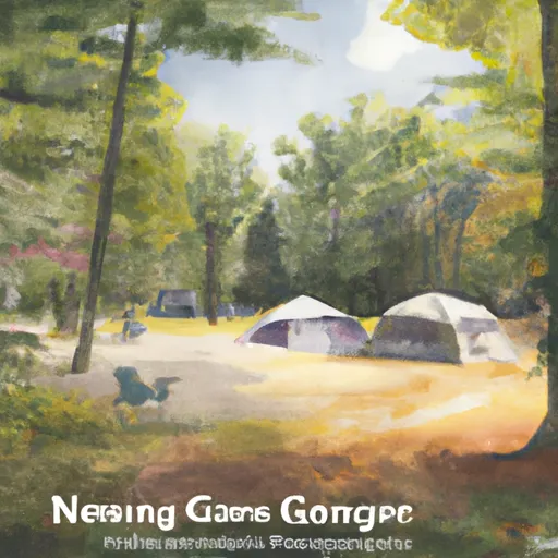
Newaygo State Park
Reservations are accepted at Newaygo State Park, allowing campers to secure their preferred site in advance. It is highly recommended to make reservations, especially during the peak season, to guarantee availability. The best time to visit this campground is from late spring to early fall when the weather is pleasant for outdoor activities. During this time, campers can enjoy hiking and biking on the park's scenic trails, fishing in the nearby Muskegon River, or simply relaxing by the campfire.
Newaygo State Park offers various attractions and activities for campers. Nature enthusiasts can explore the park's diverse wildlife, including deer, squirrels, and a variety of bird species. The nearby Muskegon River provides excellent opportunities for fishing and canoeing, with smallmouth bass and trout being the most commonly caught species. However, visitors should be cautious of poison ivy, which can be found in the park. It is advisable to educate oneself on identifying and avoiding this plant to prevent any unwanted encounters. Overall, Newaygo State Park is a great destination for camping enthusiasts seeking a peaceful and enjoyable outdoor experience in Michigan.
What's on-site at Newaygo State Park
Key facilities Snoflo tracks for this campground. Confirm with the operator before booking -- amenities can change seasonally.
Plan your trip down to the hour
Same weather feed Snoflo's iOS app uses -- updated continuously from NOAA / yr.no.
Next 5 days, hour by hour
Temperature line with weather symbols on top, snow + rain accumulation as columns, humidity as a dotted line.
5-day forecast table
Every 3 hours, broken out across temperature, snow, rain, humidity, and wind. Each cell is colour-coded relative to the column min/max so trends jump out at a glance.
| Time | Condition | Temp (°F) | Snow (in) | Rain (in) | Humidity (%) | Wind (mps) | Wind dir |
|---|---|---|---|---|---|---|---|
| Loading detailed forecast… | |||||||
15-day temperature & precipitation
Daily temperatures, snow, and rain projected over the next two weeks. Hover any point for the full breakdown.
Other campgrounds in the area
Snoflo-tracked campsites within driving distance of Newaygo State Park, with reservations status.
| Campground | Reservations | Toilets | View |
|---|---|---|---|
| Newaygo State Park Rustic Campground | ✗ | ✗ | → |
| Oxbow Park | ✗ | ✗ | → |
| Big Bend Park | ✗ | ✗ | → |
| Sandy Beach County Park | ✗ | ✗ | → |
| Brower County Park | ✗ | ✗ | → |
Nearby streamflow
USGS streamgauges within reach of Newaygo State Park -- pulled live from the National Water Information System.
| Streamgauge | Discharge | View |
|---|---|---|
| Little Muskegon River Near Oak Grove | 77 cfs | → |
| Muskegon River Near Croton | 1,200 cfs | → |
| Rogue River Near Rockford | 91 cfs | → |
| Muskegon River At Evart | 566 cfs | → |
| White River Near Whitehall | 252 cfs | → |
| Fish Creek Near Crystal | 12 cfs | → |
Nearby snow depths
NRCS SNOTEL stations within reach of Newaygo State Park -- relevant when planning a shoulder-season or alpine trip.
| SNOTEL station | Snowpack | 24h Snowfall | View |
|---|---|---|---|
| White Cloud 7.5 Ene | 0.0 in | 0.0 in | → |
| Water Works | 0.0 in | 0.0 in | → |
| Sparta 5.7 Ene | 0.0 in | 0.0 in | → |
| Fremont | 2.0 in | 0.0 in | → |
| Belmont 1.0 Wnw | 0.0 in | 0.0 in | → |
| Coopersville 0.7 Nne | 0.0 in | 0.0 in | → |
Plan a longer trip
The closest parks, lakes, boat launches, and paddle runs so a camping night can grow into a full weekend.
Parks
- Newaygo State Park
- Sandy Beach County Park
- High Rollway Park
- Ed H. Henning County Park
- Hemlock Park
- Salisbury Park
Boat launches
- Newaygo State Park
- Oxbow Park
- Sandy Beach County Park
- Hardy Dam County Marina
- Brower Park
- Stanwood Boat Club
Fishing spots
- Baptist Lake
- Fishing Peir
- Blanch Lake
- St. Hubert Angler Parking
- Idlewild Lake
- Little Pine Island Lake
Points of interest
- Hardy Hydroelectric Plant
- Croton Hydroelectric Plant
- Jim Crow Museum Of Racist Imagery
- Loda Lake National Wildflower Sanctuary
- White Creek Railroad
- White Pine Trail
Paddle runs
- Morley Dam In T13n, R10w To Croton Dam Pond In T12n, R11w
- Croton Dam In T12n, R11w To City Of Newaygo In T12n, R12w
- South Branch From Forest Boundary East Of Hesperia At West Section Line Of Sec 22, T14n, R14w To Echo Drive In Sec 6, T13n, R12w
- North Branch From Its Confluence With South Branch In Sec 22, T13n, R16 W To Mclaren Lake In Sec 11, T14n, R15w
- Mainstem To Forest Boundary At North Section Line Of Sec 2, T13n, R15w (1.5 Miles West Of Herperia)
Camping essentials & Leave No Trace
- Pack it in, pack it out
- Take all trash, food scraps, and gear back with you to keep campsites clean and protect wildlife.
- Respect wildlife
- Observe animals from a distance, store food securely, and never feed wildlife to maintain natural behavior and safety.
- Know before you go
- Check weather, fire restrictions, trail conditions, and permit requirements to ensure a safe and well-planned trip.
- Minimize campfire impact
- Use established fire rings, keep fires small, fully extinguish them, or opt for a camp stove when fires are restricted.
- Leave what you find
- Preserve natural and cultural features by avoiding removal of plants, rocks, artifacts, or other elements of the environment.
Set push alerts in the Snoflo app
Save Newaygo State Park as a favorite, set a custom threshold (precipitation, snowpack, freezing temperatures), and the iOS app will push the moment conditions cross.
About Newaygo State Park
Can I make reservations at Newaygo State Park?
Yes -- this campground accepts reservations. Snoflo recommends booking early for peak season; check the operator (Recreation.gov / state park system / private operator) for the booking window and cancellation policy.
How fresh is the weather data on this page?
The hourly forecast updates throughout the day from the NOAA / yr.no public feeds. Streamflow data is pulled live from USGS streamgauges and snowpack from the NRCS SNOTEL network.
What's the best time of year to visit?
Use the 15-day temperature & precipitation outlook on this page to plan -- pick a window with comfortable temperatures and low precipitation. For longer trips, the 5-day hourly meteogram shows snow + rain accumulation hour-by-hour.
How do I get to Newaygo State Park?
Tap Directions in the hero above to open driving directions in Google Maps, or Open in map to center the Snoflo interactive map on the campground.
Can I get alerts when conditions change?
Yes -- alerts are managed through the Snoflo iOS app. Favorite this campground, set a threshold (temperature, snowpack, precipitation), and you'll get a push the moment it crosses.
Other campgrounds near here
Snoflo-tracked campgrounds within driving distance of Newaygo State Park.