Seaton Creek Campground
Community Reviews
Been here? Share the conditions.
Reviews, ratings & photos are added in the free Snoflo iOS app — rate a spot, tag the conditions, and your visit is verified by location. Add or manage your reviews from the app.
Seaton Creek
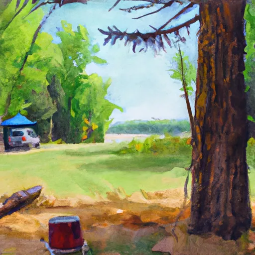
There are no reservations accepted at Seaton Creek, and campsites are available on a first-come, first-served basis. It is recommended to arrive early, especially during peak seasons, to secure a spot. The best time to visit Seaton Creek is during the summer months when the weather is pleasant for outdoor activities such as hiking or fishing. It is important to come prepared with all necessary camping equipment, including tents, sleeping bags, and cooking supplies, as there are no facilities or hookups available.
While camping at Seaton Creek, there are several points of interest to explore. The campground is located near the Pere Marquette River, which is renowned for its excellent fishing opportunities. Visitors can also enjoy hiking trails that wind through the surrounding Manistee National Forest, offering breathtaking views of the area's natural beauty. However, it is crucial to be cautious of wildlife encounters, as black bears have been spotted in the area. Campers are advised to properly store their food and maintain a safe distance from any wildlife they may encounter.
What's on-site at Seaton Creek
Key facilities Snoflo tracks for this campground. Confirm with the operator before booking -- amenities can change seasonally.
Plan your trip down to the hour
Same weather feed Snoflo's iOS app uses -- updated continuously from NOAA / yr.no.
Next 5 days, hour by hour
Temperature line with weather symbols on top, snow + rain accumulation as columns, humidity as a dotted line.
5-day forecast table
Every 3 hours, broken out across temperature, snow, rain, humidity, and wind. Each cell is colour-coded relative to the column min/max so trends jump out at a glance.
| Time | Condition | Temp (°F) | Snow (in) | Rain (in) | Humidity (%) | Wind (mps) | Wind dir |
|---|---|---|---|---|---|---|---|
| Loading detailed forecast… | |||||||
15-day temperature & precipitation
Daily temperatures, snow, and rain projected over the next two weeks. Hover any point for the full breakdown.
Other campgrounds in the area
Snoflo-tracked campsites within driving distance of Seaton Creek, with reservations status.
| Campground | Reservations | Toilets | View |
|---|---|---|---|
| Seaton Creek Campground | ✗ | ✗ | → |
| Northern Exposure | ✗ | ✗ | → |
| Fletcher Creek (Primitive) | ✗ | ✗ | → |
| Red Bridge River Access Site | ✗ | ✗ | → |
| Government Landing Site 21 | ✗ | ✗ | → |
Nearby streamflow
USGS streamgauges within reach of Seaton Creek -- pulled live from the National Water Information System.
| Streamgauge | Discharge | View |
|---|---|---|
| Manistee River Near Mesick | 1,170 cfs | → |
| Manistee River Near Sherman | 1,100 cfs | → |
| Manistee River Near Wellston | 1,750 cfs | → |
| Pine River At High School Bridge Nr Hoxeyville | 231 cfs | → |
| East Branch Pine River Near Tustin | 9 cfs | → |
| Platte River At Honor | 145 cfs | → |
Nearby snow depths
NRCS SNOTEL stations within reach of Seaton Creek -- relevant when planning a shoulder-season or alpine trip.
| SNOTEL station | Snowpack | 24h Snowfall | View |
|---|---|---|---|
| Wellston Tippy Dam | 0.0 in | 0.0 in | → |
| Wellston 0.8 N | 0.0 in | 0.0 in | → |
| Benzonia 5.3 S | 0.0 in | 0.0 in | → |
| Beulah 7ssw | 0.0 in | 0.0 in | → |
| Grawn 1.3 Ssw | 0.0 in | 0.0 in | → |
| Cadillac 9&10 News | 0.0 in | 0.0 in | → |
Plan a longer trip
The closest parks, lakes, boat launches, and paddle runs so a camping night can grow into a full weekend.
Parks
- Green Lake Township Memorial Park
- Interlochen State Park
- Mitchell State Park
- Kenwood Heritage Park
- Blair Township Park
- Diggins Park
Boat launches
- North Coates Highway Dickson Township
- Red Bridge River Access Site
- North 11 Road 5798, Springville Township
- Government Landing Access Dickson Township
- Dilling Road Dickson Township
- Sawdust Hole River Access
Fishing spots
- Suicide Bend Fishing Site
- Lake Cadillac
- Lake Dubonnet
- Lake Arcadia (Public Fishing Dock At Grebe Park)
- Bar Lake - Lake Michigan - Bar Lake Outlet
- Hopkins Creek
Points of interest
- Caberfae Scenic Overlook
- Udell Lookout Tower
- Adventure Island
- Manistee County Courthouse Fountain
- Manton Area Historical Museum
- Kiss Monument
Paddle runs
- Kings Road Bridge (2 Miles West Of Town Of Luther In T19n, R12w To Slackwater Of The State Fish Weir In T21n, R16w
- Southern Boundary Of Sleeping Bear Dunes National Lakeshore To Mouth At Lake Michigan
- Southeastern Boundary Of Sleeping Bear Dunes National Lakeshore To Northwetern Boundary Of Sleeping Bear Dunes National Lakeshore
Camping essentials & Leave No Trace
- Pack it in, pack it out
- Take all trash, food scraps, and gear back with you to keep campsites clean and protect wildlife.
- Respect wildlife
- Observe animals from a distance, store food securely, and never feed wildlife to maintain natural behavior and safety.
- Know before you go
- Check weather, fire restrictions, trail conditions, and permit requirements to ensure a safe and well-planned trip.
- Minimize campfire impact
- Use established fire rings, keep fires small, fully extinguish them, or opt for a camp stove when fires are restricted.
- Leave what you find
- Preserve natural and cultural features by avoiding removal of plants, rocks, artifacts, or other elements of the environment.
Set push alerts in the Snoflo app
Save Seaton Creek as a favorite, set a custom threshold (precipitation, snowpack, freezing temperatures), and the iOS app will push the moment conditions cross.
About Seaton Creek
Can I make reservations at Seaton Creek?
This campground does not appear to accept reservations -- it's typically first-come, first-served. Arrive early on summer weekends.
How fresh is the weather data on this page?
The hourly forecast updates throughout the day from the NOAA / yr.no public feeds. Streamflow data is pulled live from USGS streamgauges and snowpack from the NRCS SNOTEL network.
What's the best time of year to visit?
Use the 15-day temperature & precipitation outlook on this page to plan -- pick a window with comfortable temperatures and low precipitation. For longer trips, the 5-day hourly meteogram shows snow + rain accumulation hour-by-hour.
How do I get to Seaton Creek?
Tap Directions in the hero above to open driving directions in Google Maps, or Open in map to center the Snoflo interactive map on the campground.
Can I get alerts when conditions change?
Yes -- alerts are managed through the Snoflo iOS app. Favorite this campground, set a threshold (temperature, snowpack, precipitation), and you'll get a push the moment it crosses.
Other campgrounds near here
Snoflo-tracked campgrounds within driving distance of Seaton Creek.