Ash Ridge Backpack Campsite campground
Community Reviews
Been here? Share the conditions.
Reviews, ratings & photos are added in the free Snoflo iOS app — rate a spot, tag the conditions, and your visit is verified by location. Add or manage your reviews from the app.
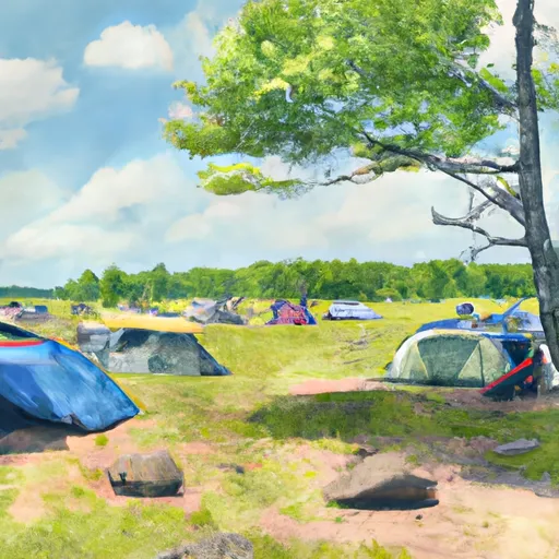
Ash Ridge Backpack Campsite
Reservations are not accepted at Ash Ridge Backpack Campsite, as campsites are available on a first-come, first-served basis. Therefore, it is advisable to arrive early to secure a spot, especially during peak seasons. The best time to visit this camping area is during the summer months of June to August, when the weather is mild and conducive to outdoor activities.
While camping at Ash Ridge, campers can explore the surrounding area, which offers numerous hiking trails with breathtaking views of the lush forests and pristine lakes. However, it is essential to be cautious of wildlife encounters, such as bears and snakes, and to practice proper food storage to avoid attracting animals to the campsite. Additionally, it is recommended to bring bug repellent as there can be mosquitos and ticks in the area. Overall, Ash Ridge Backpack Campsite is an ideal destination for outdoor enthusiasts seeking a serene and adventurous camping experience in the beautiful state of Minnesota.
What's on-site at Ash Ridge Backpack Campsite
Key facilities Snoflo tracks for this campground. Confirm with the operator before booking -- amenities can change seasonally.
Plan your trip down to the hour
Same weather feed Snoflo's iOS app uses -- updated continuously from NOAA / yr.no.
Next 5 days, hour by hour
Temperature line with weather symbols on top, snow + rain accumulation as columns, humidity as a dotted line.
5-day forecast table
Every 3 hours, broken out across temperature, snow, rain, humidity, and wind. Each cell is colour-coded relative to the column min/max so trends jump out at a glance.
| Time | Condition | Temp (°F) | Snow (in) | Rain (in) | Humidity (%) | Wind (mps) | Wind dir |
|---|---|---|---|---|---|---|---|
| Loading detailed forecast… | |||||||
15-day temperature & precipitation
Daily temperatures, snow, and rain projected over the next two weeks. Hover any point for the full breakdown.
Other campgrounds in the area
Snoflo-tracked campsites within driving distance of Ash Ridge Backpack Campsite, with reservations status.
| Campground | Reservations | Toilets | View |
|---|---|---|---|
| High Landing Backpack Campsite | ✗ | ✗ | → |
| Lost Lake Backpack Campsite | ✗ | ✗ | → |
| Silver Creek Backpack Campsite | ✗ | ✗ | → |
| Jay Cooke State Park | ✓ | ✗ | → |
| Spafford City Park Campground | ✗ | ✗ | → |
Nearby streamflow
USGS streamgauges within reach of Ash Ridge Backpack Campsite -- pulled live from the National Water Information System.
| Streamgauge | Discharge | View |
|---|---|---|
| St. Louis River At Scanlon | 982 cfs | → |
| Nemadji River Near South Superior | 103 cfs | → |
| Knife River Near Two Harbors | 3 cfs | → |
| Bois Brule River At Brule | 110 cfs | → |
| St. Croix River Near Danbury | 726 cfs | → |
| Kettle River Below Sandstone | 300 cfs | → |
Nearby snow depths
NRCS SNOTEL stations within reach of Ash Ridge Backpack Campsite -- relevant when planning a shoulder-season or alpine trip.
| SNOTEL station | Snowpack | 24h Snowfall | View |
|---|---|---|---|
| Cloquet 2.1 Ese | 0.0 in | 0.0 in | → |
| Cloquet 3.4 Ene | 0.0 in | 0.0 in | → |
| Nohrsc Cloquet | 0.0 in | 0.0 in | → |
| Superior Wwtp | 0.0 in | 0.0 in | → |
| Duluth Nws | 0.0 in | 0.0 in | → |
| Duluth | 5.0 in | 0.0 in | → |
Plan a longer trip
The closest parks, lakes, boat launches, and paddle runs so a camping night can grow into a full weekend.
Parks
- Jay Cooke State Park
- Chambers Grove
- Fondulac Park
- Blackmer Park
- Terry Egerdahl Memorial Field
- Klang Park
Boat launches
- Fond Du Lac Campground
- Chub Lake
- Boyscout Park
- Hay Lake
- Saint Louis River -- Oliver - Sajac Memorial Park Access
- Spirit/ Clyde Avenue
Fishing spots
Camping essentials & Leave No Trace
- Pack it in, pack it out
- Take all trash, food scraps, and gear back with you to keep campsites clean and protect wildlife.
- Respect wildlife
- Observe animals from a distance, store food securely, and never feed wildlife to maintain natural behavior and safety.
- Know before you go
- Check weather, fire restrictions, trail conditions, and permit requirements to ensure a safe and well-planned trip.
- Minimize campfire impact
- Use established fire rings, keep fires small, fully extinguish them, or opt for a camp stove when fires are restricted.
- Leave what you find
- Preserve natural and cultural features by avoiding removal of plants, rocks, artifacts, or other elements of the environment.
Set push alerts in the Snoflo app
Save Ash Ridge Backpack Campsite as a favorite, set a custom threshold (precipitation, snowpack, freezing temperatures), and the iOS app will push the moment conditions cross.
About Ash Ridge Backpack Campsite
Can I make reservations at Ash Ridge Backpack Campsite?
This campground does not appear to accept reservations -- it's typically first-come, first-served. Arrive early on summer weekends.
How fresh is the weather data on this page?
The hourly forecast updates throughout the day from the NOAA / yr.no public feeds. Streamflow data is pulled live from USGS streamgauges and snowpack from the NRCS SNOTEL network.
What's the best time of year to visit?
Use the 15-day temperature & precipitation outlook on this page to plan -- pick a window with comfortable temperatures and low precipitation. For longer trips, the 5-day hourly meteogram shows snow + rain accumulation hour-by-hour.
How do I get to Ash Ridge Backpack Campsite?
Tap Directions in the hero above to open driving directions in Google Maps, or Open in map to center the Snoflo interactive map on the campground.
Can I get alerts when conditions change?
Yes -- alerts are managed through the Snoflo iOS app. Favorite this campground, set a threshold (temperature, snowpack, precipitation), and you'll get a push the moment it crosses.
Other campgrounds near here
Snoflo-tracked campgrounds within driving distance of Ash Ridge Backpack Campsite.