Huntersville State Forest - Landing Campground
Community Reviews
Been here? Share the conditions.
Reviews, ratings & photos are added in the free Snoflo iOS app — rate a spot, tag the conditions, and your visit is verified by location. Add or manage your reviews from the app.
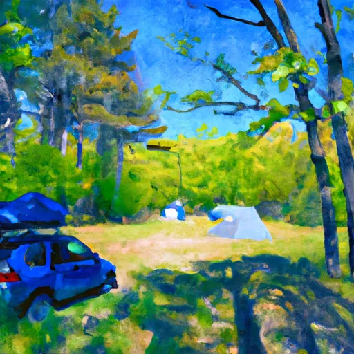
Huntersville State Forest - Landing
Reservations are not required at Huntersville State Forest - Landing camping area, making it a great option for spontaneous trips. However, it is advisable to arrive early, especially during peak seasons, to secure a site. The best time to visit this camping area is during the summer and fall months when the weather is pleasant and the foliage is stunning.
While visiting Huntersville State Forest - Landing camping area, campers can explore the surrounding natural beauty, including hiking trails and scenic views. Additionally, the campground is an excellent base for fishing and boating enthusiasts, with nearby lakes offering ample opportunities to indulge in water activities. It is important to be cautious of wildlife in the area and to store food properly to avoid attracting animals. Overall, Huntersville State Forest - Landing camping area is a fantastic destination for nature lovers seeking a peaceful and enjoyable camping experience in Minnesota.
What's on-site at Huntersville State Forest - Landing
Key facilities Snoflo tracks for this campground. Confirm with the operator before booking -- amenities can change seasonally.
Plan your trip down to the hour
Same weather feed Snoflo's iOS app uses -- updated continuously from NOAA / yr.no.
Next 5 days, hour by hour
Temperature line with weather symbols on top, snow + rain accumulation as columns, humidity as a dotted line.
5-day forecast table
Every 3 hours, broken out across temperature, snow, rain, humidity, and wind. Each cell is colour-coded relative to the column min/max so trends jump out at a glance.
| Time | Condition | Temp (°F) | Snow (in) | Rain (in) | Humidity (%) | Wind (mps) | Wind dir |
|---|---|---|---|---|---|---|---|
| Loading detailed forecast… | |||||||
15-day temperature & precipitation
Daily temperatures, snow, and rain projected over the next two weeks. Hover any point for the full breakdown.
Other campgrounds in the area
Snoflo-tracked campsites within driving distance of Huntersville State Forest - Landing, with reservations status.
| Campground | Reservations | Toilets | View |
|---|---|---|---|
| Huntersville Forest Landing - Huntersville State Forest | ✗ | ✓ | → |
| Hunterville Township Campsite | ✗ | ✓ | → |
| Huntersville Township | ✗ | ✗ | → |
| Anderson's Crossing | ✗ | ✓ | → |
| Andersons Crossing | ✗ | ✗ | → |
Nearby streamflow
USGS streamgauges within reach of Huntersville State Forest - Landing -- pulled live from the National Water Information System.
| Streamgauge | Discharge | View |
|---|---|---|
| Crow Wing River At Nimrod | 144 cfs | → |
| Straight River Near Park Rapids | 27 cfs | → |
| Crow Wing River Near Pillager | 570 cfs | → |
| Mississippi River At Brainerd | 902 cfs | → |
| Mississippi River Near Bemidji | 217 cfs | → |
| Long Prairie River At Long Prairie | 78 cfs | → |
Nearby snow depths
NRCS SNOTEL stations within reach of Huntersville State Forest - Landing -- relevant when planning a shoulder-season or alpine trip.
| SNOTEL station | Snowpack | 24h Snowfall | View |
|---|---|---|---|
| Park Rapids 1.0 Nne | 0.0 in | 0.0 in | → |
| New York Mills | 0.0 in | 0.0 in | → |
| Cross Lake Dam | 0.0 in | 0.0 in | → |
| Brainerd | 0.0 in | 0.0 in | → |
| Fort Ripley 0.8 N | 0.0 in | 0.0 in | → |
| Cass Lake | 0.0 in | 0.0 in | → |
Plan a longer trip
The closest parks, lakes, boat launches, and paddle runs so a camping night can grow into a full weekend.
Parks
- Huntersville State Forest
- Badoura State Forest
- Lyons State Forest
- Two Inlets State Forest
- Chippewa National Forest
- Itasca State Park
Boat launches
Fishing spots
Camping essentials & Leave No Trace
- Pack it in, pack it out
- Take all trash, food scraps, and gear back with you to keep campsites clean and protect wildlife.
- Respect wildlife
- Observe animals from a distance, store food securely, and never feed wildlife to maintain natural behavior and safety.
- Know before you go
- Check weather, fire restrictions, trail conditions, and permit requirements to ensure a safe and well-planned trip.
- Minimize campfire impact
- Use established fire rings, keep fires small, fully extinguish them, or opt for a camp stove when fires are restricted.
- Leave what you find
- Preserve natural and cultural features by avoiding removal of plants, rocks, artifacts, or other elements of the environment.
Set push alerts in the Snoflo app
Save Huntersville State Forest - Landing as a favorite, set a custom threshold (precipitation, snowpack, freezing temperatures), and the iOS app will push the moment conditions cross.
About Huntersville State Forest - Landing
Can I make reservations at Huntersville State Forest - Landing?
This campground does not appear to accept reservations -- it's typically first-come, first-served. Arrive early on summer weekends.
How fresh is the weather data on this page?
The hourly forecast updates throughout the day from the NOAA / yr.no public feeds. Streamflow data is pulled live from USGS streamgauges and snowpack from the NRCS SNOTEL network.
What's the best time of year to visit?
Use the 15-day temperature & precipitation outlook on this page to plan -- pick a window with comfortable temperatures and low precipitation. For longer trips, the 5-day hourly meteogram shows snow + rain accumulation hour-by-hour.
How do I get to Huntersville State Forest - Landing?
Tap Directions in the hero above to open driving directions in Google Maps, or Open in map to center the Snoflo interactive map on the campground.
Can I get alerts when conditions change?
Yes -- alerts are managed through the Snoflo iOS app. Favorite this campground, set a threshold (temperature, snowpack, precipitation), and you'll get a push the moment it crosses.
Other campgrounds near here
Snoflo-tracked campgrounds within driving distance of Huntersville State Forest - Landing.