Joemma Beach State Park campground
Community Reviews
Been here? Share the conditions.
Reviews, ratings & photos are added in the free Snoflo iOS app — rate a spot, tag the conditions, and your visit is verified by location. Add or manage your reviews from the app.
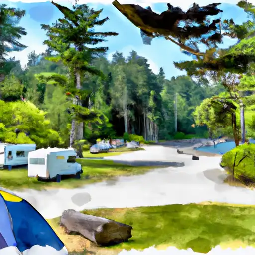
Joemma Beach State Park
What's on-site at Joemma Beach State Park
Key facilities Snoflo tracks for this campground. Confirm with the operator before booking -- amenities can change seasonally.
Plan your trip down to the hour
Same weather feed Snoflo's iOS app uses -- updated continuously from NOAA / yr.no.
Next 5 days, hour by hour
Temperature line with weather symbols on top, snow + rain accumulation as columns, humidity as a dotted line.
5-day forecast table
Every 3 hours, broken out across temperature, snow, rain, humidity, and wind. Each cell is colour-coded relative to the column min/max so trends jump out at a glance.
| Time | Condition | Temp (°F) | Snow (in) | Rain (in) | Humidity (%) | Wind (mps) | Wind dir |
|---|---|---|---|---|---|---|---|
| Loading detailed forecast… | |||||||
15-day temperature & precipitation
Daily temperatures, snow, and rain projected over the next two weeks. Hover any point for the full breakdown.
Other campgrounds in the area
Snoflo-tracked campsites within driving distance of Joemma Beach State Park, with reservations status.
| Campground | Reservations | Toilets | View |
|---|---|---|---|
| Wwta Camp Site | ✗ | ✗ | → |
| Penrose Point State Park | ✓ | ✗ | → |
| Jarrell Cove State Park | ✓ | ✗ | → |
| Kopachuck State Park | ✗ | ✗ | → |
| Gig Harbor Rv Resort | ✗ | ✗ | → |
Nearby streamflow
USGS streamgauges within reach of Joemma Beach State Park -- pulled live from the National Water Information System.
| Streamgauge | Discharge | View |
|---|---|---|
| Huge Creek Near Wauna | 6 cfs | → |
| Chambers Creek Bl Leach Creek Near Steilacoom | 131 cfs | → |
| Flett Creek At Tacoma | 11 cfs | → |
| Leach Creek Near Fircrest | 2 cfs | → |
| Clover Creek Near Tillicum | 31 cfs | → |
| Deschutes River At E St Bridge At Tumwater | 199 cfs | → |
Nearby snow depths
NRCS SNOTEL stations within reach of Joemma Beach State Park -- relevant when planning a shoulder-season or alpine trip.
| SNOTEL station | Snowpack | 24h Snowfall | View |
|---|---|---|---|
| Kent | 0.0 in | 0.0 in | → |
| Mt Tebo Snotel | 48.0 in | 0.0 in | → |
| Nohrsc Mount Crag | 0.0 in | 0.0 in | → |
| Mount Crag | 0.0 in | 0.0 in | → |
| Nohrsc Burnt Mountain | 0.0 in | 0.0 in | → |
| Burnt Mountain | 0.0 in | 0.0 in | → |
Plan a longer trip
The closest parks, lakes, boat launches, and paddle runs so a camping night can grow into a full weekend.
Parks
- Joemma Beach State Park
- Mcmicken Island State Park
- Penrose Point State Park
- Jarrell Cove State Park
- Eagle Island State Park
- Hope Island State Park
Boat launches
- 177th Avenue Kp North 3300, Lakebay
- East Harstine Bridge Road 51, Shelton
- Southeast Arkada Court 30, Shelton
- Whitham Road Northeast 7006, Thurston County
- 3rd Avenue Fi 100-176, Fox Island
- Hall Road Kp North 17820-17998, Vaughn
Paddle runs
- Headwaters- Includes All Tributaries To Confluence With North Fork Skokomish River
- Headwaters To Confluence With North Fork Skokomish River
- Brothers Wilderness Boundary To Olympic Nf Boundary
- Headwaters- Includes All Tributaries Within Park To Olympic National Park Boundary
- Olympic Nf/Olympic Np Bounary To Brothers Wilderness Boundary
Camping essentials & Leave No Trace
- Pack it in, pack it out
- Take all trash, food scraps, and gear back with you to keep campsites clean and protect wildlife.
- Respect wildlife
- Observe animals from a distance, store food securely, and never feed wildlife to maintain natural behavior and safety.
- Know before you go
- Check weather, fire restrictions, trail conditions, and permit requirements to ensure a safe and well-planned trip.
- Minimize campfire impact
- Use established fire rings, keep fires small, fully extinguish them, or opt for a camp stove when fires are restricted.
- Leave what you find
- Preserve natural and cultural features by avoiding removal of plants, rocks, artifacts, or other elements of the environment.
Set push alerts in the Snoflo app
Save Joemma Beach State Park as a favorite, set a custom threshold (precipitation, snowpack, freezing temperatures), and the iOS app will push the moment conditions cross.
About Joemma Beach State Park
Can I make reservations at Joemma Beach State Park?
This campground does not appear to accept reservations -- it's typically first-come, first-served. Arrive early on summer weekends.
How fresh is the weather data on this page?
The hourly forecast updates throughout the day from the NOAA / yr.no public feeds. Streamflow data is pulled live from USGS streamgauges and snowpack from the NRCS SNOTEL network.
What's the best time of year to visit?
Use the 15-day temperature & precipitation outlook on this page to plan -- pick a window with comfortable temperatures and low precipitation. For longer trips, the 5-day hourly meteogram shows snow + rain accumulation hour-by-hour.
How do I get to Joemma Beach State Park?
Tap Directions in the hero above to open driving directions in Google Maps, or Open in map to center the Snoflo interactive map on the campground.
Can I get alerts when conditions change?
Yes -- alerts are managed through the Snoflo iOS app. Favorite this campground, set a threshold (temperature, snowpack, precipitation), and you'll get a push the moment it crosses.
Other campgrounds near here
Snoflo-tracked campgrounds within driving distance of Joemma Beach State Park.