Upper Dailey Creek Campground
Community Reviews
Been here? Share the conditions.
Reviews, ratings & photos are added in the free Snoflo iOS app — rate a spot, tag the conditions, and your visit is verified by location. Add or manage your reviews from the app.
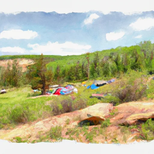
Upper Dailey Creek
An interesting fact about the area is that it was once a mining town during the 1800s gold rush. Visitors can still see the remnants of the old mining operations in the surrounding hills.
The best time to visit the Upper Dailey Creek Camping area is during the summer months, from May to September. During this time, the average temperature ranges from 70 to 80 degrees Fahrenheit. However, it is important to note that the area is known for its sudden weather changes, so visitors should come prepared for all types of weather. Overall, the Upper Dailey Creek Camping area is a beautiful and peaceful location for those looking to enjoy the natural beauty of Montana's mountains and forests.
What's on-site at Upper Dailey Creek
Key facilities Snoflo tracks for this campground. Confirm with the operator before booking -- amenities can change seasonally.
Plan your trip down to the hour
Same weather feed Snoflo's iOS app uses -- updated continuously from NOAA / yr.no.
Next 5 days, hour by hour
Temperature line with weather symbols on top, snow + rain accumulation as columns, humidity as a dotted line.
5-day forecast table
Every 3 hours, broken out across temperature, snow, rain, humidity, and wind. Each cell is colour-coded relative to the column min/max so trends jump out at a glance.
| Time | Condition | Temp (°F) | Snow (in) | Rain (in) | Humidity (%) | Wind (mps) | Wind dir |
|---|---|---|---|---|---|---|---|
| Loading detailed forecast… | |||||||
15-day temperature & precipitation
Daily temperatures, snow, and rain projected over the next two weeks. Hover any point for the full breakdown.
Other campgrounds in the area
Snoflo-tracked campsites within driving distance of Upper Dailey Creek, with reservations status.
| Campground | Reservations | Toilets | View |
|---|---|---|---|
| Wf2 | ✗ | ✗ | → |
| Black Butte Creek | ✓ | ✗ | → |
| Tom Minor Campground | ✗ | ✗ | → |
| Tom Miner Campground | ✗ | ✗ | → |
| Tom Miner | ✗ | ✓ | → |
Nearby streamflow
USGS streamgauges within reach of Upper Dailey Creek -- pulled live from the National Water Information System.
| Streamgauge | Discharge | View |
|---|---|---|
| Yellowstone River At Corwin Springs Mt | 3,890 cfs | → |
| Madison River Bl Hebgen Lake Nr Grayling Mt | 976 cfs | → |
| Gardner River Near Mammoth Ynp | 184 cfs | → |
| Boiling River At Mammoth | 22 cfs | → |
| Madison River At Kirby Ranch Nr Cameron Mt | 1,180 cfs | → |
| Gallatin River Near Gallatin Gateway Mt | 703 cfs | → |
Nearby snow depths
NRCS SNOTEL stations within reach of Upper Dailey Creek -- relevant when planning a shoulder-season or alpine trip.
| SNOTEL station | Snowpack | 24h Snowfall | View |
|---|---|---|---|
| Carrot Basin | 0.0 in | 0.0 in | → |
| Carrot Basin | 0.0 in | 0.0 in | → |
| Beaver Creek | 0.0 in | 0.0 in | → |
| Nohrsc Beaver Creek | 0.0 in | 0.0 in | → |
| Lone Mountain | 0.0 in | 0.0 in | → |
| Nohrsc Lone Mountain | 0.0 in | 0.0 in | → |
Plan a longer trip
The closest parks, lakes, boat launches, and paddle runs so a camping night can grow into a full weekend.
Boat launches
- Carbella Boat Ramp
- Old Yellowstone Trail Park County
- Brogan's Landing
- Dailey Lake
- Daily Lake Road Park County
Fishing spots
Points of interest
- Yellowstone Hot Springs
- Yellowstone Gateway Garden
- North Entrance Webcam
- Electric Peak Webcam
- The Guestbook
- Mammoth Hot Springs Terraces
Paddle runs
- Gallatin Canyon, Sec. 19, T4s, R4e To Yellowstone National Park, Sec. 27, T9s, R5e
- Begins Where The River Parallels A Two-Lane Highway To The Western Boundary Of Yellowstone National Park
- Gallatin Forest Boundary, Sec. 32, T7s, R7e To Yellowstone National Park, Sec. 23, T9s, R8e
- Yankee Jim Canyon (Joe Brown To Miner)
- The Headwaters, In The Gallatin Range To Ends Downstream Of Osprey Falls
- Moose To Storm Castle
Camping essentials & Leave No Trace
- Pack it in, pack it out
- Take all trash, food scraps, and gear back with you to keep campsites clean and protect wildlife.
- Respect wildlife
- Observe animals from a distance, store food securely, and never feed wildlife to maintain natural behavior and safety.
- Know before you go
- Check weather, fire restrictions, trail conditions, and permit requirements to ensure a safe and well-planned trip.
- Minimize campfire impact
- Use established fire rings, keep fires small, fully extinguish them, or opt for a camp stove when fires are restricted.
- Leave what you find
- Preserve natural and cultural features by avoiding removal of plants, rocks, artifacts, or other elements of the environment.
Set push alerts in the Snoflo app
Save Upper Dailey Creek as a favorite, set a custom threshold (precipitation, snowpack, freezing temperatures), and the iOS app will push the moment conditions cross.
About Upper Dailey Creek
Can I make reservations at Upper Dailey Creek?
Yes -- this campground accepts reservations. Snoflo recommends booking early for peak season; check the operator (Recreation.gov / state park system / private operator) for the booking window and cancellation policy.
How fresh is the weather data on this page?
The hourly forecast updates throughout the day from the NOAA / yr.no public feeds. Streamflow data is pulled live from USGS streamgauges and snowpack from the NRCS SNOTEL network.
What's the best time of year to visit?
Use the 15-day temperature & precipitation outlook on this page to plan -- pick a window with comfortable temperatures and low precipitation. For longer trips, the 5-day hourly meteogram shows snow + rain accumulation hour-by-hour.
How do I get to Upper Dailey Creek?
Tap Directions in the hero above to open driving directions in Google Maps, or Open in map to center the Snoflo interactive map on the campground.
Can I get alerts when conditions change?
Yes -- alerts are managed through the Snoflo iOS app. Favorite this campground, set a threshold (temperature, snowpack, precipitation), and you'll get a push the moment it crosses.
Other campgrounds near here
Snoflo-tracked campgrounds within driving distance of Upper Dailey Creek.