Willow Creek Fas Campground
Community Reviews
Been here? Share the conditions.
Reviews, ratings & photos are added in the free Snoflo iOS app — rate a spot, tag the conditions, and your visit is verified by location. Add or manage your reviews from the app.
Willow Creek Fas
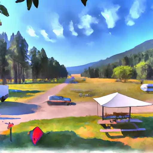
The campsite amenities include fire rings, picnic tables, and vault toilets. This is a first-come-first-serve campground with a total of 10 campsites available.
An interesting fact about the area is that it was once part of the Lewis and Clark Expedition. The Missouri River, which is located nearby, was traveled by the expedition when they explored the area.
The best time to visit Willow Creek FAS Camping Area is during the summer months. The average temperature during this time of year is around 75 degrees Fahrenheit. However, it is important to note that the area can experience sudden changes in weather, so it's always a good idea to pack warm clothing just in case.
Overall, Willow Creek FAS Camping Area is a great spot for camping and enjoying the beautiful natural surroundings. It's a perfect place to escape from the hustle and bustle of everyday life and connect with nature.
What's on-site at Willow Creek Fas
Key facilities Snoflo tracks for this campground. Confirm with the operator before booking -- amenities can change seasonally.
Plan your trip down to the hour
Same weather feed Snoflo's iOS app uses -- updated continuously from NOAA / yr.no.
Next 5 days, hour by hour
Temperature line with weather symbols on top, snow + rain accumulation as columns, humidity as a dotted line.
5-day forecast table
Every 3 hours, broken out across temperature, snow, rain, humidity, and wind. Each cell is colour-coded relative to the column min/max so trends jump out at a glance.
| Time | Condition | Temp (°F) | Snow (in) | Rain (in) | Humidity (%) | Wind (mps) | Wind dir |
|---|---|---|---|---|---|---|---|
| Loading detailed forecast… | |||||||
15-day temperature & precipitation
Daily temperatures, snow, and rain projected over the next two weeks. Hover any point for the full breakdown.
Other campgrounds in the area
Snoflo-tracked campsites within driving distance of Willow Creek Fas, with reservations status.
| Campground | Reservations | Toilets | View |
|---|---|---|---|
| Wagon's West | ✗ | ✗ | → |
| Nilan Reservoir Fas | ✗ | ✓ | → |
| Pishkun Reservoir Fas | ✗ | ✓ | → |
| Home Gulch Campground | ✓ | ✗ | → |
| Home Gulch | ✗ | ✓ | → |
Nearby streamflow
USGS streamgauges within reach of Willow Creek Fas -- pulled live from the National Water Information System.
| Streamgauge | Discharge | View |
|---|---|---|
| Sun River Bl Willow Cr Nr Augusta Mt | 242 cfs | → |
| Sun River Bl Diversion Dam Nr Augusta Mt | 105 cfs | → |
| South Fork Sun River Near Augusta Mt | 193 cfs | → |
| North Fork Sun River Near Augusta Mt | 213 cfs | → |
| Sun River At Simms Mt | 92 cfs | → |
| Teton River Bl South Fork Nr Choteau Mt | 142 cfs | → |
Nearby snow depths
NRCS SNOTEL stations within reach of Willow Creek Fas -- relevant when planning a shoulder-season or alpine trip.
| SNOTEL station | Snowpack | 24h Snowfall | View |
|---|---|---|---|
| Gibson Dam | 0.0 in | 0.0 in | → |
| Wood Creek | 0.0 in | 0.0 in | → |
| Wood Creek | 0.0 in | 0.0 in | → |
| Choteau | 0.0 in | 0.0 in | → |
| Nohrsc Fairfield 5.0 Nne | 0.0 in | 0.0 in | → |
| Bynum 4 Sse | 0.0 in | 0.0 in | → |
Plan a longer trip
The closest parks, lakes, boat launches, and paddle runs so a camping night can grow into a full weekend.
Parks
Boat launches
- Willow Creek Reservoir
- North Fork Sun River Rec Site
- Nilan Reservoir
- Pishkun Reservoir
- Gibson Boating Site
- Lowry Bridge
Fishing spots
Points of interest
Paddle runs
- Headwaters, Sec. 13, T18n, R10w To Forest Boundary, Sec. 6, T17n, R7w
- Wilderness Boundary To South Fork Sun River, Sec. 26, T22n, R10w
- Headwaters, Sec. 4, T18n, R10w To North Fork Sun River, Sec. 26, T22n, R10w
- Fool Creek, Sec. 24, T25n, R11w To Wilderness Boundary
- Headwaters, Sec. 15, T18n, R10w To Straight Creek, Sec. 25, T19n, R10w
- Dobrota Headwaters, Sec. 23, T18n, R10w To Mainstem, Sec. 31, T18n, R9w
Camping essentials & Leave No Trace
- Pack it in, pack it out
- Take all trash, food scraps, and gear back with you to keep campsites clean and protect wildlife.
- Respect wildlife
- Observe animals from a distance, store food securely, and never feed wildlife to maintain natural behavior and safety.
- Know before you go
- Check weather, fire restrictions, trail conditions, and permit requirements to ensure a safe and well-planned trip.
- Minimize campfire impact
- Use established fire rings, keep fires small, fully extinguish them, or opt for a camp stove when fires are restricted.
- Leave what you find
- Preserve natural and cultural features by avoiding removal of plants, rocks, artifacts, or other elements of the environment.
Set push alerts in the Snoflo app
Save Willow Creek Fas as a favorite, set a custom threshold (precipitation, snowpack, freezing temperatures), and the iOS app will push the moment conditions cross.
About Willow Creek Fas
Can I make reservations at Willow Creek Fas?
This campground does not appear to accept reservations -- it's typically first-come, first-served. Arrive early on summer weekends.
How fresh is the weather data on this page?
The hourly forecast updates throughout the day from the NOAA / yr.no public feeds. Streamflow data is pulled live from USGS streamgauges and snowpack from the NRCS SNOTEL network.
What's the best time of year to visit?
Use the 15-day temperature & precipitation outlook on this page to plan -- pick a window with comfortable temperatures and low precipitation. For longer trips, the 5-day hourly meteogram shows snow + rain accumulation hour-by-hour.
How do I get to Willow Creek Fas?
Tap Directions in the hero above to open driving directions in Google Maps, or Open in map to center the Snoflo interactive map on the campground.
Can I get alerts when conditions change?
Yes -- alerts are managed through the Snoflo iOS app. Favorite this campground, set a threshold (temperature, snowpack, precipitation), and you'll get a push the moment it crosses.
Other campgrounds near here
Snoflo-tracked campgrounds within driving distance of Willow Creek Fas.