East Twin campground
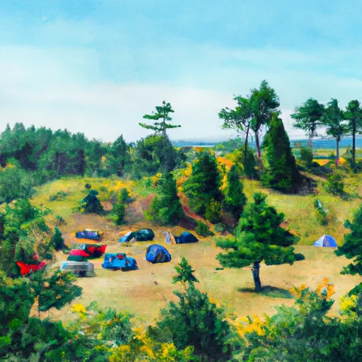
East Twin
What's on-site at East Twin
Key facilities Snoflo tracks for this campground. Confirm with the operator before booking -- amenities can change seasonally.
Plan your trip down to the hour
Same weather feed Snoflo's iOS app uses -- updated continuously from NOAA / yr.no.
Next 5 days, hour by hour
Temperature line with weather symbols on top, snow + rain accumulation as columns, humidity as a dotted line.
5-day forecast table
Every 3 hours, broken out across temperature, snow, rain, humidity, and wind. Each cell is colour-coded relative to the column min/max so trends jump out at a glance.
| Time | Condition | Temp (°F) | Snow (in) | Rain (in) | Humidity (%) | Wind (mps) | Wind dir |
|---|---|---|---|---|---|---|---|
| Loading detailed forecast… | |||||||
15-day temperature & precipitation
Daily temperatures, snow, and rain projected over the next two weeks. Hover any point for the full breakdown.
Other campgrounds in the area
Snoflo-tracked campsites within driving distance of East Twin, with reservations status.
| Campground | Reservations | Toilets | View |
|---|---|---|---|
| East Twin Recreation Area Campground | ✓ | ✓ | → |
| East Twin Recreation Area | ✓ | ✗ | → |
| Day Lake | ✓ | ✗ | → |
| Day Lake Recreation Area | ✓ | ✗ | → |
| Day Lake Recreation Area Campground | ✓ | ✓ | → |
Nearby streamflow
USGS streamgauges within reach of East Twin -- pulled live from the National Water Information System.
| Streamgauge | Discharge | View |
|---|---|---|
| Bad River Near Mellen | 101 cfs | → |
| White River Near Ashland | 245 cfs | → |
| Bad River Near Odanah | 796 cfs | → |
| Namekagon River At Leonards | 157 cfs | → |
| Chippewa River At Bishops Bridge Near Winter | 598 cfs | → |
| North Fish Creek Near Moquah | 55 cfs | → |
Nearby snow depths
NRCS SNOTEL stations within reach of East Twin -- relevant when planning a shoulder-season or alpine trip.
| SNOTEL station | Snowpack | 24h Snowfall | View |
|---|---|---|---|
| Clam Lake 4w | 0.0 in | 0.0 in | → |
| Nohrsc Clam Lake 4 W | 0.0 in | 0.0 in | → |
| Butternut 5.9 Sw | 0.0 in | 0.0 in | → |
| Butternut 0.2 Nnw | 0.0 in | 0.0 in | → |
| Upson | 0.0 in | 0.0 in | → |
| Ashland | 0.0 in | 0.0 in | → |
Plan a longer trip
The closest parks, lakes, boat launches, and paddle runs so a camping night can grow into a full weekend.
Parks
- Bayfield County Park
- Great Divide Wayside Park
- Marian Park Pavillion
- Wilderness Porcupine Lake
- Copper Falls State Park
- Chief River Wildlife Area
Boat launches
- East Twin Lake - Access Off Forest Rd 190
- Day Lake - Access
- Upper Clam Lake - Clam Lake - Access
- Lower Clam Lake -- Access At Nw End Of Lake
- Mineral Lake -- Access
- Coffee Lake Road Town Of Grandview
Points of interest
Camping essentials & Leave No Trace
- Pack it in, pack it out
- Take all trash, food scraps, and gear back with you to keep campsites clean and protect wildlife.
- Respect wildlife
- Observe animals from a distance, store food securely, and never feed wildlife to maintain natural behavior and safety.
- Know before you go
- Check weather, fire restrictions, trail conditions, and permit requirements to ensure a safe and well-planned trip.
- Minimize campfire impact
- Use established fire rings, keep fires small, fully extinguish them, or opt for a camp stove when fires are restricted.
- Leave what you find
- Preserve natural and cultural features by avoiding removal of plants, rocks, artifacts, or other elements of the environment.
Set push alerts in the Snoflo app
Save East Twin as a favorite, set a custom threshold (precipitation, snowpack, freezing temperatures), and the iOS app will push the moment conditions cross.
About East Twin
Can I make reservations at East Twin?
Yes -- this campground accepts reservations. Snoflo recommends booking early for peak season; check the operator (Recreation.gov / state park system / private operator) for the booking window and cancellation policy.
How fresh is the weather data on this page?
The hourly forecast updates throughout the day from the NOAA / yr.no public feeds. Streamflow data is pulled live from USGS streamgauges and snowpack from the NRCS SNOTEL network.
What's the best time of year to visit?
Use the 15-day temperature & precipitation outlook on this page to plan -- pick a window with comfortable temperatures and low precipitation. For longer trips, the 5-day hourly meteogram shows snow + rain accumulation hour-by-hour.
How do I get to East Twin?
Tap Directions in the hero above to open driving directions in Google Maps, or Open in map to center the Snoflo interactive map on the campground.
Can I get alerts when conditions change?
Yes -- alerts are managed through the Snoflo iOS app. Favorite this campground, set a threshold (temperature, snowpack, precipitation), and you'll get a push the moment it crosses.
Other campgrounds near here
Snoflo-tracked campgrounds within driving distance of East Twin.