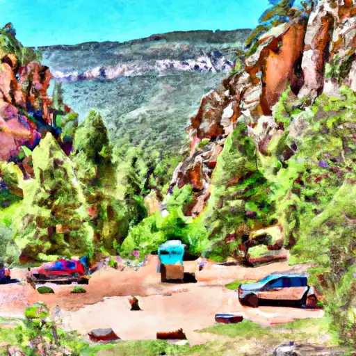
James Canyon Campground
Community Reviews
Been here? Share the conditions.
Reviews, ratings & photos are added in the free Snoflo iOS app — rate a spot, tag the conditions, and your visit is verified by location. Add or manage your reviews from the app.
James Canyon
Reservations are not required at James Canyon camping area, as it operates on a first-come, first-served basis. However, it is recommended to arrive early, especially during peak seasons, to secure a camping spot. The best time to visit this campground is during the spring and fall months when the weather is pleasant, and the scenic beauty of the surrounding area is at its peak.
Campers at James Canyon should be cautious of wildlife encounters, as the area is home to various animal species. It is important to store food securely and maintain a safe distance from wildlife to prevent any unwanted incidents. Additionally, campers should be aware of potential flash floods that can occur during heavy rainstorms, so it is crucial to stay informed about weather forecasts and take necessary precautions. With its enchanting surroundings and essential amenities, James Canyon camping area promises an unforgettable camping experience for nature enthusiasts.
What's on-site at James Canyon
Key facilities Snoflo tracks for this campground. Confirm with the operator before booking -- amenities can change seasonally.
Plan your trip down to the hour
Same weather feed Snoflo's iOS app uses -- updated continuously from NOAA / yr.no.
Next 5 days, hour by hour
Temperature line with weather symbols on top, snow + rain accumulation as columns, humidity as a dotted line.
5-day forecast table
Every 3 hours, broken out across temperature, snow, rain, humidity, and wind. Each cell is colour-coded relative to the column min/max so trends jump out at a glance.
| Time | Condition | Temp (°F) | Snow (in) | Rain (in) | Humidity (%) | Wind (mps) | Wind dir |
|---|---|---|---|---|---|---|---|
| Loading detailed forecast… | |||||||
15-day temperature & precipitation
Daily temperatures, snow, and rain projected over the next two weeks. Hover any point for the full breakdown.
Other campgrounds in the area
Snoflo-tracked campsites within driving distance of James Canyon, with reservations status.
| Campground | Reservations | Toilets | View |
|---|---|---|---|
| James Canyon Campground | ✗ | ✗ | → |
| Deer Spring Rv Park | ✗ | ✗ | → |
| 16 Springs Canyon Rv Park | ✗ | ✗ | → |
| Upper Rv | ✗ | ✗ | → |
| Scenic Canyon Rv Park | ✗ | ✗ | → |
Nearby streamflow
USGS streamgauges within reach of James Canyon -- pulled live from the National Water Information System.
| Streamgauge | Discharge | View |
|---|---|---|
| Rio Penasco Near Dunken | · | → |
| Tularosa Creek Near Bent | 9 cfs | → |
| Rio Ruidoso At Hollywood | 18 cfs | → |
| Rio Ruidoso At Ruidoso | 34 cfs | → |
| Eagle Creek Below South Fork Near Alto | 0 cfs | → |
| Rio Hondo At Diamond A Ranch Nr Roswell | 0 cfs | → |
Nearby snow depths
NRCS SNOTEL stations within reach of James Canyon -- relevant when planning a shoulder-season or alpine trip.
| SNOTEL station | Snowpack | 24h Snowfall | View |
|---|---|---|---|
| Sierra Blanca | 0.0 in | 0.0 in | → |
Plan a longer trip
The closest parks, lakes, boat launches, and paddle runs so a camping night can grow into a full weekend.
Parks
- Oliver Lee State Park
- Links At Sierra Blanca
- Fort Stanton-Snowy River Cave National Conservation Area
Points of interest
- Weed Lookout Tower
- Wofford Lookout Tower
- Sacramento Mountains Historical Society Museum
- Cloudcroft Lodge Historic Site
- High Rolls Tunnel
- The Alamogordo "A"
Paddle runs
- Headwaters Rio Penasco, Water Canyon And Benson Canyon To Confluence Of Benson Canyon And Rio Penasco Sec 10, T17s, R12e
- Confluence Of Western Headwaters (Sec 36, T18s, R12e) To Northern Boundary Of Private Land
- Northern Boundary Of Sec 25, T18s, R11e To Confluence Of Sacramento River And Apple Tree Canyon
- Main Fresnal Canyon From Eastern Boundary Sec 6, T16s, R11e To Main Fresnal Canyon To The Western Boundary Sec 6, R16s, R11e
- Eastern Boundary Sec 12, T18s, R10e To Nf Boundary At Oliver Lee State Park
- Headwaters Nf Rio Ruidoso To Nf Boundary
Camping essentials & Leave No Trace
- Pack it in, pack it out
- Take all trash, food scraps, and gear back with you to keep campsites clean and protect wildlife.
- Respect wildlife
- Observe animals from a distance, store food securely, and never feed wildlife to maintain natural behavior and safety.
- Know before you go
- Check weather, fire restrictions, trail conditions, and permit requirements to ensure a safe and well-planned trip.
- Minimize campfire impact
- Use established fire rings, keep fires small, fully extinguish them, or opt for a camp stove when fires are restricted.
- Leave what you find
- Preserve natural and cultural features by avoiding removal of plants, rocks, artifacts, or other elements of the environment.
Set push alerts in the Snoflo app
Save James Canyon as a favorite, set a custom threshold (precipitation, snowpack, freezing temperatures), and the iOS app will push the moment conditions cross.
About James Canyon
Can I make reservations at James Canyon?
This campground does not appear to accept reservations -- it's typically first-come, first-served. Arrive early on summer weekends.
How fresh is the weather data on this page?
The hourly forecast updates throughout the day from the NOAA / yr.no public feeds. Streamflow data is pulled live from USGS streamgauges and snowpack from the NRCS SNOTEL network.
What's the best time of year to visit?
Use the 15-day temperature & precipitation outlook on this page to plan -- pick a window with comfortable temperatures and low precipitation. For longer trips, the 5-day hourly meteogram shows snow + rain accumulation hour-by-hour.
How do I get to James Canyon?
Tap Directions in the hero above to open driving directions in Google Maps, or Open in map to center the Snoflo interactive map on the campground.
Can I get alerts when conditions change?
Yes -- alerts are managed through the Snoflo iOS app. Favorite this campground, set a threshold (temperature, snowpack, precipitation), and you'll get a push the moment it crosses.
Other campgrounds near here
Snoflo-tracked campgrounds within driving distance of James Canyon.