Oswegatchie 45 Campground
Community Reviews
Been here? Share the conditions.
Reviews, ratings & photos are added in the free Snoflo iOS app — rate a spot, tag the conditions, and your visit is verified by location. Add or manage your reviews from the app.
Oswegatchie 45
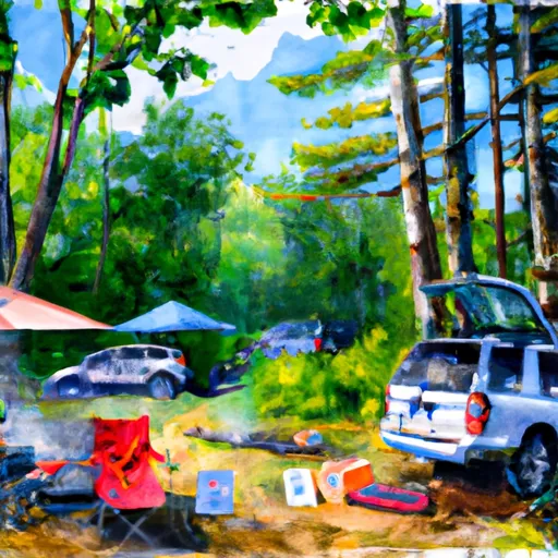
Reservations are required to secure a spot at Oswegatchie 45. This helps to maintain the campground's popularity and guarantee availability, especially during peak seasons. It is advisable to make reservations well in advance to avoid disappointment.
The best time to visit Oswegatchie 45 is during the summer months when the weather is pleasant for outdoor activities such as hiking, fishing, and wildlife watching. However, it is important to note that the campground can get crowded during this time, so planning and booking ahead is crucial.
While enjoying the beautiful surroundings, campers should be cautious of the local wildlife, including black bears. It is essential to properly store food and dispose of trash to prevent attracting animals to the campsite. Additionally, campers should be aware of the rules and regulations in place to ensure the preservation of the campground and its environment.
In summary, Oswegatchie 45 in New York offers a well-equipped camping area with amenities like campsites, restrooms, and potable water. Reservations are required, and it is recommended to visit during the summer months. Campers should be mindful of wildlife and adhere to the campground's rules and regulations to ensure a pleasant and safe camping experience.
What's on-site at Oswegatchie 45
Key facilities Snoflo tracks for this campground. Confirm with the operator before booking -- amenities can change seasonally.
Plan your trip down to the hour
Same weather feed Snoflo's iOS app uses -- updated continuously from NOAA / yr.no.
Next 5 days, hour by hour
Temperature line with weather symbols on top, snow + rain accumulation as columns, humidity as a dotted line.
5-day forecast table
Every 3 hours, broken out across temperature, snow, rain, humidity, and wind. Each cell is colour-coded relative to the column min/max so trends jump out at a glance.
| Time | Condition | Temp (°F) | Snow (in) | Rain (in) | Humidity (%) | Wind (mps) | Wind dir |
|---|---|---|---|---|---|---|---|
| Loading detailed forecast… | |||||||
15-day temperature & precipitation
Daily temperatures, snow, and rain projected over the next two weeks. Hover any point for the full breakdown.
Other campgrounds in the area
Snoflo-tracked campsites within driving distance of Oswegatchie 45, with reservations status.
| Campground | Reservations | Toilets | View |
|---|---|---|---|
| Oswegatchie 44 | ✗ | ✗ | → |
| Oswegatchie 43 | ✗ | ✗ | → |
| Oswegatchie 42 | ✗ | ✗ | → |
| Oswegatchie 41/High Rock | ✗ | ✗ | → |
| Cranberry Lake 41 | ✗ | ✗ | → |
Nearby streamflow
USGS streamgauges within reach of Oswegatchie 45 -- pulled live from the National Water Information System.
| Streamgauge | Discharge | View |
|---|---|---|
| Oswegatchie River Near Oswegatchie Ny | 188 cfs | → |
| West Branch Oswegatchie R Nr Harrisville Ny | 88 cfs | → |
| Raquette River At Piercefield Ny | 508 cfs | → |
| Beaver River At Croghan Ny | 430 cfs | → |
| Buck Creek Near Inlet Ny | 0 cfs | → |
| Buck Creek | 1 cfs | → |
Nearby snow depths
NRCS SNOTEL stations within reach of Oswegatchie 45 -- relevant when planning a shoulder-season or alpine trip.
| SNOTEL station | Snowpack | 24h Snowfall | View |
|---|---|---|---|
| Twitchell | 0.0 in | 0.0 in | → |
| Stillwater Reservoir Area | 0.0 in | 0.0 in | → |
| Stillwater Reservoir | 0.0 in | 0.0 in | → |
| Number Four Snow | 0.0 in | 0.0 in | → |
| Nohrsc Russell 4.1 Sse | 0.0 in | 0.0 in | → |
| Limekiln Lake Rd Nr Inlet | 0.0 in | 0.0 in | → |
Plan a longer trip
The closest parks, lakes, boat launches, and paddle runs so a camping night can grow into a full weekend.
Parks
- Tupper Lake Municipal Park
- Higley Flow State Park
- Gouverneur And St. Lawrence County Fairgrounds
- Great Camp Sagamore
- Catharge Park
- Lewis County Fairgrounds
Boat launches
- Oswegatchie River
- Ranger School Road 68 B, Oswegatchie
- Cranberry Lake
- Stillwater Reservoir
- Horseshoe Lake
- Bog River Flow
Camping essentials & Leave No Trace
- Pack it in, pack it out
- Take all trash, food scraps, and gear back with you to keep campsites clean and protect wildlife.
- Respect wildlife
- Observe animals from a distance, store food securely, and never feed wildlife to maintain natural behavior and safety.
- Know before you go
- Check weather, fire restrictions, trail conditions, and permit requirements to ensure a safe and well-planned trip.
- Minimize campfire impact
- Use established fire rings, keep fires small, fully extinguish them, or opt for a camp stove when fires are restricted.
- Leave what you find
- Preserve natural and cultural features by avoiding removal of plants, rocks, artifacts, or other elements of the environment.
Set push alerts in the Snoflo app
Save Oswegatchie 45 as a favorite, set a custom threshold (precipitation, snowpack, freezing temperatures), and the iOS app will push the moment conditions cross.
About Oswegatchie 45
Can I make reservations at Oswegatchie 45?
This campground does not appear to accept reservations -- it's typically first-come, first-served. Arrive early on summer weekends.
How fresh is the weather data on this page?
The hourly forecast updates throughout the day from the NOAA / yr.no public feeds. Streamflow data is pulled live from USGS streamgauges and snowpack from the NRCS SNOTEL network.
What's the best time of year to visit?
Use the 15-day temperature & precipitation outlook on this page to plan -- pick a window with comfortable temperatures and low precipitation. For longer trips, the 5-day hourly meteogram shows snow + rain accumulation hour-by-hour.
How do I get to Oswegatchie 45?
Tap Directions in the hero above to open driving directions in Google Maps, or Open in map to center the Snoflo interactive map on the campground.
Can I get alerts when conditions change?
Yes -- alerts are managed through the Snoflo iOS app. Favorite this campground, set a threshold (temperature, snowpack, precipitation), and you'll get a push the moment it crosses.
Other campgrounds near here
Snoflo-tracked campgrounds within driving distance of Oswegatchie 45.