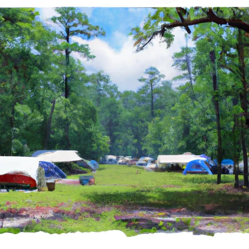
Camp Alice Campground
Community Reviews
Been here? Share the conditions.
Reviews, ratings & photos are added in the free Snoflo iOS app — rate a spot, tag the conditions, and your visit is verified by location. Add or manage your reviews from the app.
Camp Alice
Surrounding Views:
Camp Alice is located in a beautiful area surrounded by dense forests, flowing rivers, and cascading waterfalls. The area offers stunning views of the Blue Ridge Mountains, which are known for their breathtaking beauty.
Specific Nearby Points of Interest:
There are several points of interest located near Camp Alice, including the Linville Gorge Wilderness Area, Table Rock Mountain, Grandfather Mountain, and the Linville Falls. These natural attractions offer visitors opportunities to hike, fish, bird watch, and enjoy scenic drives.
Campground Amenities:
Camp Alice provides visitors with several amenities to enhance their camping experience. These amenities include picnic tables, fire rings, flush toilets, and potable water. The campground also offers a playground, making it an ideal location for families with children.
Interesting Facts About the Area:
The Pisgah National Forest, where Camp Alice is located, is one of the oldest national forests in the United States. The forest was established in 1916, and its name is derived from the Cherokee word for "peaks of the sky." The area is also known for its rich biodiversity, containing over 160 species of trees and 1,600 plant species.
Best Time of Year to Visit:
The best time of year to visit Camp Alice is during the summer months when the weather is warmer and drier. The average temperature during this time of year is around 80 degrees Fahrenheit. However, visitors should be prepared for occasional rain showers and thunderstorms.
In conclusion, Camp Alice is an excellent camping area for visitors who want to enjoy the beauty of the Pisgah National Forest and explore the nearby attractions. With various amenities and stunning views, this camping area is a perfect spot for families, friends, and outdoor enthusiasts.
What's on-site at Camp Alice
Key facilities Snoflo tracks for this campground. Confirm with the operator before booking -- amenities can change seasonally.
Plan your trip down to the hour
Same weather feed Snoflo's iOS app uses -- updated continuously from NOAA / yr.no.
Next 5 days, hour by hour
Temperature line with weather symbols on top, snow + rain accumulation as columns, humidity as a dotted line.
5-day forecast table
Every 3 hours, broken out across temperature, snow, rain, humidity, and wind. Each cell is colour-coded relative to the column min/max so trends jump out at a glance.
| Time | Condition | Temp (°F) | Snow (in) | Rain (in) | Humidity (%) | Wind (mps) | Wind dir |
|---|---|---|---|---|---|---|---|
| Loading detailed forecast… | |||||||
15-day temperature & precipitation
Daily temperatures, snow, and rain projected over the next two weeks. Hover any point for the full breakdown.
Other campgrounds in the area
Snoflo-tracked campsites within driving distance of Camp Alice, with reservations status.
| Campground | Reservations | Toilets | View |
|---|---|---|---|
| Mount Mitchell State Park | ✓ | ✗ | → |
| Briar Bottom Campground | ✗ | ✗ | → |
| Briar Bottom Group Campground | ✗ | ✗ | → |
| Black Mountain | ✗ | ✗ | → |
| Black Mountain Campground | ✗ | ✗ | → |
Nearby streamflow
USGS streamgauges within reach of Camp Alice -- pulled live from the National Water Information System.
| Streamgauge | Discharge | View |
|---|---|---|
| North Fork Swannanoa River Near Walkertown | 11 cfs | → |
| South Toe River Near Celo | 83 cfs | → |
| Beetree Creek Near Swannanoa | 2 cfs | → |
| Catawba R Nr Pleasant Gardens | 89 cfs | → |
| Ivy River Near Marshall | 70 cfs | → |
| French Broad River At Asheville | 1,170 cfs | → |
Nearby snow depths
NRCS SNOTEL stations within reach of Camp Alice -- relevant when planning a shoulder-season or alpine trip.
| SNOTEL station | Snowpack | 24h Snowfall | View |
|---|---|---|---|
| Barnardsville 2 Se | 0.0 in | 0.0 in | → |
| Erwin | 0.0 in | 0.0 in | → |
| Banner Elk | 0.0 in | 0.0 in | → |
| Beech Mountain | 0.0 in | 0.0 in | → |
| Flat Springs 1.2 E | 0.0 in | 0.0 in | → |
| Flat Springs 1e | 0.0 in | 0.0 in | → |
Plan a longer trip
The closest parks, lakes, boat launches, and paddle runs so a camping night can grow into a full weekend.
Parks
- Mount Mitchell State Park
- Carolina Hemlocks Recreational Area
- Big Ivy Historical Park
- Black Mountain Recreation Park
- Blue Ridge Parkway Headquarters
- Yellow Mountain State Natural Area
Boat launches
- Black Bear
- Houseboat Lane 299, Mcdowell County
- Craven Street Bridge
- Hidden Cove Boat Ramp Mcdowell County
- Lake Lyre Boat Ramp
- Canal Bridge Boat Ramp Burke County
Fishing spots
- Asheville Recreation Park Lake
- Nolichucky River
- Bailey Branch
- Anderson Branch
- Big Pine Creek
- Dillard Place
Points of interest
- Mt Mitchell Museum
- Ridge Junction Overlook
- Highest Point On Parkway North Of Asheville, Nc
- Mount Mitchell Overlook
- Bald Knob Ridge Overlook
- Green Knob Overlook
Paddle runs
- Boundary Between Mitchell And Yancy Counties To Nc/Tn Stateline
- Linville Gorge Wilderness Boundary To Southern End Of Wilderness
- Linville Wilderness Boundary To Lake James
- Blue Ridge Parkway Boundary To Linville Gorge Boundary
- Headwaters Above Linville Gap To Blue Ridge Parkway Boundary
- Tn/Nc State Line (Rm 100.6) To Mine Branch (Rm 99.3)
Camping essentials & Leave No Trace
- Pack it in, pack it out
- Take all trash, food scraps, and gear back with you to keep campsites clean and protect wildlife.
- Respect wildlife
- Observe animals from a distance, store food securely, and never feed wildlife to maintain natural behavior and safety.
- Know before you go
- Check weather, fire restrictions, trail conditions, and permit requirements to ensure a safe and well-planned trip.
- Minimize campfire impact
- Use established fire rings, keep fires small, fully extinguish them, or opt for a camp stove when fires are restricted.
- Leave what you find
- Preserve natural and cultural features by avoiding removal of plants, rocks, artifacts, or other elements of the environment.
Set push alerts in the Snoflo app
Save Camp Alice as a favorite, set a custom threshold (precipitation, snowpack, freezing temperatures), and the iOS app will push the moment conditions cross.
About Camp Alice
Can I make reservations at Camp Alice?
This campground does not appear to accept reservations -- it's typically first-come, first-served. Arrive early on summer weekends.
How fresh is the weather data on this page?
The hourly forecast updates throughout the day from the NOAA / yr.no public feeds. Streamflow data is pulled live from USGS streamgauges and snowpack from the NRCS SNOTEL network.
What's the best time of year to visit?
Use the 15-day temperature & precipitation outlook on this page to plan -- pick a window with comfortable temperatures and low precipitation. For longer trips, the 5-day hourly meteogram shows snow + rain accumulation hour-by-hour.
How do I get to Camp Alice?
Tap Directions in the hero above to open driving directions in Google Maps, or Open in map to center the Snoflo interactive map on the campground.
Can I get alerts when conditions change?
Yes -- alerts are managed through the Snoflo iOS app. Favorite this campground, set a threshold (temperature, snowpack, precipitation), and you'll get a push the moment it crosses.
Other campgrounds near here
Snoflo-tracked campgrounds within driving distance of Camp Alice.