Doughton Park Campground Campground
Community Reviews
Been here? Share the conditions.
Reviews, ratings & photos are added in the free Snoflo iOS app — rate a spot, tag the conditions, and your visit is verified by location. Add or manage your reviews from the app.
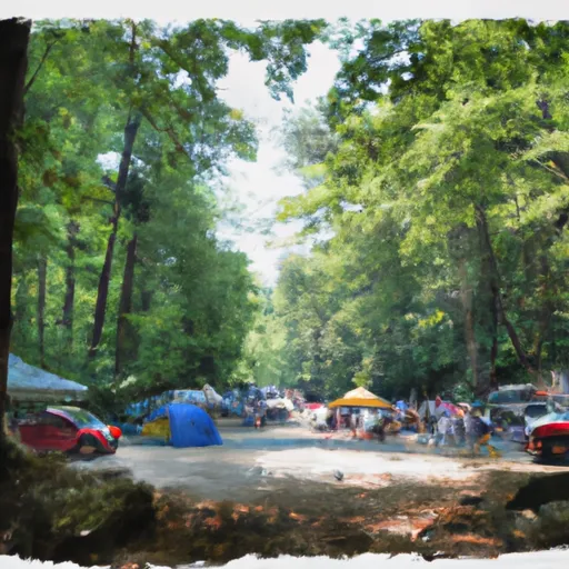
Doughton Park Campground
Nearby points of interest include the Blue Ridge Parkway, which offers spectacular scenic drives and hiking trails, and the Mountain-to-Sea Trail, which is a long-distance hiking trail that passes through the park. There are also several waterfalls and streams in the area, including Roaring Fork Falls and Basin Creek Falls.
The campground amenities include tent and RV sites, restrooms, showers, picnic tables, fire rings and grills. There are also several hiking trails that start at the campground, including the Fodder Stack Trail and the Bluff Mountain Trail. The park also offers ranger-led programs and educational activities for visitors.
Interesting facts about the area include the fact that Doughton Park was once used as a hunting ground by Cherokee Indians and later as a cattle grazing area by early settlers. The park also has a rich history of moonshining and bootlegging during the Prohibition era.
The best time of year to visit Doughton Park Campground is in the fall, when the leaves change colors and the temperatures are mild. The average temperature in October is around 60 degrees Fahrenheit, making it perfect for hiking and outdoor activities. It is important to note that the campground is only open from May to October, so plan accordingly.
What's on-site at Doughton Park Campground
Key facilities Snoflo tracks for this campground. Confirm with the operator before booking -- amenities can change seasonally.
Plan your trip down to the hour
Same weather feed Snoflo's iOS app uses -- updated continuously from NOAA / yr.no.
Next 5 days, hour by hour
Temperature line with weather symbols on top, snow + rain accumulation as columns, humidity as a dotted line.
5-day forecast table
Every 3 hours, broken out across temperature, snow, rain, humidity, and wind. Each cell is colour-coded relative to the column min/max so trends jump out at a glance.
| Time | Condition | Temp (°F) | Snow (in) | Rain (in) | Humidity (%) | Wind (mps) | Wind dir |
|---|---|---|---|---|---|---|---|
| Loading detailed forecast… | |||||||
15-day temperature & precipitation
Daily temperatures, snow, and rain projected over the next two weeks. Hover any point for the full breakdown.
Nearby streamflow
USGS streamgauges within reach of Doughton Park Campground -- pulled live from the National Water Information System.
| Streamgauge | Discharge | View |
|---|---|---|
| South Fork New River Near Jefferson | 202 cfs | → |
| Reddies River At North Wilkesboro | 65 cfs | → |
| New River Near Galax | 1,000 cfs | → |
| Yadkin River At Wilkesboro | 323 cfs | → |
| Chestnut Creek At Galax | 38 cfs | → |
| Mitchell River Near State Road | 57 cfs | → |
Nearby snow depths
NRCS SNOTEL stations within reach of Doughton Park Campground -- relevant when planning a shoulder-season or alpine trip.
| SNOTEL station | Snowpack | 24h Snowfall | View |
|---|---|---|---|
| Jefferson 2 E | 0.0 in | 0.0 in | → |
| Elk Creek Coop | 0.0 in | 0.0 in | → |
| Elkin | 0.0 in | 0.0 in | → |
| Galax Water Plant | 0.0 in | 0.0 in | → |
| Whitetop Coop | 0.0 in | 0.0 in | → |
| Boone 1se | 0.0 in | 0.0 in | → |
Plan a longer trip
The closest parks, lakes, boat launches, and paddle runs so a camping night can grow into a full weekend.
Parks
- Bullhead Mountain State Natural Area
- Thurmond Chatham Game Land
- Stone Mountain State Park
- New River State Park
- Big Spring Bog State Natural Area Preserve
- Mitchell River Game Land
Boat launches
- Farmers Fish Camp Road Alleghany County
- New River Canoe And Campground
- Old River Lane 998, Grayson County
- Cox's Chapel Road Grayson County
- Mouth Of Wilson
- Baywood Boat Ramp
Fishing spots
Camping essentials & Leave No Trace
- Pack it in, pack it out
- Take all trash, food scraps, and gear back with you to keep campsites clean and protect wildlife.
- Respect wildlife
- Observe animals from a distance, store food securely, and never feed wildlife to maintain natural behavior and safety.
- Know before you go
- Check weather, fire restrictions, trail conditions, and permit requirements to ensure a safe and well-planned trip.
- Minimize campfire impact
- Use established fire rings, keep fires small, fully extinguish them, or opt for a camp stove when fires are restricted.
- Leave what you find
- Preserve natural and cultural features by avoiding removal of plants, rocks, artifacts, or other elements of the environment.
Set push alerts in the Snoflo app
Save Doughton Park Campground as a favorite, set a custom threshold (precipitation, snowpack, freezing temperatures), and the iOS app will push the moment conditions cross.
About Doughton Park Campground
Can I make reservations at Doughton Park Campground?
This campground does not appear to accept reservations -- it's typically first-come, first-served. Arrive early on summer weekends.
How fresh is the weather data on this page?
The hourly forecast updates throughout the day from the NOAA / yr.no public feeds. Streamflow data is pulled live from USGS streamgauges and snowpack from the NRCS SNOTEL network.
What's the best time of year to visit?
Use the 15-day temperature & precipitation outlook on this page to plan -- pick a window with comfortable temperatures and low precipitation. For longer trips, the 5-day hourly meteogram shows snow + rain accumulation hour-by-hour.
How do I get to Doughton Park Campground?
Tap Directions in the hero above to open driving directions in Google Maps, or Open in map to center the Snoflo interactive map on the campground.
Can I get alerts when conditions change?
Yes -- alerts are managed through the Snoflo iOS app. Favorite this campground, set a threshold (temperature, snowpack, precipitation), and you'll get a push the moment it crosses.
Other campgrounds near here
Snoflo-tracked campgrounds within driving distance of Doughton Park Campground.