Corral Springs Campground Campground
Community Reviews
Been here? Share the conditions.
Reviews, ratings & photos are added in the free Snoflo iOS app — rate a spot, tag the conditions, and your visit is verified by location. Add or manage your reviews from the app.
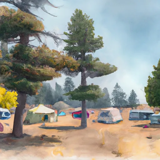
Corral Springs Campground
Reservations are not accepted at Corral Springs Campground, as it operates on a first-come, first-served basis. It is recommended to arrive early, especially during peak seasons, to secure a campsite. The best time to visit this campground is during the summer months, from June to September, when the weather is more favorable for outdoor activities.
While camping at Corral Springs, there are a few notable items of interest to explore. The campground is situated near the scenic Santiam Pass, providing opportunities for hiking, fishing, and wildlife viewing. It is also in close proximity to several beautiful lakes, offering visitors the chance to enjoy water activities such as boating and swimming. However, campers should be cautious of wildlife encounters, including black bears and cougars, and should store food securely to avoid attracting them. In summary, Corral Springs Campground in Oregon is a delightful camping destination with basic amenities and a variety of outdoor activities to enjoy during the summer months.
What's on-site at Corral Springs Campground
Key facilities Snoflo tracks for this campground. Confirm with the operator before booking -- amenities can change seasonally.
Plan your trip down to the hour
Same weather feed Snoflo's iOS app uses -- updated continuously from NOAA / yr.no.
Next 5 days, hour by hour
Temperature line with weather symbols on top, snow + rain accumulation as columns, humidity as a dotted line.
5-day forecast table
Every 3 hours, broken out across temperature, snow, rain, humidity, and wind. Each cell is colour-coded relative to the column min/max so trends jump out at a glance.
| Time | Condition | Temp (°F) | Snow (in) | Rain (in) | Humidity (%) | Wind (mps) | Wind dir |
|---|---|---|---|---|---|---|---|
| Loading detailed forecast… | |||||||
15-day temperature & precipitation
Daily temperatures, snow, and rain projected over the next two weeks. Hover any point for the full breakdown.
Other campgrounds in the area
Snoflo-tracked campsites within driving distance of Corral Springs Campground, with reservations status.
| Campground | Reservations | Toilets | View |
|---|---|---|---|
| Corral Springs | ✗ | ✓ | → |
| Digit Point | ✗ | ✓ | → |
| Digit Point Campground | ✓ | ✗ | → |
| Boundary Spring | ✗ | ✓ | → |
| Kelsay Valley Campground / Trailhead | ✓ | ✗ | → |
Nearby streamflow
USGS streamgauges within reach of Corral Springs Campground -- pulled live from the National Water Information System.
| Streamgauge | Discharge | View |
|---|---|---|
| Lake Creek Near Diamond | 113 cfs | → |
| North Umpqua R Bl Lemolo Lk Nr T Falls | 87 cfs | → |
| N.Umpqua R Abv White Mule Ck | 89 cfs | → |
| N.Umpqua R Blw Warm Springs Ck Nr Toketee Falls | 89 cfs | → |
| Clearwater R Ab Trap Cr Nr T Falls | 52 cfs | → |
| Clearwater R Blw Mowich Creek | 50 cfs | → |
Nearby snow depths
NRCS SNOTEL stations within reach of Corral Springs Campground -- relevant when planning a shoulder-season or alpine trip.
| SNOTEL station | Snowpack | 24h Snowfall | View |
|---|---|---|---|
| Chemult Alternate | 0.0 in | 0.0 in | → |
| Nohrsc Chemult Alternate | 0.0 in | 0.0 in | → |
| Nohrsc Crescent | 0.0 in | 0.0 in | → |
| Nohrsc Crescent 0.7 W | 0.0 in | 0.0 in | → |
| Diamond Lake | 0.0 in | 0.0 in | → |
| Nohrsc Diamond Lake | 0.0 in | 0.0 in | → |
Plan a longer trip
The closest parks, lakes, boat launches, and paddle runs so a camping night can grow into a full weekend.
Parks
- Deschutes National Forest
- Wilderness Mount Thielsen
- Wilderness Diamond Peak
- Willamette National Forest
- Andrew Wiley Park
- National Wildlife Refuge Klamath Marsh
Boat launches
- Digit Point Campground
- North End Boating Site (Diamond Lake)
- North End Boat Ramp
- Diamond Lake Campground - C Loop
- Diamond Lake Campground - M Loop
- Spring Campground
Fishing spots
Points of interest
- Hemlock Butte Ski Cabin
- Lemolo Falls
- Mazama Viewpoint
- Westview Shelter
- Betchtel Shelter
- Wizard Island
Paddle runs
- Mt. Thielsen Wilderness Boundary To Maidu Lake
- Oregon Cascades Recreation Area Boundary To Mt. Thielsen Wilderness Boundary
- Lemolo Lake To Oregon Cacades Recreation Area Boundary
- Headwaters To Rogue-Umpqua Wilderness Boundary
- Rogue-Umpqua Wilderness Boundary To Confluence With North Fork Rogue River
- Lower Timpanogas Lake To Confluence With Echo Creek
Camping essentials & Leave No Trace
- Pack it in, pack it out
- Take all trash, food scraps, and gear back with you to keep campsites clean and protect wildlife.
- Respect wildlife
- Observe animals from a distance, store food securely, and never feed wildlife to maintain natural behavior and safety.
- Know before you go
- Check weather, fire restrictions, trail conditions, and permit requirements to ensure a safe and well-planned trip.
- Minimize campfire impact
- Use established fire rings, keep fires small, fully extinguish them, or opt for a camp stove when fires are restricted.
- Leave what you find
- Preserve natural and cultural features by avoiding removal of plants, rocks, artifacts, or other elements of the environment.
Set push alerts in the Snoflo app
Save Corral Springs Campground as a favorite, set a custom threshold (precipitation, snowpack, freezing temperatures), and the iOS app will push the moment conditions cross.
About Corral Springs Campground
Can I make reservations at Corral Springs Campground?
This campground does not appear to accept reservations -- it's typically first-come, first-served. Arrive early on summer weekends.
How fresh is the weather data on this page?
The hourly forecast updates throughout the day from the NOAA / yr.no public feeds. Streamflow data is pulled live from USGS streamgauges and snowpack from the NRCS SNOTEL network.
What's the best time of year to visit?
Use the 15-day temperature & precipitation outlook on this page to plan -- pick a window with comfortable temperatures and low precipitation. For longer trips, the 5-day hourly meteogram shows snow + rain accumulation hour-by-hour.
How do I get to Corral Springs Campground?
Tap Directions in the hero above to open driving directions in Google Maps, or Open in map to center the Snoflo interactive map on the campground.
Can I get alerts when conditions change?
Yes -- alerts are managed through the Snoflo iOS app. Favorite this campground, set a threshold (temperature, snowpack, precipitation), and you'll get a push the moment it crosses.
Other campgrounds near here
Snoflo-tracked campgrounds within driving distance of Corral Springs Campground.