Twin Rocks Shelter Campground
Community Reviews
Been here? Share the conditions.
Reviews, ratings & photos are added in the free Snoflo iOS app — rate a spot, tag the conditions, and your visit is verified by location. Add or manage your reviews from the app.
Twin Rocks Shelter
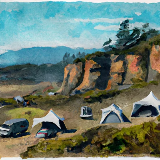
The campground features seven primitive campsites and amenities include picnic tables, fire rings, and vault toilets. The campground operates on a first-come, first-served basis and is open year-round.
An interesting fact about the area is that it is home to the largest wooden structure in the world, the Tillamook Air Museum, which was formerly a blimp hangar during World War II.
The best time of year to visit the Twin Rocks Shelter Camping Area is during the summer months when temperatures are mild, averaging around 70 degrees Fahrenheit during the day and dropping to the mid-50s at night. It is important to note, however, that the area can experience heavy rainfall during the winter months.
What's on-site at Twin Rocks Shelter
Key facilities Snoflo tracks for this campground. Confirm with the operator before booking -- amenities can change seasonally.
Plan your trip down to the hour
Same weather feed Snoflo's iOS app uses -- updated continuously from NOAA / yr.no.
Next 5 days, hour by hour
Temperature line with weather symbols on top, snow + rain accumulation as columns, humidity as a dotted line.
5-day forecast table
Every 3 hours, broken out across temperature, snow, rain, humidity, and wind. Each cell is colour-coded relative to the column min/max so trends jump out at a glance.
| Time | Condition | Temp (°F) | Snow (in) | Rain (in) | Humidity (%) | Wind (mps) | Wind dir |
|---|---|---|---|---|---|---|---|
| Loading detailed forecast… | |||||||
15-day temperature & precipitation
Daily temperatures, snow, and rain projected over the next two weeks. Hover any point for the full breakdown.
Other campgrounds in the area
Snoflo-tracked campsites within driving distance of Twin Rocks Shelter, with reservations status.
| Campground | Reservations | Toilets | View |
|---|---|---|---|
| Saddle Camp Shelter | ✗ | ✗ | → |
| Mineral Forest Camp | ✗ | ✓ | → |
| Mineral Campground | ✗ | ✗ | → |
| Mineral Camp Campground | ✓ | ✗ | → |
| Musick Guard Station | ✗ | ✗ | → |
Nearby streamflow
USGS streamgauges within reach of Twin Rocks Shelter -- pulled live from the National Water Information System.
| Streamgauge | Discharge | View |
|---|---|---|
| Steamboat Creek Near Glide | 29 cfs | → |
| Row River Above Pitcher Creek Near | 30 cfs | → |
| M F Willamette R Ab Salt Cr. | 546 cfs | → |
| Boulder Creek Near Toketee Falls | 5 cfs | → |
| N Umpqua River Abv Copeland Ck Nr Toketee Falls | 678 cfs | → |
| Mf Willamette River Blw N Fork | 926 cfs | → |
Nearby snow depths
NRCS SNOTEL stations within reach of Twin Rocks Shelter -- relevant when planning a shoulder-season or alpine trip.
| SNOTEL station | Snowpack | 24h Snowfall | View |
|---|---|---|---|
| Nohrsc Holland Meadows | 0.0 in | 0.0 in | → |
| Holland Meadows | 0.0 in | 0.0 in | → |
| Cottage Grove 2e | 0.0 in | 0.0 in | → |
| Toketee Airstrip | 0.0 in | 0.0 in | → |
| Nohrsc Toketee Airstrip | 0.0 in | 0.0 in | → |
| Railroad Overpass | 0.0 in | 0.0 in | → |
Plan a longer trip
The closest parks, lakes, boat launches, and paddle runs so a camping night can grow into a full weekend.
Parks
- Greenwater Rest & Recreation Area
- Salmon Creek Park
- Wilderness Boulder Creek
- Willamette National Forest
- South Regional Park
- Lions Ballfield
Boat launches
- Bingham Boat Ramp
- Gravel Bin Take Out
- Packard Creek Day Use Area
- Forest Road 2100-019 Lane County
- Bogus Creek
- Bogus Raft Launch Boating Site
Fishing spots
Points of interest
- Warner Mountain Lookout
- Dorena Bridge
- Office Bridge
- Flying Dog Gallery
- Susan Creek Campground
- Baker Wayside Recreation Site
Paddle runs
- Headwaters Of East Fork Steamboat Creek To Confluence With Siwash Creek
- Confluence Of Siwash Creek To Little Falls
- Confluence With Echo Creek To Hills Creek Reservoir
- Little Falls To Confluence With North Umpqua River
- Lower Timpanogas Lake To Confluence With Echo Creek
- Headwaters To Boulder Creek Wilderness Boundary
Camping essentials & Leave No Trace
- Pack it in, pack it out
- Take all trash, food scraps, and gear back with you to keep campsites clean and protect wildlife.
- Respect wildlife
- Observe animals from a distance, store food securely, and never feed wildlife to maintain natural behavior and safety.
- Know before you go
- Check weather, fire restrictions, trail conditions, and permit requirements to ensure a safe and well-planned trip.
- Minimize campfire impact
- Use established fire rings, keep fires small, fully extinguish them, or opt for a camp stove when fires are restricted.
- Leave what you find
- Preserve natural and cultural features by avoiding removal of plants, rocks, artifacts, or other elements of the environment.
Set push alerts in the Snoflo app
Save Twin Rocks Shelter as a favorite, set a custom threshold (precipitation, snowpack, freezing temperatures), and the iOS app will push the moment conditions cross.
About Twin Rocks Shelter
Can I make reservations at Twin Rocks Shelter?
This campground does not appear to accept reservations -- it's typically first-come, first-served. Arrive early on summer weekends.
How fresh is the weather data on this page?
The hourly forecast updates throughout the day from the NOAA / yr.no public feeds. Streamflow data is pulled live from USGS streamgauges and snowpack from the NRCS SNOTEL network.
What's the best time of year to visit?
Use the 15-day temperature & precipitation outlook on this page to plan -- pick a window with comfortable temperatures and low precipitation. For longer trips, the 5-day hourly meteogram shows snow + rain accumulation hour-by-hour.
How do I get to Twin Rocks Shelter?
Tap Directions in the hero above to open driving directions in Google Maps, or Open in map to center the Snoflo interactive map on the campground.
Can I get alerts when conditions change?
Yes -- alerts are managed through the Snoflo iOS app. Favorite this campground, set a threshold (temperature, snowpack, precipitation), and you'll get a push the moment it crosses.
Other campgrounds near here
Snoflo-tracked campgrounds within driving distance of Twin Rocks Shelter.