Fisher Landing campground
Community Reviews
Been here? Share the conditions.
Reviews, ratings & photos are added in the free Snoflo iOS app — rate a spot, tag the conditions, and your visit is verified by location. Add or manage your reviews from the app.
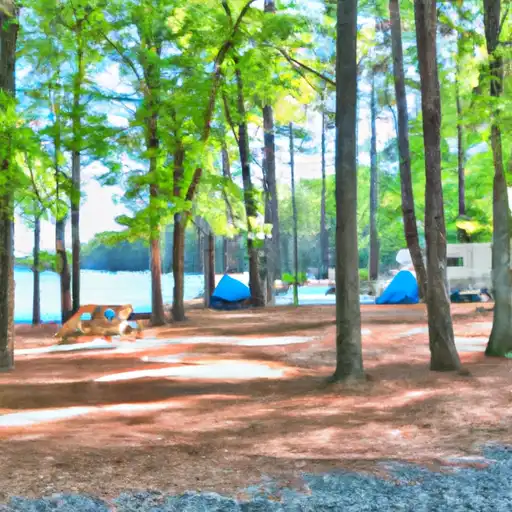
Fisher Landing
Fisher Landing is a campground in Virginia tracked by Snoflo. This page combines live weather, USGS streamflow, NRCS snowpack readings, and amenity data with nearby parks, lakes, and boat launches so you can plan a trip from a single screen.
Use the forecast meteograms to pick a weather window, the amenities card to confirm reservations and facilities, and the Nearby section to extend a single night into a longer trip. For push alerts when conditions change, save this campground as a favorite in the Snoflo iOS app.
What's on-site at Fisher Landing
Key facilities Snoflo tracks for this campground. Confirm with the operator before booking -- amenities can change seasonally.
Plan your trip down to the hour
Same weather feed Snoflo's iOS app uses -- updated continuously from NOAA / yr.no.
Next 5 days, hour by hour
Temperature line with weather symbols on top, snow + rain accumulation as columns, humidity as a dotted line.
5-day forecast table
Every 3 hours, broken out across temperature, snow, rain, humidity, and wind. Each cell is colour-coded relative to the column min/max so trends jump out at a glance.
| Time | Condition | Temp (°F) | Snow (in) | Rain (in) | Humidity (%) | Wind (mps) | Wind dir |
|---|---|---|---|---|---|---|---|
| Loading detailed forecast… | |||||||
15-day temperature & precipitation
Daily temperatures, snow, and rain projected over the next two weeks. Hover any point for the full breakdown.
Other campgrounds in the area
Snoflo-tracked campsites within driving distance of Fisher Landing, with reservations status.
| Campground | Reservations | Toilets | View |
|---|---|---|---|
| Flanners Beach/Neuse River Campground | ✓ | ✗ | → |
| Oyster Point Camp | ✗ | ✗ | → |
| Cedar Point | ✓ | ✗ | → |
| Hammocks Beach State Park | ✗ | ✓ | → |
| Goose Creek State Park Tent Campground | ✗ | ✗ | → |
Nearby streamflow
USGS streamgauges within reach of Fisher Landing -- pulled live from the National Water Information System.
| Streamgauge | Discharge | View |
|---|---|---|
| Trent River Near Trenton | 7 cfs | → |
| Neuse River Near Fort Barnwell | 496 cfs | → |
| New River Near Gum Branch | 22 cfs | → |
| Neuse River At Kinston | 261 cfs | → |
| Chicod Cr At Sr1760 Near Simpson | 2 cfs | → |
| Contentnea Creek At Hookerton | 38 cfs | → |
Nearby snow depths
NRCS SNOTEL stations within reach of Fisher Landing -- relevant when planning a shoulder-season or alpine trip.
| SNOTEL station | Snowpack | 24h Snowfall | View |
|---|---|---|---|
| New Bern 7.3 Ese | 0.0 in | 0.0 in | → |
| Trent Woods 1.3 Sse | 0.0 in | 0.0 in | → |
| Grantsboro 4.6 Ssw | 0.0 in | 0.0 in | → |
| Havelock 1.9 Sse | 0.0 in | 0.0 in | → |
| New Bern 6.4 Ene | 0.0 in | 0.0 in | → |
| New Bern 5.3 Sw | 0.0 in | 0.0 in | → |
Plan a longer trip
The closest parks, lakes, boat launches, and paddle runs so a camping night can grow into a full weekend.
Parks
- Neuse River Game Land
- Wilderness Sheep Ridge
- Wilderness Catfish Lake South
- Wilderness Pond Pine
- Croatan National Forest
- Wilderness Pocosin
Boat launches
- Lee Landing Road, New Bern
- Creek Place Road 349, Arapahoe
- Midyette Street 301, Oriental
- Dixon Fields Canoe Launch
- Weyerhaeuser Road Craven County
- Long Point Road Jones County
Paddle runs
- Fs Road 121-2 To Confluence With Brice Creek
- East Prong From Sr 1100 To Confluence With Brice Creek
- West Prong From Sr 1100 To Fs Road 121-2
- Brice Creek From Confluence With East/West Prongs To Nf Boundary Past Brice Creek Boat Ramp
- Nf Boundary To Confluence With Trent River
- 1.25 Miles Upstream From Hwy 17 Bridge To Black Swamp Creek
Camping essentials & Leave No Trace
- Pack it in, pack it out
- Take all trash, food scraps, and gear back with you to keep campsites clean and protect wildlife.
- Respect wildlife
- Observe animals from a distance, store food securely, and never feed wildlife to maintain natural behavior and safety.
- Know before you go
- Check weather, fire restrictions, trail conditions, and permit requirements to ensure a safe and well-planned trip.
- Minimize campfire impact
- Use established fire rings, keep fires small, fully extinguish them, or opt for a camp stove when fires are restricted.
- Leave what you find
- Preserve natural and cultural features by avoiding removal of plants, rocks, artifacts, or other elements of the environment.
Set push alerts in the Snoflo app
Save Fisher Landing as a favorite, set a custom threshold (precipitation, snowpack, freezing temperatures), and the iOS app will push the moment conditions cross.
About Fisher Landing
Can I make reservations at Fisher Landing?
This campground does not appear to accept reservations -- it's typically first-come, first-served. Arrive early on summer weekends.
How fresh is the weather data on this page?
The hourly forecast updates throughout the day from the NOAA / yr.no public feeds. Streamflow data is pulled live from USGS streamgauges and snowpack from the NRCS SNOTEL network.
What's the best time of year to visit?
Use the 15-day temperature & precipitation outlook on this page to plan -- pick a window with comfortable temperatures and low precipitation. For longer trips, the 5-day hourly meteogram shows snow + rain accumulation hour-by-hour.
How do I get to Fisher Landing?
Tap Directions in the hero above to open driving directions in Google Maps, or Open in map to center the Snoflo interactive map on the campground.
Can I get alerts when conditions change?
Yes -- alerts are managed through the Snoflo iOS app. Favorite this campground, set a threshold (temperature, snowpack, precipitation), and you'll get a push the moment it crosses.
Other campgrounds near here
Snoflo-tracked campgrounds within driving distance of Fisher Landing.