Larrabee State Park Campground
Community Reviews
Been here? Share the conditions.
Reviews, ratings & photos are added in the free Snoflo iOS app — rate a spot, tag the conditions, and your visit is verified by location. Add or manage your reviews from the app.
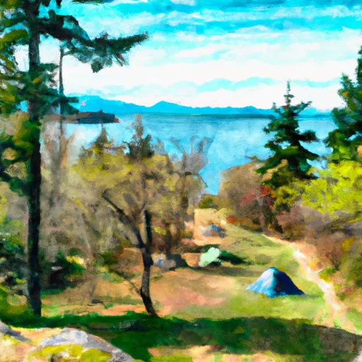
Larrabee State Park
The best time to visit Larrabee State Park is during the summer months when the weather is mild and perfect for outdoor activities. However, it is important to note that this is a popular destination, so making a reservation ahead of time is highly recommended. It is worth mentioning that the park can get crowded during peak season, so planning your trip during weekdays or non-peak times can provide a more peaceful and serene camping experience.
While exploring Larrabee State Park, campers should be cautious of the presence of wildlife, including bears and deer. It is essential to properly store food and garbage to avoid attracting these animals to your campsite. Additionally, there are specific regulations in place regarding campfires, so it is crucial to follow the guidelines provided by the park. Overall, Larrabee State Park offers a beautiful setting for camping, with a range of amenities, making it an excellent choice for outdoor enthusiasts seeking a memorable camping experience in Washington.
What's on-site at Larrabee State Park
Key facilities Snoflo tracks for this campground. Confirm with the operator before booking -- amenities can change seasonally.
Plan your trip down to the hour
Same weather feed Snoflo's iOS app uses -- updated continuously from NOAA / yr.no.
Next 5 days, hour by hour
Temperature line with weather symbols on top, snow + rain accumulation as columns, humidity as a dotted line.
5-day forecast table
Every 3 hours, broken out across temperature, snow, rain, humidity, and wind. Each cell is colour-coded relative to the column min/max so trends jump out at a glance.
| Time | Condition | Temp (°F) | Snow (in) | Rain (in) | Humidity (%) | Wind (mps) | Wind dir |
|---|---|---|---|---|---|---|---|
| Loading detailed forecast… | |||||||
15-day temperature & precipitation
Daily temperatures, snow, and rain projected over the next two weeks. Hover any point for the full breakdown.
Other campgrounds in the area
Snoflo-tracked campsites within driving distance of Larrabee State Park, with reservations status.
| Campground | Reservations | Toilets | View |
|---|---|---|---|
| Cedar Lake Camp | ✗ | ✗ | → |
| Pine Lake Camp | ✗ | ✗ | → |
| Lizard Lake Camp | ✗ | ✗ | → |
| Samish Island Campground & Retreat Center | ✗ | ✗ | → |
| Friday Creek Campground | ✗ | ✗ | → |
Nearby streamflow
USGS streamgauges within reach of Larrabee State Park -- pulled live from the National Water Information System.
| Streamgauge | Discharge | View |
|---|---|---|
| Olsen Creek Near Bellingham | 1 cfs | → |
| Carpenter Creek At N Shore Drive Nr Bellingham | 0 cfs | → |
| Brannian Creek At S Bay Dr Nr Wickersham | 0 cfs | → |
| Anderson Creek Near Bellingham | 1 cfs | → |
| Samish River Near Burlington | 30 cfs | → |
| Nooksack River At Ferndale | 1,450 cfs | → |
Nearby snow depths
NRCS SNOTEL stations within reach of Larrabee State Park -- relevant when planning a shoulder-season or alpine trip.
| SNOTEL station | Snowpack | 24h Snowfall | View |
|---|---|---|---|
| Elbow Lake | 0.0 in | 0.0 in | → |
| Elbow Lake | 0.0 in | 0.0 in | → |
| Nohrsc Mf Nooksack | 0.0 in | 0.0 in | → |
| Mf Nooksack | 0.0 in | 0.0 in | → |
| Nohrsc Wells Creek | 0.0 in | 0.0 in | → |
| Wells Creek | 0.0 in | 0.0 in | → |
Plan a longer trip
The closest parks, lakes, boat launches, and paddle runs so a camping night can grow into a full weekend.
Parks
- Larrabee State Park
- Boulevard Park
- Maritime Heritage Park
- Whatcom Falls Park
- Elizabeth Park
- Cornwall Memorial Park
Boat launches
- Larrabee State Park
- Galbriath Loop Bellingham
- 6th Street
- Chuckanut Drive 3098, Skagit County
- Lake Samish
- Beach Avenue Whatcom County
Points of interest
- Whatcom Maritime Heritage Museum
- Steam Work For Bellingham
- Wandering Oaks Fine Art Gallery And Glass Studio
- Dakota Gallery
- Geheim Gallery
- Spark Museum Of Electrical Invention
Paddle runs
- Fish Hatchery To Confluence With South Fork Nooksack River
- Nooksack Falls Power Plant To Fish Hatchery Near Kendall, Wa
- Headwaters In Ne1/4 Of Sec 23, T37n, R7e To Confluence With Soufh Fork Nooksack River
- Headwaters To Confluence With Bell Creek
- Bell Creek To Mt. Baker-Snoqualmie Nf Boundary
- Douglas Fir Campground To Mt. Baker Highway
Camping essentials & Leave No Trace
- Pack it in, pack it out
- Take all trash, food scraps, and gear back with you to keep campsites clean and protect wildlife.
- Respect wildlife
- Observe animals from a distance, store food securely, and never feed wildlife to maintain natural behavior and safety.
- Know before you go
- Check weather, fire restrictions, trail conditions, and permit requirements to ensure a safe and well-planned trip.
- Minimize campfire impact
- Use established fire rings, keep fires small, fully extinguish them, or opt for a camp stove when fires are restricted.
- Leave what you find
- Preserve natural and cultural features by avoiding removal of plants, rocks, artifacts, or other elements of the environment.
Set push alerts in the Snoflo app
Save Larrabee State Park as a favorite, set a custom threshold (precipitation, snowpack, freezing temperatures), and the iOS app will push the moment conditions cross.
About Larrabee State Park
Can I make reservations at Larrabee State Park?
Yes -- this campground accepts reservations. Snoflo recommends booking early for peak season; check the operator (Recreation.gov / state park system / private operator) for the booking window and cancellation policy.
How fresh is the weather data on this page?
The hourly forecast updates throughout the day from the NOAA / yr.no public feeds. Streamflow data is pulled live from USGS streamgauges and snowpack from the NRCS SNOTEL network.
What's the best time of year to visit?
Use the 15-day temperature & precipitation outlook on this page to plan -- pick a window with comfortable temperatures and low precipitation. For longer trips, the 5-day hourly meteogram shows snow + rain accumulation hour-by-hour.
How do I get to Larrabee State Park?
Tap Directions in the hero above to open driving directions in Google Maps, or Open in map to center the Snoflo interactive map on the campground.
Can I get alerts when conditions change?
Yes -- alerts are managed through the Snoflo iOS app. Favorite this campground, set a threshold (temperature, snowpack, precipitation), and you'll get a push the moment it crosses.
Other campgrounds near here
Snoflo-tracked campgrounds within driving distance of Larrabee State Park.