Mowich Lake - Mount Rainier National Park Campground
Community Reviews
Been here? Share the conditions.
Reviews, ratings & photos are added in the free Snoflo iOS app — rate a spot, tag the conditions, and your visit is verified by location. Add or manage your reviews from the app.
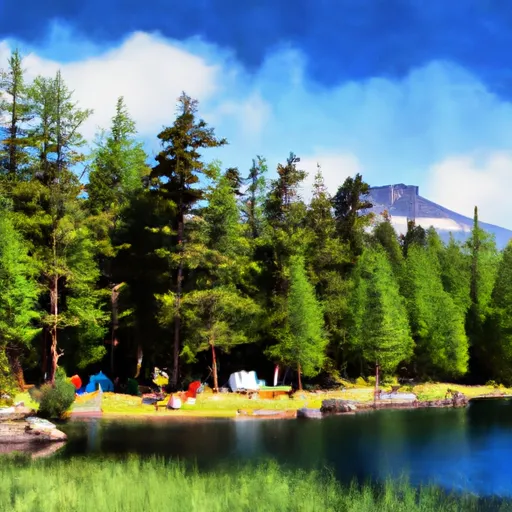
Mowich Lake - Mount Rainier National Park
Reservations are not accepted for the Mowich Lake campground, and it operates on a first-come, first-served basis. This means that campers should arrive early to secure a spot, especially during peak seasons when the campground tends to fill up quickly. The best time of year to visit Mowich Lake is during the summer months, from July to September, when the weather is generally mild and the lake is accessible. However, visitors should be aware that the campground is only open from late June to early October, depending on weather conditions.
Aside from the stunning Mowich Lake, there are several points of interest near the campground. Hikers can explore numerous trails, including the popular Spray Park Trail, which offers striking views of wildflowers, waterfalls, and glaciers. Wildlife enthusiasts may have the opportunity to spot black bears, elk, and various bird species. It is important to be cautious and store all food securely to avoid attracting animals. Moreover, campers should be prepared for changing weather conditions and be aware of the park's regulations to ensure a safe and enjoyable trip.
What's on-site at Mowich Lake - Mount Rainier National Park
Key facilities Snoflo tracks for this campground. Confirm with the operator before booking -- amenities can change seasonally.
Plan your trip down to the hour
Same weather feed Snoflo's iOS app uses -- updated continuously from NOAA / yr.no.
Next 5 days, hour by hour
Temperature line with weather symbols on top, snow + rain accumulation as columns, humidity as a dotted line.
5-day forecast table
Every 3 hours, broken out across temperature, snow, rain, humidity, and wind. Each cell is colour-coded relative to the column min/max so trends jump out at a glance.
| Time | Condition | Temp (°F) | Snow (in) | Rain (in) | Humidity (%) | Wind (mps) | Wind dir |
|---|---|---|---|---|---|---|---|
| Loading detailed forecast… | |||||||
15-day temperature & precipitation
Daily temperatures, snow, and rain projected over the next two weeks. Hover any point for the full breakdown.
Other campgrounds in the area
Snoflo-tracked campsites within driving distance of Mowich Lake - Mount Rainier National Park, with reservations status.
| Campground | Reservations | Toilets | View |
|---|---|---|---|
| Mowich Lake Walk-In Campground | ✗ | ✗ | → |
| Eagle's Roost Camp | ✓ | ✓ | → |
| South Mowich River Camp | ✓ | ✗ | → |
| Cataract Valley Camp | ✓ | ✓ | → |
| Ipsut Creek Campground | ✓ | ✓ | → |
Nearby streamflow
USGS streamgauges within reach of Mowich Lake - Mount Rainier National Park -- pulled live from the National Water Information System.
| Streamgauge | Discharge | View |
|---|---|---|
| Puyallup River Near Electron | 571 cfs | → |
| Carbon River Near Fairfax | 410 cfs | → |
| White River Below Clearwater River Nr Buckley | 2,550 cfs | → |
| Nisqually River Near National | 634 cfs | → |
| South Prairie Creek At South Prairie | 54 cfs | → |
| White River Above Boise Creek At Buckley | 627 cfs | → |
Nearby snow depths
NRCS SNOTEL stations within reach of Mowich Lake - Mount Rainier National Park -- relevant when planning a shoulder-season or alpine trip.
| SNOTEL station | Snowpack | 24h Snowfall | View |
|---|---|---|---|
| Mowich | 0.0 in | 0.0 in | → |
| Burnt Mountain | 0.0 in | 0.0 in | → |
| Nohrsc Burnt Mountain | 0.0 in | 0.0 in | → |
| Paradise | 5.9 in | 0.0 in | → |
| Rainier Paradise Ranger Stn | 0.0 in | 0.0 in | → |
| Paradise | 0.0 in | 0.0 in | → |
Plan a longer trip
The closest parks, lakes, boat launches, and paddle runs so a camping night can grow into a full weekend.
Parks
- Wilderness Clearwater
- Wilderness Glacier View
- Wilkeson Creek County Park
- Federation Forest State Park
- White River Park
- King County Enumclaw Park
Boat launches
- Orville Road East 29517, Orting
- Benbow Resort
- Lake Whitman
- State Game Road 11999, Pierce County
- Clear Lake
- Orville Road East 39200-41144, Eatonville
Points of interest
- Mowich Lake Ranger Station
- Tolmie Peak Lookout
- Evans Creek Off Road Vehicle Trail Area
- Coffee Cup
- The Trident
- Mount Fremont Fire Lookout
Paddle runs
- Confluence With Ipsut Creek To Western Boundary Of Mount Rainier National Park
- Headwaters On The Nw Slope Of Mount Rainier At Carbon Glacier To Confluence With Ipsut Creek
- Headwaters In The Mystic Lake Basin On The North Side Of Mount Rainier To Northern Boundary Of Mount Rainier National Park
- Headwaters At The Terminus Of The Ingraham Glacier To Ends 1/4 Mile North Of Box Canyon
- Headwaters On The Southeast Flank Of Mount Rainier At An Elevation Of 5500 Ft To Confluence With Chinook Creek
- Huckleberry Creek To Confluence With Clearwater River
Camping essentials & Leave No Trace
- Pack it in, pack it out
- Take all trash, food scraps, and gear back with you to keep campsites clean and protect wildlife.
- Respect wildlife
- Observe animals from a distance, store food securely, and never feed wildlife to maintain natural behavior and safety.
- Know before you go
- Check weather, fire restrictions, trail conditions, and permit requirements to ensure a safe and well-planned trip.
- Minimize campfire impact
- Use established fire rings, keep fires small, fully extinguish them, or opt for a camp stove when fires are restricted.
- Leave what you find
- Preserve natural and cultural features by avoiding removal of plants, rocks, artifacts, or other elements of the environment.
Set push alerts in the Snoflo app
Save Mowich Lake - Mount Rainier National Park as a favorite, set a custom threshold (precipitation, snowpack, freezing temperatures), and the iOS app will push the moment conditions cross.
About Mowich Lake - Mount Rainier National Park
Can I make reservations at Mowich Lake - Mount Rainier National Park?
This campground does not appear to accept reservations -- it's typically first-come, first-served. Arrive early on summer weekends.
How fresh is the weather data on this page?
The hourly forecast updates throughout the day from the NOAA / yr.no public feeds. Streamflow data is pulled live from USGS streamgauges and snowpack from the NRCS SNOTEL network.
What's the best time of year to visit?
Use the 15-day temperature & precipitation outlook on this page to plan -- pick a window with comfortable temperatures and low precipitation. For longer trips, the 5-day hourly meteogram shows snow + rain accumulation hour-by-hour.
How do I get to Mowich Lake - Mount Rainier National Park?
Tap Directions in the hero above to open driving directions in Google Maps, or Open in map to center the Snoflo interactive map on the campground.
Can I get alerts when conditions change?
Yes -- alerts are managed through the Snoflo iOS app. Favorite this campground, set a threshold (temperature, snowpack, precipitation), and you'll get a push the moment it crosses.
Other campgrounds near here
Snoflo-tracked campgrounds within driving distance of Mowich Lake - Mount Rainier National Park.