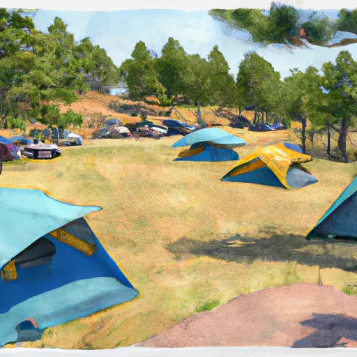
Site 38 Campground
Community Reviews
Been here? Share the conditions.
Reviews, ratings & photos are added in the free Snoflo iOS app — rate a spot, tag the conditions, and your visit is verified by location. Add or manage your reviews from the app.
Site 38
Reservations are accepted at Site 38, allowing campers to plan their trip in advance and secure a spot. It is advisable to make a reservation, especially during peak seasons, as availability can be limited. The best time of year to visit is during the warmer months, typically from late spring to early fall, when the weather is pleasant and conducive to outdoor activities.
Exploring the surrounding area is a must. Nature enthusiasts will be thrilled to discover scenic hiking trails, picturesque viewpoints, and breathtaking wildlife in the vicinity. It's important to be cautious of potential hazards while camping, such as wildlife encounters and unpredictable weather conditions. Remember to practice proper food storage techniques and bring appropriate gear to ensure a safe and enjoyable camping experience in this beautiful camping area.
What's on-site at Site 38
Key facilities Snoflo tracks for this campground. Confirm with the operator before booking -- amenities can change seasonally.
Plan your trip down to the hour
Same weather feed Snoflo's iOS app uses -- updated continuously from NOAA / yr.no.
Next 5 days, hour by hour
Temperature line with weather symbols on top, snow + rain accumulation as columns, humidity as a dotted line.
5-day forecast table
Every 3 hours, broken out across temperature, snow, rain, humidity, and wind. Each cell is colour-coded relative to the column min/max so trends jump out at a glance.
| Time | Condition | Temp (°F) | Snow (in) | Rain (in) | Humidity (%) | Wind (mps) | Wind dir |
|---|---|---|---|---|---|---|---|
| Loading detailed forecast… | |||||||
15-day temperature & precipitation
Daily temperatures, snow, and rain projected over the next two weeks. Hover any point for the full breakdown.
Nearby streamflow
USGS streamgauges within reach of Site 38 -- pulled live from the National Water Information System.
| Streamgauge | Discharge | View |
|---|---|---|
| Snoqualmie River Near Carnation | 648 cfs | → |
| Tolt River Near Carnation | 134 cfs | → |
| Sf Tolt River Bl Regulating Basin Nr Carnation | 71 cfs | → |
| North Fork Tolt River Near Carnation | 68 cfs | → |
| Raging River Near Fall City | 12 cfs | → |
| Snoqualmie River Near Snoqualmie | 556 cfs | → |
Nearby snow depths
NRCS SNOTEL stations within reach of Site 38 -- relevant when planning a shoulder-season or alpine trip.
| SNOTEL station | Snowpack | 24h Snowfall | View |
|---|---|---|---|
| Nohrsc Alpine Meadows | 1.0 in | 0.0 in | → |
| Alpine Meadows | 1.0 in | 0.0 in | → |
| Skookum Creek | 0.0 in | 0.0 in | → |
| Skookum Creek | 0.0 in | 0.0 in | → |
| Kent | 0.0 in | 0.0 in | → |
| Mount Gardner | 0.0 in | 0.0 in | → |
Plan a longer trip
The closest parks, lakes, boat launches, and paddle runs so a camping night can grow into a full weekend.
Parks
- Hocker Park
- Valley Memorial Park
- Chinook Bend Natural Area
- Tolt-Macdonald Park And Campground
- Soaring Eagle Regional Park
- Moss Lake Natural Area
Boat launches
- Northeast Tolt Hill Road 30348-30762, Carnation
- Lake Langlois Road Northeast King County
- Lake Marcel Community Park
- Upper Tolt
- Richter
- Beaver Lake
Points of interest
- Segis Pietertje Prospect
- Snoqualmie Falls
- Albert Anderson Memorial Park
- Northern Pacific Railway Steam Rotary Snowplow 10
- Vala Art Center
- Microsoft Logo
Paddle runs
- Snoqualmie Falls To Plum's Landing
- Confluence With Taylor River To Confluence With North Fork Snoqualmie River
- Wagner Bridge To Confluence With Middle Fork Snoqualmie River
- Alpine Lakes Wilderness Boundary To Quartz Creek Road
- Confluence Of Tye And Foss Rivers To Gold Bar
- Confluence With Troublesome Creek To Confluence With South Fork Skykomish River
Camping essentials & Leave No Trace
- Pack it in, pack it out
- Take all trash, food scraps, and gear back with you to keep campsites clean and protect wildlife.
- Respect wildlife
- Observe animals from a distance, store food securely, and never feed wildlife to maintain natural behavior and safety.
- Know before you go
- Check weather, fire restrictions, trail conditions, and permit requirements to ensure a safe and well-planned trip.
- Minimize campfire impact
- Use established fire rings, keep fires small, fully extinguish them, or opt for a camp stove when fires are restricted.
- Leave what you find
- Preserve natural and cultural features by avoiding removal of plants, rocks, artifacts, or other elements of the environment.
Set push alerts in the Snoflo app
Save Site 38 as a favorite, set a custom threshold (precipitation, snowpack, freezing temperatures), and the iOS app will push the moment conditions cross.
About Site 38
Can I make reservations at Site 38?
This campground does not appear to accept reservations -- it's typically first-come, first-served. Arrive early on summer weekends.
How fresh is the weather data on this page?
The hourly forecast updates throughout the day from the NOAA / yr.no public feeds. Streamflow data is pulled live from USGS streamgauges and snowpack from the NRCS SNOTEL network.
What's the best time of year to visit?
Use the 15-day temperature & precipitation outlook on this page to plan -- pick a window with comfortable temperatures and low precipitation. For longer trips, the 5-day hourly meteogram shows snow + rain accumulation hour-by-hour.
How do I get to Site 38?
Tap Directions in the hero above to open driving directions in Google Maps, or Open in map to center the Snoflo interactive map on the campground.
Can I get alerts when conditions change?
Yes -- alerts are managed through the Snoflo iOS app. Favorite this campground, set a threshold (temperature, snowpack, precipitation), and you'll get a push the moment it crosses.