Troublesome Creek Campground Campground
Community Reviews
Been here? Share the conditions.
Reviews, ratings & photos are added in the free Snoflo iOS app — rate a spot, tag the conditions, and your visit is verified by location. Add or manage your reviews from the app.
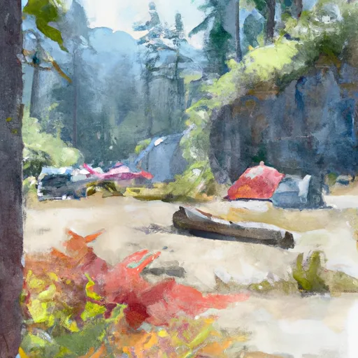
Troublesome Creek Campground
There are several points of interest close by, including the scenic Bavarian village of Leavenworth, the Wenatchee River, and the Icicle Gorge Trail. The campground itself offers a variety of amenities, including picnic tables, fire rings, potable water, and vault toilets. However, it is important to note that there are no hookups available for RVs.
Campsites are available on a first-come-first-serve basis, with a total of 28 sites available. One interesting fact about the Troublesome Creek Campground is that it was established in the 1930s as a Civilian Conservation Corps (CCC) campsite.
The best time of year to visit the Troublesome Creek Campground is during the summer months, from June through September. Average temperatures during this time range from the mid-70s during the day to the low 50s at night, making for comfortable camping conditions.
Overall, Troublesome Creek Campground is an excellent option for those seeking a peaceful, rustic camping experience in a beautiful forest setting.
What's on-site at Troublesome Creek Campground
Key facilities Snoflo tracks for this campground. Confirm with the operator before booking -- amenities can change seasonally.
Plan your trip down to the hour
Same weather feed Snoflo's iOS app uses -- updated continuously from NOAA / yr.no.
Next 5 days, hour by hour
Temperature line with weather symbols on top, snow + rain accumulation as columns, humidity as a dotted line.
5-day forecast table
Every 3 hours, broken out across temperature, snow, rain, humidity, and wind. Each cell is colour-coded relative to the column min/max so trends jump out at a glance.
| Time | Condition | Temp (°F) | Snow (in) | Rain (in) | Humidity (%) | Wind (mps) | Wind dir |
|---|---|---|---|---|---|---|---|
| Loading detailed forecast… | |||||||
15-day temperature & precipitation
Daily temperatures, snow, and rain projected over the next two weeks. Hover any point for the full breakdown.
Other campgrounds in the area
Snoflo-tracked campsites within driving distance of Troublesome Creek Campground, with reservations status.
| Campground | Reservations | Toilets | View |
|---|---|---|---|
| Lake Ross Barnett | ✗ | ✗ | → |
| Okatoma Water Park | ✗ | ✗ | → |
| Dry Creek Water Park | ✗ | ✗ | → |
| Simpson County Lake | ✗ | ✓ | → |
| Lake Mike Conner | ✗ | ✗ | → |
| Big Creek Waterpark | ✗ | ✗ | → |
Nearby streamflow
USGS streamgauges within reach of Troublesome Creek Campground -- pulled live from the National Water Information System.
| Streamgauge | Discharge | View |
|---|---|---|
| Leaf River Nr Collins | 258 cfs | → |
| Strong River At D`Lo | 88 cfs | → |
| Okatoma Creek At Sanford | 114 cfs | → |
| Tallahala Creek At Waldrup | 117 cfs | → |
| Tallahala Creek At Laurel | 17 cfs | → |
| Bouie Creek Nr Hattiesburg | 190 cfs | → |
Plan a longer trip
The closest parks, lakes, boat launches, and paddle runs so a camping night can grow into a full weekend.
Parks
- Bienville National Forest
- National Conservation Area Cane
- Cotton Mill Park
- Roosevelt State Park
- Shiloh Park
Camping essentials & Leave No Trace
- Pack it in, pack it out
- Take all trash, food scraps, and gear back with you to keep campsites clean and protect wildlife.
- Respect wildlife
- Observe animals from a distance, store food securely, and never feed wildlife to maintain natural behavior and safety.
- Know before you go
- Check weather, fire restrictions, trail conditions, and permit requirements to ensure a safe and well-planned trip.
- Minimize campfire impact
- Use established fire rings, keep fires small, fully extinguish them, or opt for a camp stove when fires are restricted.
- Leave what you find
- Preserve natural and cultural features by avoiding removal of plants, rocks, artifacts, or other elements of the environment.
Set push alerts in the Snoflo app
Save Troublesome Creek Campground as a favorite, set a custom threshold (precipitation, snowpack, freezing temperatures), and the iOS app will push the moment conditions cross.
About Troublesome Creek Campground
Can I make reservations at Troublesome Creek Campground?
This campground does not appear to accept reservations -- it's typically first-come, first-served. Arrive early on summer weekends.
How fresh is the weather data on this page?
The hourly forecast updates throughout the day from the NOAA / yr.no public feeds. Streamflow data is pulled live from USGS streamgauges and snowpack from the NRCS SNOTEL network.
What's the best time of year to visit?
Use the 15-day temperature & precipitation outlook on this page to plan -- pick a window with comfortable temperatures and low precipitation. For longer trips, the 5-day hourly meteogram shows snow + rain accumulation hour-by-hour.
How do I get to Troublesome Creek Campground?
Tap Directions in the hero above to open driving directions in Google Maps, or Open in map to center the Snoflo interactive map on the campground.
Can I get alerts when conditions change?
Yes -- alerts are managed through the Snoflo iOS app. Favorite this campground, set a threshold (temperature, snowpack, precipitation), and you'll get a push the moment it crosses.
Other campgrounds near here
Snoflo-tracked campgrounds within driving distance of Troublesome Creek Campground.