Upper Bakeoven Dispersed Camping Area Campground
Community Reviews
Been here? Share the conditions.
Reviews, ratings & photos are added in the free Snoflo iOS app — rate a spot, tag the conditions, and your visit is verified by location. Add or manage your reviews from the app.
Upper Bakeoven Dispersed Camping Area
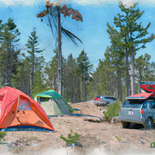
The campground has numerous amenities, including fire pits, picnic tables, and vault toilets. It is a first-come, first-serve site, meaning that visitors can claim any of the available 18 campsites upon arrival. However, there is no potable water or garbage service, so campers must pack out all garbage and bring their own drinking water.
An interesting fact about the area is that it is home to a variety of wildlife, including black bears, cougars, and elk. Visitors should take appropriate precautions when camping in bear country, such as storing food in bear-resistant containers.
The best time to visit the Upper Bakeoven Dispersed Camping Area is from late spring to early fall when temperatures are mild, ranging from the mid-60s to low 80s Fahrenheit. However, visitors should be aware that the campground is at an elevation of over 4,500 feet, so temperatures can drop significantly at night. Overall, the Upper Bakeoven Dispersed Camping Area is a fantastic camping spot for those seeking natural beauty and solitude in the great outdoors.
What's on-site at Upper Bakeoven Dispersed Camping Area
Key facilities Snoflo tracks for this campground. Confirm with the operator before booking -- amenities can change seasonally.
Plan your trip down to the hour
Same weather feed Snoflo's iOS app uses -- updated continuously from NOAA / yr.no.
Next 5 days, hour by hour
Temperature line with weather symbols on top, snow + rain accumulation as columns, humidity as a dotted line.
5-day forecast table
Every 3 hours, broken out across temperature, snow, rain, humidity, and wind. Each cell is colour-coded relative to the column min/max so trends jump out at a glance.
| Time | Condition | Temp (°F) | Snow (in) | Rain (in) | Humidity (%) | Wind (mps) | Wind dir |
|---|---|---|---|---|---|---|---|
| Loading detailed forecast… | |||||||
15-day temperature & precipitation
Daily temperatures, snow, and rain projected over the next two weeks. Hover any point for the full breakdown.
Other campgrounds in the area
Snoflo-tracked campsites within driving distance of Upper Bakeoven Dispersed Camping Area, with reservations status.
| Campground | Reservations | Toilets | View |
|---|---|---|---|
| Golden Stairs Campsite | ✗ | ✗ | → |
| Flint Seeps Group Campsite | ✗ | ✗ | → |
| Happy Canyon Campsite | ✗ | ✗ | → |
| The Wall Campsite | ✗ | ✗ | → |
| Teapot Rock Campsite | ✗ | ✗ | → |
| Big Drop 1 Beach | ✗ | ✗ | → |
Nearby streamflow
USGS streamgauges within reach of Upper Bakeoven Dispersed Camping Area -- pulled live from the National Water Information System.
| Streamgauge | Discharge | View |
|---|---|---|
| Cowlitz River At Packwood | 467 cfs | → |
| Klickitat River Above West Fork Near Glenwood | 64 cfs | → |
| American River Near Nile | 50 cfs | → |
| Toppenish Creek Near Fort Simcoe | 7 cfs | → |
| Cispus River Ab Yellowjacket Creek Near Randle | 356 cfs | → |
| Ahtanum Creek At Union Gap | 5 cfs | → |
Nearby snow depths
NRCS SNOTEL stations within reach of Upper Bakeoven Dispersed Camping Area -- relevant when planning a shoulder-season or alpine trip.
| SNOTEL station | Snowpack | 24h Snowfall | View |
|---|---|---|---|
| Green Lake | 0.0 in | 0.0 in | → |
| Pigtail Peak | 0.0 in | 0.0 in | → |
| Pigtail Peak | 0.0 in | 0.0 in | → |
| White Pass E.S. | 0.0 in | 0.0 in | → |
| White Pass Upper | 8.1 in | 0.0 in | → |
| Nohrsc White Pass E.S. | 0.0 in | 0.0 in | → |
Plan a longer trip
The closest parks, lakes, boat launches, and paddle runs so a camping night can grow into a full weekend.
Parks
- Mount Baker-Snoqualmie National Forest
- Wilderness William O. Douglas
- Wilderness Goat Rocks
- Mount Rainier National Park
- Wilderness Tatoosh
- Wilderness Norse Peak
Boat launches
- Horseshoe Cove
- Clear Lake Recreation Area
- Silver Beach Resort
- Rimrock Lake Resort
- National Forest Development Road 714, Naches
- Dog Lake Campground
Points of interest
- Clear Creek Overlook Interpretive Site
- Big Cedar
- Shriner Peak Fire Lookout
- Historic Packwood Station
- White Pass Country Historical Museum
- Boxx Gallery
Paddle runs
- Headwaters In Se1/4 Of Sec 9, T14n, R11e To Goat Rocks Wilderness Boundary
- Goat Rocks Wilderness Boundary To Confluence With Muddy Fork Cowlitz River
- Mt. Ranier Np/Gifford Pinchot Nf Boundary To Confluence With Clear Fork Cowlitz River
- Headwaters In Sw1/4 Of Sec 27, T12n, R11e To Goat Rocks Wilderness Boundary
- Tatoosh Wilderness Boundary To Confluence With Clear Fork Cowlitz River
- Junction Of Muddy And Clear Forks Cowlitz To Gifford Pinchot Nf Boundary
Camping essentials & Leave No Trace
- Pack it in, pack it out
- Take all trash, food scraps, and gear back with you to keep campsites clean and protect wildlife.
- Respect wildlife
- Observe animals from a distance, store food securely, and never feed wildlife to maintain natural behavior and safety.
- Know before you go
- Check weather, fire restrictions, trail conditions, and permit requirements to ensure a safe and well-planned trip.
- Minimize campfire impact
- Use established fire rings, keep fires small, fully extinguish them, or opt for a camp stove when fires are restricted.
- Leave what you find
- Preserve natural and cultural features by avoiding removal of plants, rocks, artifacts, or other elements of the environment.
Set push alerts in the Snoflo app
Save Upper Bakeoven Dispersed Camping Area as a favorite, set a custom threshold (precipitation, snowpack, freezing temperatures), and the iOS app will push the moment conditions cross.
About Upper Bakeoven Dispersed Camping Area
Can I make reservations at Upper Bakeoven Dispersed Camping Area?
This campground does not appear to accept reservations -- it's typically first-come, first-served. Arrive early on summer weekends.
How fresh is the weather data on this page?
The hourly forecast updates throughout the day from the NOAA / yr.no public feeds. Streamflow data is pulled live from USGS streamgauges and snowpack from the NRCS SNOTEL network.
What's the best time of year to visit?
Use the 15-day temperature & precipitation outlook on this page to plan -- pick a window with comfortable temperatures and low precipitation. For longer trips, the 5-day hourly meteogram shows snow + rain accumulation hour-by-hour.
How do I get to Upper Bakeoven Dispersed Camping Area?
Tap Directions in the hero above to open driving directions in Google Maps, or Open in map to center the Snoflo interactive map on the campground.
Can I get alerts when conditions change?
Yes -- alerts are managed through the Snoflo iOS app. Favorite this campground, set a threshold (temperature, snowpack, precipitation), and you'll get a push the moment it crosses.
Other campgrounds near here
Snoflo-tracked campgrounds within driving distance of Upper Bakeoven Dispersed Camping Area.