Verlot Campground Campground
Community Reviews
Been here? Share the conditions.
Reviews, ratings & photos are added in the free Snoflo iOS app — rate a spot, tag the conditions, and your visit is verified by location. Add or manage your reviews from the app.
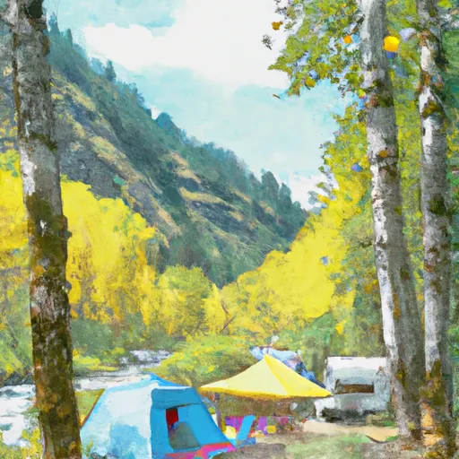
Verlot Campground
There are several points of interest near the campground, including the Big Four Ice Caves, which are a popular hiking destination. Visitors can also explore the nearby Wallace Falls State Park or take a scenic drive to the stunning Mount Baker Ski Area.
The campground offers a variety of amenities, including picnic tables, fire pits, drinking water, and restrooms. There are 44 campsites available on a first-come, first-served basis, and the campground is open from May to October.
An interesting fact about the area is that it is home to several rare and endangered species, including the Northern Spotted Owl and the Marbled Murrelet.
The best time to visit the campground is during the summer months, from June to September, when the temperatures range from 70-80 degrees Fahrenheit during the day and drop to 50-60 degrees Fahrenheit at night. However, visitors should be prepared for rain as the area receives an average of 12 inches of precipitation during the summer months.
What's on-site at Verlot Campground
Key facilities Snoflo tracks for this campground. Confirm with the operator before booking -- amenities can change seasonally.
Plan your trip down to the hour
Same weather feed Snoflo's iOS app uses -- updated continuously from NOAA / yr.no.
Next 5 days, hour by hour
Temperature line with weather symbols on top, snow + rain accumulation as columns, humidity as a dotted line.
5-day forecast table
Every 3 hours, broken out across temperature, snow, rain, humidity, and wind. Each cell is colour-coded relative to the column min/max so trends jump out at a glance.
| Time | Condition | Temp (°F) | Snow (in) | Rain (in) | Humidity (%) | Wind (mps) | Wind dir |
|---|---|---|---|---|---|---|---|
| Loading detailed forecast… | |||||||
15-day temperature & precipitation
Daily temperatures, snow, and rain projected over the next two weeks. Hover any point for the full breakdown.
Other campgrounds in the area
Snoflo-tracked campsites within driving distance of Verlot Campground, with reservations status.
| Campground | Reservations | Toilets | View |
|---|---|---|---|
| Verlot | ✓ | ✓ | → |
| Turlo | ✓ | ✓ | → |
| Turlo Campground | ✓ | ✓ | → |
| Gold Basin Campground | ✓ | ✓ | → |
| Gold Basin | ✓ | ✓ | → |
Nearby streamflow
USGS streamgauges within reach of Verlot Campground -- pulled live from the National Water Information System.
| Streamgauge | Discharge | View |
|---|---|---|
| Sultan River Below Diversion Dam Near Sultan | 108 cfs | → |
| South Fork Sultan River Near Sultan | 10 cfs | → |
| Sultan River Below Powerplant Near Sultan | 314 cfs | → |
| Sauk River At Darrington | 5,220 cfs | → |
| Sauk River Ab Whitechuck River Near Darrington | 280 cfs | → |
| Nf Stillaguamish River Near Arlington | 233 cfs | → |
Nearby snow depths
NRCS SNOTEL stations within reach of Verlot Campground -- relevant when planning a shoulder-season or alpine trip.
| SNOTEL station | Snowpack | 24h Snowfall | View |
|---|---|---|---|
| White Chuck Mountain | 0.4 in | 0.0 in | → |
| Decline Creek Snotel | 0.0 in | 0.0 in | → |
| Alpine Meadows | 1.0 in | 0.0 in | → |
| Nohrsc Alpine Meadows | 1.0 in | 0.0 in | → |
| Skookum Creek | 0.0 in | 0.0 in | → |
| Skookum Creek | 0.0 in | 0.0 in | → |
Plan a longer trip
The closest parks, lakes, boat launches, and paddle runs so a camping night can grow into a full weekend.
Parks
- Mount Pilchuck State Park
- O Reilly Acres County Park
- Frank Mason Park
- Wilderness Boulder River
- Lake Roesiger County Park
- Squire Creek Park
Boat launches
- Bosworth Lake
- Middle Shore Road 2998, Lake Roesiger
- South Shore Road Snohomish County
- West Lake Riley Road Snohomish County
- Flowing Lake County Park
- Storm Lake
Points of interest
- Cut Log
- Three Fingers Lookout
- Granite Falls And Fish Ladder
- Oso Slide Memorial
- Flat Iron Gallery
- Abby Lola Bertain Memorial Wishing Well
Paddle runs
- Headwaters In Ne1/4 Of Sec 14, T29n, R10e To Confluence With Canyon Creek
- Headwaters In Sw1/4 Of Sec 7, T31n, R9e To Boulder River Wilderness Boundary
- Boulder River Wilderness Boundary To Confluence With Stillaguamish River
- Glacier Peak Wilderness Boundary To Confluence With Sauk River
- Canyon Creek To Confluence With North Fork Stillaguamish River
- Confluence Of Tye And Foss Rivers To Gold Bar
Camping essentials & Leave No Trace
- Pack it in, pack it out
- Take all trash, food scraps, and gear back with you to keep campsites clean and protect wildlife.
- Respect wildlife
- Observe animals from a distance, store food securely, and never feed wildlife to maintain natural behavior and safety.
- Know before you go
- Check weather, fire restrictions, trail conditions, and permit requirements to ensure a safe and well-planned trip.
- Minimize campfire impact
- Use established fire rings, keep fires small, fully extinguish them, or opt for a camp stove when fires are restricted.
- Leave what you find
- Preserve natural and cultural features by avoiding removal of plants, rocks, artifacts, or other elements of the environment.
Set push alerts in the Snoflo app
Save Verlot Campground as a favorite, set a custom threshold (precipitation, snowpack, freezing temperatures), and the iOS app will push the moment conditions cross.
About Verlot Campground
Can I make reservations at Verlot Campground?
Yes -- this campground accepts reservations. Snoflo recommends booking early for peak season; check the operator (Recreation.gov / state park system / private operator) for the booking window and cancellation policy.
How fresh is the weather data on this page?
The hourly forecast updates throughout the day from the NOAA / yr.no public feeds. Streamflow data is pulled live from USGS streamgauges and snowpack from the NRCS SNOTEL network.
What's the best time of year to visit?
Use the 15-day temperature & precipitation outlook on this page to plan -- pick a window with comfortable temperatures and low precipitation. For longer trips, the 5-day hourly meteogram shows snow + rain accumulation hour-by-hour.
How do I get to Verlot Campground?
Tap Directions in the hero above to open driving directions in Google Maps, or Open in map to center the Snoflo interactive map on the campground.
Can I get alerts when conditions change?
Yes -- alerts are managed through the Snoflo iOS app. Favorite this campground, set a threshold (temperature, snowpack, precipitation), and you'll get a push the moment it crosses.
Other campgrounds near here
Snoflo-tracked campgrounds within driving distance of Verlot Campground.