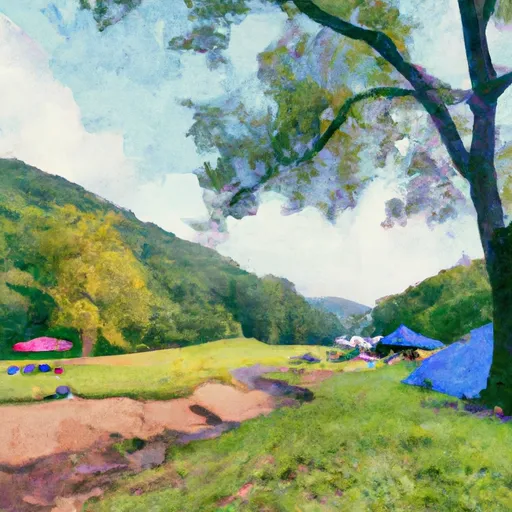
Bakers Run Campground
Community Reviews
Been here? Share the conditions.
Reviews, ratings & photos are added in the free Snoflo iOS app — rate a spot, tag the conditions, and your visit is verified by location. Add or manage your reviews from the app.
Bakers Run
Reservations are not required at Bakers Run camping area, as campsites are available on a first-come, first-served basis. It is important to note that during peak seasons, the campground can get crowded, so early arrival is recommended to secure a spot. The best time to visit this camping area is during the spring and fall seasons when the weather is mild, and the foliage is vibrant, creating an idyllic atmosphere.
While camping at Bakers Run, campers can immerse themselves in the natural beauty of the surrounding area. The campground is located near the Monongahela National Forest, providing opportunities for hiking, fishing, and wildlife viewing. As with any camping area, it is essential to be cautious of local wildlife and practice proper food storage to prevent encounters with bears or other animals. Overall, Bakers Run camping area offers a peaceful retreat where campers can enjoy nature and create lasting memories.
What's on-site at Bakers Run
Key facilities Snoflo tracks for this campground. Confirm with the operator before booking -- amenities can change seasonally.
Plan your trip down to the hour
Same weather feed Snoflo's iOS app uses -- updated continuously from NOAA / yr.no.
Next 5 days, hour by hour
Temperature line with weather symbols on top, snow + rain accumulation as columns, humidity as a dotted line.
5-day forecast table
Every 3 hours, broken out across temperature, snow, rain, humidity, and wind. Each cell is colour-coded relative to the column min/max so trends jump out at a glance.
| Time | Condition | Temp (°F) | Snow (in) | Rain (in) | Humidity (%) | Wind (mps) | Wind dir |
|---|---|---|---|---|---|---|---|
| Loading detailed forecast… | |||||||
15-day temperature & precipitation
Daily temperatures, snow, and rain projected over the next two weeks. Hover any point for the full breakdown.
Other campgrounds in the area
Snoflo-tracked campsites within driving distance of Bakers Run, with reservations status.
| Campground | Reservations | Toilets | View |
|---|---|---|---|
| Gerald R. Freeman Campground | ✗ | ✗ | → |
| Gerald R. Freeman | ✓ | ✗ | → |
| Bee Run | ✗ | ✗ | → |
| Flatwoods Koa | ✗ | ✗ | → |
| Bulltown | ✓ | ✗ | → |
Nearby streamflow
USGS streamgauges within reach of Bakers Run -- pulled live from the National Water Information System.
| Streamgauge | Discharge | View |
|---|---|---|
| Elk River Below Webster Springs | 127 cfs | → |
| L Kanawha River Nr Wildcat | 1,640 cfs | → |
| Birch River At Herold | 11 cfs | → |
| Williams River At Dyer | 90 cfs | → |
| Buckhannon River At Alton | 3,860 cfs | → |
| Cranberry River Near Richwood | 177 cfs | → |
Nearby snow depths
NRCS SNOTEL stations within reach of Bakers Run -- relevant when planning a shoulder-season or alpine trip.
| SNOTEL station | Snowpack | 24h Snowfall | View |
|---|---|---|---|
| Hacker Valley | 0.0 in | 0.0 in | → |
| Craigsville 0.6 Ne | 0.0 in | 0.0 in | → |
| Glenville | 5.0 in | 0.0 in | → |
| Stonewall Jackson Dam | 0.0 in | 0.0 in | → |
| Clay 0.2 Wsw | 0.0 in | 0.0 in | → |
| Buckhannon | 0.0 in | 0.0 in | → |
Plan a longer trip
The closest parks, lakes, boat launches, and paddle runs so a camping night can grow into a full weekend.
Parks
- Holly River State Park
- Stonewall Jackson Lake State Park
- West Virginia Wildlife Center
- Cedar Creek State Park
- Kumbrabow State Forest
- Wilderness Cranberry
Boat launches
Points of interest
- Battle Of Bulltown Confederate Entrenchments
- Bridge Street
- Burnsville Bridge
- Covered Bridge Road
- Fidler's Mill - Historic Gristmill & Building
- Helvetia Village Historic District
Paddle runs
- The Cora Brown Bridge In Nicholas County To The Confluence With The Elk River In Braxton County
- The Junction With Williams River To The Junction With Panther Creek
- Three Forks To Spice Run
- The U.S. Forest Service Cranberry Campground To The Confluence With The Gauley River
- Rabbit Run To Private Land .5 Mile From Richwood
- National Forest Land To Tea Creek
Camping essentials & Leave No Trace
- Pack it in, pack it out
- Take all trash, food scraps, and gear back with you to keep campsites clean and protect wildlife.
- Respect wildlife
- Observe animals from a distance, store food securely, and never feed wildlife to maintain natural behavior and safety.
- Know before you go
- Check weather, fire restrictions, trail conditions, and permit requirements to ensure a safe and well-planned trip.
- Minimize campfire impact
- Use established fire rings, keep fires small, fully extinguish them, or opt for a camp stove when fires are restricted.
- Leave what you find
- Preserve natural and cultural features by avoiding removal of plants, rocks, artifacts, or other elements of the environment.
Set push alerts in the Snoflo app
Save Bakers Run as a favorite, set a custom threshold (precipitation, snowpack, freezing temperatures), and the iOS app will push the moment conditions cross.
About Bakers Run
Can I make reservations at Bakers Run?
This campground does not appear to accept reservations -- it's typically first-come, first-served. Arrive early on summer weekends.
How fresh is the weather data on this page?
The hourly forecast updates throughout the day from the NOAA / yr.no public feeds. Streamflow data is pulled live from USGS streamgauges and snowpack from the NRCS SNOTEL network.
What's the best time of year to visit?
Use the 15-day temperature & precipitation outlook on this page to plan -- pick a window with comfortable temperatures and low precipitation. For longer trips, the 5-day hourly meteogram shows snow + rain accumulation hour-by-hour.
How do I get to Bakers Run?
Tap Directions in the hero above to open driving directions in Google Maps, or Open in map to center the Snoflo interactive map on the campground.
Can I get alerts when conditions change?
Yes -- alerts are managed through the Snoflo iOS app. Favorite this campground, set a threshold (temperature, snowpack, precipitation), and you'll get a push the moment it crosses.
Other campgrounds near here
Snoflo-tracked campgrounds within driving distance of Bakers Run.