Fontenelle Creek Campsite 38 Campground
Community Reviews
Been here? Share the conditions.
Reviews, ratings & photos are added in the free Snoflo iOS app — rate a spot, tag the conditions, and your visit is verified by location. Add or manage your reviews from the app.
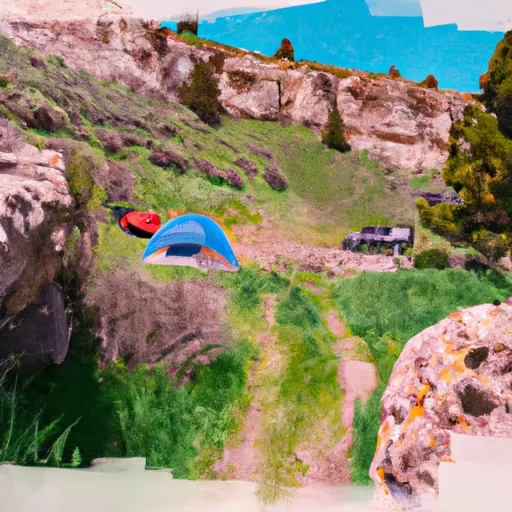
Fontenelle Creek Campsite 38
Nearby points of interest include the Bridger-Teton National Forest, the Wind River Range, and the Green River. The Bridger-Teton National Forest offers hiking and fishing opportunities, while the Wind River Range is a popular destination for backpacking and mountaineering. The Green River is also a great spot for fishing and kayaking.
The campground amenities include fire rings, picnic tables, and vault toilets. Campers should bring their own drinking water. The area is known for its wildlife, including elk, moose, and bears, so it is important to practice proper food storage and wildlife safety precautions.
The best time of year to visit the Fontenelle Creek Campsite 38 is in the summer months when the average temperature is around 70°F. However, visitors should be prepared for cooler temperatures at night and sudden weather changes.
Overall, the Fontenelle Creek Campsite 38 is a great spot for outdoor enthusiasts looking for a beautiful and secluded camping experience in Wyoming's Upper Green watershed.
What's on-site at Fontenelle Creek Campsite 38
Key facilities Snoflo tracks for this campground. Confirm with the operator before booking -- amenities can change seasonally.
Plan your trip down to the hour
Same weather feed Snoflo's iOS app uses -- updated continuously from NOAA / yr.no.
Next 5 days, hour by hour
Temperature line with weather symbols on top, snow + rain accumulation as columns, humidity as a dotted line.
5-day forecast table
Every 3 hours, broken out across temperature, snow, rain, humidity, and wind. Each cell is colour-coded relative to the column min/max so trends jump out at a glance.
| Time | Condition | Temp (°F) | Snow (in) | Rain (in) | Humidity (%) | Wind (mps) | Wind dir |
|---|---|---|---|---|---|---|---|
| Loading detailed forecast… | |||||||
15-day temperature & precipitation
Daily temperatures, snow, and rain projected over the next two weeks. Hover any point for the full breakdown.
Other campgrounds in the area
Snoflo-tracked campsites within driving distance of Fontenelle Creek Campsite 38, with reservations status.
| Campground | Reservations | Toilets | View |
|---|---|---|---|
| Fontenelle Creek Campsite 36 | ✗ | ✗ | → |
| Fontenelle Creek Campsite 40 | ✗ | ✗ | → |
| Fontenelle Creek Campsite 37 | ✗ | ✗ | → |
| Fontenelle Creek Campsite 39 | ✗ | ✗ | → |
| Fontenelle Creek Campsite 35 | ✗ | ✗ | → |
Nearby streamflow
USGS streamgauges within reach of Fontenelle Creek Campsite 38 -- pulled live from the National Water Information System.
| Streamgauge | Discharge | View |
|---|---|---|
| Green River Below Fontenelle Reservoir | 708 cfs | → |
| Green River Near La Barge | 1,450 cfs | → |
| Fontenelle C Nr Herschler Ranch | 30 cfs | → |
| Hams Fork Below Pole Creek | 35 cfs | → |
| New Fork River Near Big Piney | 718 cfs | → |
| Big Sandy River Near Farson | 103 cfs | → |
Nearby snow depths
NRCS SNOTEL stations within reach of Fontenelle Creek Campsite 38 -- relevant when planning a shoulder-season or alpine trip.
| SNOTEL station | Snowpack | 24h Snowfall | View |
|---|---|---|---|
| Fontenelle Dam - Coop | 0.0 in | 0.0 in | → |
| Hams Fork | 0.0 in | -1.0 in | → |
| Nohrsc Hams Fork Snotel | 1.0 in | 0.0 in | → |
| Nohrsc Indian Creek Snotel | 0.0 in | 0.0 in | → |
| Indian Creek | 0.0 in | 0.0 in | → |
| Snider Basin | 0.0 in | 0.0 in | → |
Plan a longer trip
The closest parks, lakes, boat launches, and paddle runs so a camping night can grow into a full weekend.
Parks
Boat launches
- Fontenelle Creek Boat Ramp
- Tail Race Campground Boat Launch
- Weeping Rock Campground Boat Launch
- Names Hill Boat Launch
- Slate Creek Campground Boat Launch
- Green River (Lower)
Camping essentials & Leave No Trace
- Pack it in, pack it out
- Take all trash, food scraps, and gear back with you to keep campsites clean and protect wildlife.
- Respect wildlife
- Observe animals from a distance, store food securely, and never feed wildlife to maintain natural behavior and safety.
- Know before you go
- Check weather, fire restrictions, trail conditions, and permit requirements to ensure a safe and well-planned trip.
- Minimize campfire impact
- Use established fire rings, keep fires small, fully extinguish them, or opt for a camp stove when fires are restricted.
- Leave what you find
- Preserve natural and cultural features by avoiding removal of plants, rocks, artifacts, or other elements of the environment.
Set push alerts in the Snoflo app
Save Fontenelle Creek Campsite 38 as a favorite, set a custom threshold (precipitation, snowpack, freezing temperatures), and the iOS app will push the moment conditions cross.
About Fontenelle Creek Campsite 38
Can I make reservations at Fontenelle Creek Campsite 38?
This campground does not appear to accept reservations -- it's typically first-come, first-served. Arrive early on summer weekends.
How fresh is the weather data on this page?
The hourly forecast updates throughout the day from the NOAA / yr.no public feeds. Streamflow data is pulled live from USGS streamgauges and snowpack from the NRCS SNOTEL network.
What's the best time of year to visit?
Use the 15-day temperature & precipitation outlook on this page to plan -- pick a window with comfortable temperatures and low precipitation. For longer trips, the 5-day hourly meteogram shows snow + rain accumulation hour-by-hour.
How do I get to Fontenelle Creek Campsite 38?
Tap Directions in the hero above to open driving directions in Google Maps, or Open in map to center the Snoflo interactive map on the campground.
Can I get alerts when conditions change?
Yes -- alerts are managed through the Snoflo iOS app. Favorite this campground, set a threshold (temperature, snowpack, precipitation), and you'll get a push the moment it crosses.
Other campgrounds near here
Snoflo-tracked campgrounds within driving distance of Fontenelle Creek Campsite 38.