Sugarloaf Trailhead campground
Community Reviews
Been here? Share the conditions.
Reviews, ratings & photos are added in the free Snoflo iOS app — rate a spot, tag the conditions, and your visit is verified by location. Add or manage your reviews from the app.
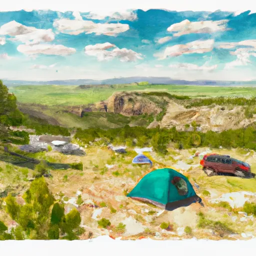
Sugarloaf Trailhead
Reservations are not accepted at the Sugarloaf Trailhead camping area, and campsites are available on a first-come, first-served basis. It is important to arrive early, especially during peak seasons, to secure a spot. The best time to visit this camping area is during the summer months, from June to September, when the weather is generally pleasant for outdoor activities.
Campers at Sugarloaf Trailhead can explore various points of interest nearby, including invigorating hiking trails and breathtaking views. It is advisable to check the weather forecast and pack appropriate gear, as the area can experience sudden changes in weather conditions. Additionally, it is essential to be cautious of wildlife encounters, such as bears, and follow proper food storage guidelines to avoid attracting them to the campsite. By being prepared and respectful of the surroundings, campers can enjoy a delightful and memorable camping experience at Sugarloaf Trailhead.
What's on-site at Sugarloaf Trailhead
Key facilities Snoflo tracks for this campground. Confirm with the operator before booking -- amenities can change seasonally.
Plan your trip down to the hour
Same weather feed Snoflo's iOS app uses -- updated continuously from NOAA / yr.no.
Next 5 days, hour by hour
Temperature line with weather symbols on top, snow + rain accumulation as columns, humidity as a dotted line.
5-day forecast table
Every 3 hours, broken out across temperature, snow, rain, humidity, and wind. Each cell is colour-coded relative to the column min/max so trends jump out at a glance.
| Time | Condition | Temp (°F) | Snow (in) | Rain (in) | Humidity (%) | Wind (mps) | Wind dir |
|---|---|---|---|---|---|---|---|
| Loading detailed forecast… | |||||||
15-day temperature & precipitation
Daily temperatures, snow, and rain projected over the next two weeks. Hover any point for the full breakdown.
Other campgrounds in the area
Snoflo-tracked campsites within driving distance of Sugarloaf Trailhead, with reservations status.
| Campground | Reservations | Toilets | View |
|---|---|---|---|
| Toaster Wall | ✗ | ✗ | → |
| Camping Area C | ✗ | ✗ | → |
| Wheatland Reservoir No. 3/Post Lake Access - Wgf | ✗ | ✓ | → |
| Jack Squirrel Camp 2 | ✗ | ✗ | → |
| Jack Squirrel Peak Camp 1 | ✗ | ✗ | → |
Nearby streamflow
USGS streamgauges within reach of Sugarloaf Trailhead -- pulled live from the National Water Information System.
| Streamgauge | Discharge | View |
|---|---|---|
| Sybille Creek Ab Mule Creek | 143 cfs | → |
| Sybille Creek Ab Canal No. 3 | 93 cfs | → |
| Laramie River Near Bosler | 1,950 cfs | → |
| North Platte River Below Glendo Reservoir | 5,710 cfs | → |
| L Medicine Bow R At Boles Spring | 1 cfs | → |
| North Platte River Below Whalen Diversion Dam | 1,720 cfs | → |
Nearby snow depths
NRCS SNOTEL stations within reach of Sugarloaf Trailhead -- relevant when planning a shoulder-season or alpine trip.
| SNOTEL station | Snowpack | 24h Snowfall | View |
|---|---|---|---|
| Windy Peak | 0.0 in | 0.0 in | → |
| Windy Peak | 0.0 in | 0.0 in | → |
| Laprele Creek Snotel | 0.0 in | 0.0 in | → |
| Laprele Creek | 0.0 in | 0.0 in | → |
| Laramie 1.4 N | 0.0 in | 0.0 in | → |
| Laramie 1se | 0.0 in | 0.0 in | → |
Plan a longer trip
The closest parks, lakes, boat launches, and paddle runs so a camping night can grow into a full weekend.
Boat launches
- Wheatland Reservoir #3 Boat Launch
- Palmer Canyon Road Albany County
- Wheatland Reservoir #3 Boat Ramp
- Wheatland Reservoir #1
- Wheatland Reservoir
- Toltec Reservoir
Camping essentials & Leave No Trace
- Pack it in, pack it out
- Take all trash, food scraps, and gear back with you to keep campsites clean and protect wildlife.
- Respect wildlife
- Observe animals from a distance, store food securely, and never feed wildlife to maintain natural behavior and safety.
- Know before you go
- Check weather, fire restrictions, trail conditions, and permit requirements to ensure a safe and well-planned trip.
- Minimize campfire impact
- Use established fire rings, keep fires small, fully extinguish them, or opt for a camp stove when fires are restricted.
- Leave what you find
- Preserve natural and cultural features by avoiding removal of plants, rocks, artifacts, or other elements of the environment.
Set push alerts in the Snoflo app
Save Sugarloaf Trailhead as a favorite, set a custom threshold (precipitation, snowpack, freezing temperatures), and the iOS app will push the moment conditions cross.
About Sugarloaf Trailhead
Can I make reservations at Sugarloaf Trailhead?
This campground does not appear to accept reservations -- it's typically first-come, first-served. Arrive early on summer weekends.
How fresh is the weather data on this page?
The hourly forecast updates throughout the day from the NOAA / yr.no public feeds. Streamflow data is pulled live from USGS streamgauges and snowpack from the NRCS SNOTEL network.
What's the best time of year to visit?
Use the 15-day temperature & precipitation outlook on this page to plan -- pick a window with comfortable temperatures and low precipitation. For longer trips, the 5-day hourly meteogram shows snow + rain accumulation hour-by-hour.
How do I get to Sugarloaf Trailhead?
Tap Directions in the hero above to open driving directions in Google Maps, or Open in map to center the Snoflo interactive map on the campground.
Can I get alerts when conditions change?
Yes -- alerts are managed through the Snoflo iOS app. Favorite this campground, set a threshold (temperature, snowpack, precipitation), and you'll get a push the moment it crosses.
Other campgrounds near here
Snoflo-tracked campgrounds within driving distance of Sugarloaf Trailhead.