Chester

Climate Recreation Community Catastrophe

Chester
Eden Index

Climate 6.4 Recreation 2.8 Community Safeguard

3.5/10

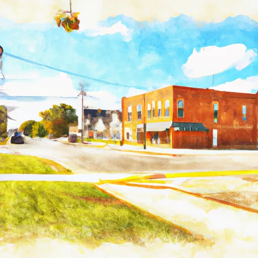
Chester is a small town located in northeast Iowa, with a population of around 120 residents. The climate in Chester is characterized by cold winters and warm summers, with an average annual temperature of 47°F. The town sits on the banks of the Upper Iowa River, which is a popular destination for kayaking and canoeing. The river is also home to a variety of fish, including smallmouth bass and brown trout. The hydrology constituents in Chester are mainly made up of agricultural runoff, which can affect water quality. Outdoor recreation opportunities in the area include hiking and camping in the nearby state parks and forests, as well as hunting and fishing in the surrounding woodlands.

What is the Eden Index?

The Snoflo Eden Index serves as a comprehensive rating system for regions, evaluating their desirability through a holistic assessment of climate health, outdoor recreation opportunities, and natural disaster risk, acknowledging the profound impact of these factors on livability and well-being.


Climate Health Indicator (CHI): 6.4


Chester receives approximately 888mm of rain per year, with humidity levels near 81% and air temperatures averaging around 7°C. Chester has a plant hardyness factor of 4, meaning plants and agriculture in this region thrive during a short period during spring and early summer. Most plants will die off during the colder winter months. By considering the ideal temperature range, reliable water supplies, clean air, and stable seasonal rain or snowpacks, the Climate Health Indicator (CHI) underscores the significance of a healthy climate as the foundation for quality living.

A healthy climate is paramount for ensuring a high quality of life and livability in a region, fostering both physical well-being and environmental harmony. This can be characterized by ideal temperatures, reliable access to water supplies, clean air, and consistent seasonal rain or snowpacks.


Weather Forecast


Streamflow Conditions

Upper Mississippi-Maquoketa-Plum

Area Rivers

Upper Mississippi-Maquoketa-Plum


Snowpack Depths

Upper Mississippi-Maquoketa-Plum


Reservoir Storage Capacity

Upper Mississippi-Maquoketa-Plum


Groundwater Levels


Recreational Opportunity Index (ROI): 2.8


The Recreational Opportunity Index (ROI) recognizes the value of outdoor recreational options, such as parks, hiking trails, camping sites, and fishing spots, while acknowledging that climate plays a pivotal role in ensuring the comfort and consistency of these experiences. Access to outdoor recreational opportunities, encompassing activities such as parks, hiking, camping, and fishing, is crucial for overall well-being, and the climate plays a pivotal role in enabling and enhancing these experiences, ensuring that individuals can engage in nature-based activities comfortably and consistently.


Camping Areas

Campground Campsites Reservations Toilets Showers Elevation
Deerwood City Park None 838 ft
Hoodoo Point City Campground 85 1,362 ft
Heritage City Park 18 1,439 ft
Rothwell Park None 858 ft
Lake Wapello State Park 80 803 ft
Split Rock County Park 54 1,069 ft
Riverside Landing - St. Croix National Scenic River None 896 ft
Bay City 25 676 ft
Lake Keomah State Park 65 810 ft
Garfvert - Nemadji State Forest 18 1,162 ft
Thunder Woman Park 190 878 ft
North Cedar Park 40 935 ft
George Wyth State Park 70 849 ft
Anderson - Berger Park None 1,143 ft
Paint Rock Springs - St. Croix State Park 210 915 ft
Shell Rock Rec Area 40 899 ft
Drakesville City Park 6 886 ft
Hatfield City Park 10 995 ft
Union Mills Access None 762 ft
Yenruogis County Park None 799 ft
Otter Creek Lake and Park 83 933 ft
Binder Park 17 655 ft
Boulder - St Croix State Forest 21 999 ft
Finger Lakes State Park None 725 ft
Lake Fisher 6 840 ft
Hoffman City Park None 920 ft
Big Woods Lake None 859 ft
Pfeiffer Lake 16 1,470 ft
T. F. Clark Co Park 13 891 ft
Highland Ridge 45 1,105 ft
Nugget Lake County Park 55 1,022 ft
Riverview - St. Croix State Park 211 905 ft
Big Rice Lake 15 1,452 ft
Balsam Lake Pine Park - Town 15 1,144 ft
Eau Galle Lake Spring Valley None 957 ft
Chacauqua River Access None 721 ft
Thomas Hill Reservoir - Hwy T Campground - MDC 10 753 ft
McKinley City Park 80 1,396 ft
Cedar Bend Park 40 975 ft
Vermilion Trail 40 1,430 ft
Twin Ponds Co Park - East None 1,053 ft
Highland Ridge - Eau Galle Reservoir None 1,130 ft
Sherwood Forest City Campground 57 1,505 ft
Lake Jeanette 12 1,375 ft
Echo Lake 24 1,275 ft
Long Branch State Park None 841 ft
Black Hawk County Park None 858 ft
Clear Lake City Park None 1,164 ft
Hickory Hills Park - La Porte City 80 911 ft
Wakemup Bay - Kabetogama State Forest 22 1,368 ft
Alcock Park 40 1,018 ft
Glendale Access None 696 ft
Diamond Lake County Park 100 910 ft
McGowen Rec Area 12 857 ft
Twin Ponds Co Park - West None 1,070 ft
Macon Co Park None 873 ft

Catastrophe Safeguard Index (CSI):


The Catastrophe Safeguard Index (CSI) recognizes that natural disaster risk, encompassing floods, fires, hurricanes, and tornadoes, can drastically affect safety and the overall appeal of an area. The level of natural disaster risk in a region significantly affects safety and the overall livability, with climate change amplifying these risks by potentially increasing the frequency and intensity of events like floods, fires, hurricanes, and tornadoes, thereby posing substantial challenges to community resilience and well-being.


Community Resilience Indicator (CRI):


The Community Resilience Indicator (CRI) recognizes that education, healthcare, and socioeconomics are crucial to the well-being of a region. The CRI acknowledges the profound impact of these elements on residents' overall quality of life. By evaluating educational resources, healthcare accessibility, and economic inclusivity, the index captures the essential aspects that contribute to a thriving community, fostering resident satisfaction, equity, and social cohesion.


Log Your Visit

When was your last visit to ?

Add a Photo

How was it? How were conditions?

Rate the


Submit

Leave A Review


Submit

Upload an Image


Favorite Limit Reached