Glasgow

Climate Recreation Community Catastrophe

Glasgow
Eden Index

Climate 8.3 Recreation 3.7 Community 2.1 Safeguard

5.1/10

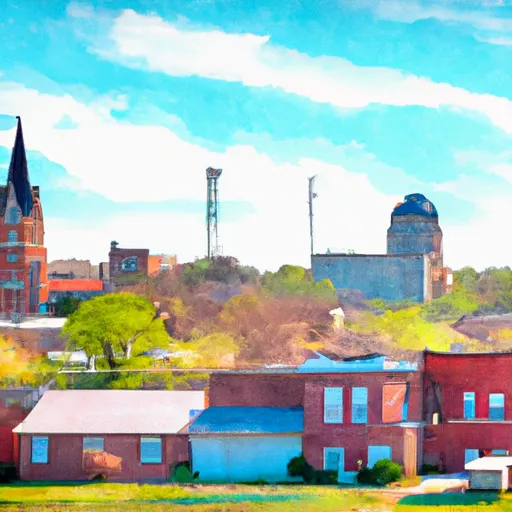
Glasgow, Missouri is a small town located in Howard County. The climate in Glasgow is characterized by hot summers and cold winters with an average annual temperature of 54°F. The town is situated on the Missouri River, and its hydrology constituents include the river and nearby streams. Outdoor recreation opportunities in Glasgow include fishing, boating, and camping along the Missouri River. The town is home to several parks, including Glasgow City Park and the Howard County Fairgrounds, which offer picnic areas, playgrounds, and sports fields. Hiking and bird watching are also popular activities in the area, with nearby conservation areas and wildlife refuges providing ample opportunities for outdoor enthusiasts.

What is the Eden Index?

The Snoflo Eden Index serves as a comprehensive rating system for regions, evaluating their desirability through a holistic assessment of climate health, outdoor recreation opportunities, and natural disaster risk, acknowledging the profound impact of these factors on livability and well-being.


Climate Health Indicator (CHI): 8.3


Glasgow receives approximately 1028mm of rain per year, with humidity levels near 81% and air temperatures averaging around 13°C. Glasgow has a plant hardyness factor of 6, meaning plants and agriculture in this region thrive during a short period during spring and early summer. Most plants will die off during the colder winter months. By considering the ideal temperature range, reliable water supplies, clean air, and stable seasonal rain or snowpacks, the Climate Health Indicator (CHI) underscores the significance of a healthy climate as the foundation for quality living.

A healthy climate is paramount for ensuring a high quality of life and livability in a region, fostering both physical well-being and environmental harmony. This can be characterized by ideal temperatures, reliable access to water supplies, clean air, and consistent seasonal rain or snowpacks.


Weather Forecast


Streamflow Conditions

Lower Missouri-Blackwater

Area Rivers

Lower Missouri-Blackwater


Snowpack Depths

Lower Missouri-Blackwater


Reservoir Storage Capacity

Lower Missouri-Blackwater


Groundwater Levels


Recreational Opportunity Index (ROI): 3.7


The Recreational Opportunity Index (ROI) recognizes the value of outdoor recreational options, such as parks, hiking trails, camping sites, and fishing spots, while acknowledging that climate plays a pivotal role in ensuring the comfort and consistency of these experiences. Access to outdoor recreational opportunities, encompassing activities such as parks, hiking, camping, and fishing, is crucial for overall well-being, and the climate plays a pivotal role in enabling and enhancing these experiences, ensuring that individuals can engage in nature-based activities comfortably and consistently.


Camping Areas

Campground Campsites Reservations Toilets Showers Elevation
Wallashuck - Red Rock Lake 80 833 ft
Salisbury City Park None 714 ft
Tyler Bend - Buffalo National River None 614 ft
Ozark Isle - Bull Shoals Lake None 689 ft
Eveland Access 26 679 ft
Petit Jean State Park None 900 ft
Lake Sylvia 27 704 ft
Cedar Creek Access None 704 ft
Sequoya Park 14 306 ft
Union Grove State Park 26 1,022 ft
Timmons Grove County Park 18 889 ft
Grammer Grove Wildlife Area None 930 ft
Katy Roundhouse Campground None 601 ft
Maxwell Taylor Park None 702 ft
Quercus Wilderness Area 5 670 ft
Pilot Grove City Park None 845 ft
Tucker Hollow - Bull Shoals Lake None 697 ft
Carver - Buffalo National River None 710 ft
Point Remove Park 16 281 ft
Stump Island Park 12 618 ft
Unionville City RV Park 45 1,065 ft
Wolf Creek Rec Area 22 963 ft
Whitebreast - Red Rock Lake 130 828 ft
Lead Hill - Bull Shoals Lake None 678 ft
Richland Creek 13 1,034 ft
Howell Station - Red Rock Lake 140 704 ft
Versailles City Park None 990 ft
Robertson Access None 758 ft
Cherokee None 277 ft
Mariposa Co Park 15 961 ft
Ivans - Red Rock Lake None 708 ft
Brookfield City Park 15 788 ft
Bennett Spring State Park None 880 ft
Thousand Hills State Park None 862 ft
Roadman Roadside Park None 956 ft
Stoehr Fishing Area None 1,064 ft
Arrow Rock State Park 46 728 ft
Riverview Park - Marshalltown None 868 ft
Miami Lake Park None 918 ft
North Overlook - Red Rock Lake 55 796 ft
Rock Creek State Park 200 902 ft
Highway 125 - Bull Shoals Lake None 707 ft
Buck Creek - Bull Shoals Lake None 724 ft
Roberts Creek Park None 803 ft
Bayou Bluff 28 634 ft
Theodosia None 691 ft

Catastrophe Safeguard Index (CSI):


The Catastrophe Safeguard Index (CSI) recognizes that natural disaster risk, encompassing floods, fires, hurricanes, and tornadoes, can drastically affect safety and the overall appeal of an area. The level of natural disaster risk in a region significantly affects safety and the overall livability, with climate change amplifying these risks by potentially increasing the frequency and intensity of events like floods, fires, hurricanes, and tornadoes, thereby posing substantial challenges to community resilience and well-being.


Community Resilience Indicator (CRI): 2.1


The Community Resilience Indicator (CRI) recognizes that education, healthcare, and socioeconomics are crucial to the well-being of a region. The CRI acknowledges the profound impact of these elements on residents' overall quality of life. By evaluating educational resources, healthcare accessibility, and economic inclusivity, the index captures the essential aspects that contribute to a thriving community, fostering resident satisfaction, equity, and social cohesion.


Log Your Visit

When was your last visit to ?

Add a Photo

How was it? How were conditions?

Rate the


Submit

Leave A Review


Submit

Upload an Image


Favorite Limit Reached