Grand-View

Climate Recreation Community Catastrophe

Grand-View
Eden Index

Climate 5.5 Recreation 6.8 Community Safeguard

4.6/10

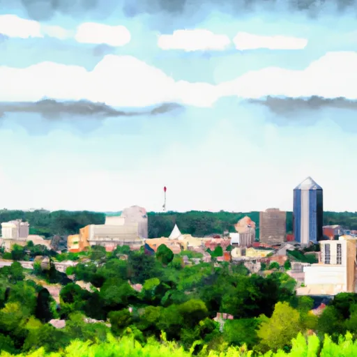
Grand-View, Wisconsin is a small town located in Bayfield County with a population of approximately 120 residents. The climate in Grand-View is classified as humid continental, with cold winters and warm summers. The town is also situated within the Chequamegon-Nicolet National Forest, providing ample opportunities for outdoor recreation, including hiking, fishing, and hunting. The hydrology constituents of Grand-View include numerous streams and small rivers that flow into Lake Superior to the north. The town is also home to several lakes, including Spider Lake and Cable Lake. These bodies of water provide opportunities for fishing and boating, and the surrounding forests offer a beautiful backdrop for outdoor enthusiasts.

What is the Eden Index?

The Snoflo Eden Index serves as a comprehensive rating system for regions, evaluating their desirability through a holistic assessment of climate health, outdoor recreation opportunities, and natural disaster risk, acknowledging the profound impact of these factors on livability and well-being.


Climate Health Indicator (CHI): 5.5


Grand-View receives approximately 840mm of rain per year, with humidity levels near 83% and air temperatures averaging around 6°C. Grand-View has a plant hardyness factor of 3, meaning plants and agriculture in this region thrive during a short period during spring and early summer. Most plants will die off during the colder winter months. By considering the ideal temperature range, reliable water supplies, clean air, and stable seasonal rain or snowpacks, the Climate Health Indicator (CHI) underscores the significance of a healthy climate as the foundation for quality living.

A healthy climate is paramount for ensuring a high quality of life and livability in a region, fostering both physical well-being and environmental harmony. This can be characterized by ideal temperatures, reliable access to water supplies, clean air, and consistent seasonal rain or snowpacks.


Weather Forecast


Streamflow Conditions

Southwestern Lake Superior

Area Rivers

Southwestern Lake Superior


Snowpack Depths

Southwestern Lake Superior


Reservoir Storage Capacity

Southwestern Lake Superior


Groundwater Levels


Recreational Opportunity Index (ROI): 6.8


The Recreational Opportunity Index (ROI) recognizes the value of outdoor recreational options, such as parks, hiking trails, camping sites, and fishing spots, while acknowledging that climate plays a pivotal role in ensuring the comfort and consistency of these experiences. Access to outdoor recreational opportunities, encompassing activities such as parks, hiking, camping, and fishing, is crucial for overall well-being, and the climate plays a pivotal role in enabling and enhancing these experiences, ensuring that individuals can engage in nature-based activities comfortably and consistently.


Camping Areas

Campground Campsites Reservations Toilets Showers Elevation
Central Park 100 978 ft
Siloam Springs State Park 180 690 ft
Little Scotia Dispersed None 1,362 ft
Jerktail Landing None 657 ft
Fountain Springs County Park None 1,006 ft
Cappy Russell Access Dispersed None 554 ft
Two Rivers - Ozark National Scenic River None 608 ft
Josie Creek County Park 15 1,250 ft
Veterans Memorial Park - West Salem 110 689 ft
Lake Wissota State Park None 947 ft
Harstad Park 27 930 ft
Lower Augusta Skunk River Access None 555 ft
Yellow River State Forest 150 645 ft
Big Hollow Creek Park 48 734 ft
Meramec State Park None 613 ft
Kawishiwi Lake 5 1,660 ft
Ninemile Lake 24 1,644 ft
Flaming Prairie Park 24 541 ft
Dawson Trail - Chippewa - Quetico Provincial Park 22 1,350 ft
George Crosby - Manitou State Park 20 1,431 ft
Bruce Village Park None 1,104 ft
Dupont Reservation Conservation Area - MDC 20 460 ft
Dawson Trail - Ojibwa - Quetico Provincial Park 85 1,355 ft
Sugar Creek City Campground None 618 ft
Toohey Lake 10 1,674 ft
Greer Crossing 72 564 ft
Harriet Lake 13 1,766 ft
Riverside Memorial Park None 844 ft
Keithsburg Riverside Campground 60 541 ft
Tettegouche State Park 30 872 ft
Blanchard Island - Mississippi River 35 556 ft
Onondaga Cave State Park None 791 ft
Finland - Finland State Forest 39 1,314 ft
New Wine County Park 55 1,002 ft
Hixton Village Campground 20 943 ft
Twin Bear County Park None 1,042 ft
Two Lakes 90 1,412 ft
Col Larson County Park None 805 ft
Upper Augusta Skunk River Access None 557 ft
Black Lake 29 1,426 ft
Snively Access 30 656 ft
Saulsbury Bridge 35 614 ft
Namekagon 34 1,453 ft
Silver Lake County Park None 1,029 ft
Big Spring - Ozark National Scenic River 123 727 ft
Loggers Lake 29 1,160 ft
Carthage City Park None 666 ft
Coon Fork Lake None 990 ft
Watercress 114 523 ft
Pictured Rocks Co Park None 885 ft
Wapello Fairgrounds Park None 587 ft
Fourth Pumping Plant Rec Area 22 531 ft
Main - Sidie Hollow Park 31 930 ft
Blackhawk Park - DeSoto 150 630 ft
Berryman 19 1,009 ft
Red Bluff 109 821 ft
Wanoka 20 1,131 ft
Boat Landing - Sidie Hollow Park 22 939 ft
Henderson County State Conservation 35 554 ft
Council Bluff - Wild Boar Ridge 100 1,268 ft
Delta Lake County Park 34 1,071 ft
Bankston Park 50 950 ft
Louisa County Fairgrounds 10 579 ft
Delabar State Park 60 575 ft
Ferry Landing 50 604 ft
Ridge - Sidie Hollow Park 20 1,209 ft
Roberts Field None 561 ft
Eckbeck ? Finland State Forest 31 1,065 ft
Welter Recreation Park None 555 ft
Esofea - Rentz Memorial Park 27 958 ft
Wapsipinicon State Park 25 825 ft
Owls Bend - Powder Mill None 556 ft
Sutton Bluff 45 820 ft
Town of Clover None 607 ft
Virginia Grove Rec Area None 769 ft
Big River State Forest 100 541 ft
Hazel Creek None 846 ft
Powder Mill - Ozark National Scenic River 8 561 ft

Catastrophe Safeguard Index (CSI):


The Catastrophe Safeguard Index (CSI) recognizes that natural disaster risk, encompassing floods, fires, hurricanes, and tornadoes, can drastically affect safety and the overall appeal of an area. The level of natural disaster risk in a region significantly affects safety and the overall livability, with climate change amplifying these risks by potentially increasing the frequency and intensity of events like floods, fires, hurricanes, and tornadoes, thereby posing substantial challenges to community resilience and well-being.


Community Resilience Indicator (CRI):


The Community Resilience Indicator (CRI) recognizes that education, healthcare, and socioeconomics are crucial to the well-being of a region. The CRI acknowledges the profound impact of these elements on residents' overall quality of life. By evaluating educational resources, healthcare accessibility, and economic inclusivity, the index captures the essential aspects that contribute to a thriving community, fostering resident satisfaction, equity, and social cohesion.


Log Your Visit

When was your last visit to ?

Add a Photo

How was it? How were conditions?

Rate the


Submit

Leave A Review


Submit

Upload an Image


Favorite Limit Reached