Independence

Climate Recreation Community Catastrophe

Independence
Eden Index

Climate 6.4 Recreation 3.7 Community Safeguard

3.8/10

Independence, Wisconsin is a picturesque city located in Trempealeau County. It experiences a humid continental climate, characterized by warm summers and cold winters. Average summer temperatures range from the mid-70s to low 80s Fahrenheit, while winter temperatures hover around freezing point, occasionally dropping below 0°F. The area receives moderate precipitation throughout the year, with the highest rainfall occurring in the summer months.

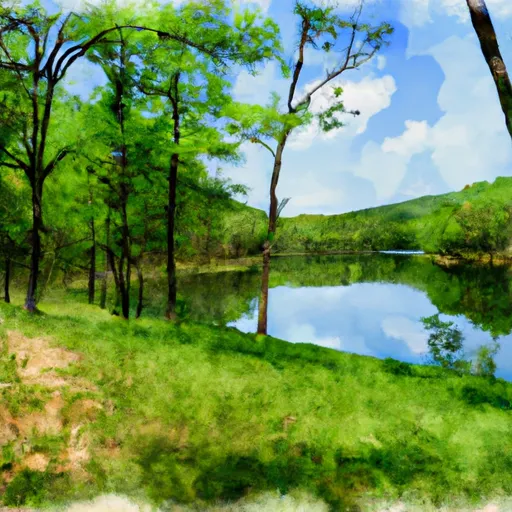
Situated in the heart of the Driftless Area, Independence benefits from its hydrological constituents. The city is surrounded by rolling hills, clear streams, and beautiful lakes, making it a haven for outdoor enthusiasts. The Trempealeau River flows nearby, offering opportunities for fishing, boating, and kayaking. The region's hydrology also creates stunning waterfalls and scenic hiking trails, such as the popular Cochrane-Fountain City Nature Trail.

Outdoor recreation opportunities in Independence are abundant. The area features numerous parks and reserves, providing opportunities for camping, picnicking, and wildlife observation. Additionally, hikers can explore the nearby Trempealeau National Wildlife Refuge, while birdwatchers can spot a variety of species in the vicinity. With its diverse climate, stunning hydrological features, and numerous outdoor activities, Independence is a fantastic destination for nature lovers and those seeking an active lifestyle.

What is the Eden Index?

The Snoflo Eden Index serves as a comprehensive rating system for regions, evaluating their desirability through a holistic assessment of climate health, outdoor recreation opportunities, and natural disaster risk, acknowledging the profound impact of these factors on livability and well-being.


Climate Health Indicator (CHI): 6.4


Independence receives approximately 856mm of rain per year, with humidity levels near 82% and air temperatures averaging around 7°C. Independence has a plant hardyness factor of 4, meaning plants and agriculture in this region thrive during a short period during spring and early summer. Most plants will die off during the colder winter months. By considering the ideal temperature range, reliable water supplies, clean air, and stable seasonal rain or snowpacks, the Climate Health Indicator (CHI) underscores the significance of a healthy climate as the foundation for quality living.

A healthy climate is paramount for ensuring a high quality of life and livability in a region, fostering both physical well-being and environmental harmony. This can be characterized by ideal temperatures, reliable access to water supplies, clean air, and consistent seasonal rain or snowpacks.


Weather Forecast


Streamflow Conditions

Upper Mississippi-Black-Root

Area Rivers

Upper Mississippi-Black-Root


Snowpack Depths

Upper Mississippi-Black-Root


Reservoir Storage Capacity

Upper Mississippi-Black-Root


Groundwater Levels


Recreational Opportunity Index (ROI): 3.7


The Recreational Opportunity Index (ROI) recognizes the value of outdoor recreational options, such as parks, hiking trails, camping sites, and fishing spots, while acknowledging that climate plays a pivotal role in ensuring the comfort and consistency of these experiences. Access to outdoor recreational opportunities, encompassing activities such as parks, hiking, camping, and fishing, is crucial for overall well-being, and the climate plays a pivotal role in enabling and enhancing these experiences, ensuring that individuals can engage in nature-based activities comfortably and consistently.


Camping Areas

Campground Campsites Reservations Toilets Showers Elevation
Bruce Village Park None 1,104 ft
Doolittle Park 40 1,236 ft
Palisades Kepler State Park 50 863 ft
Mooney Dam County Park 11 1,138 ft
Buffalo Creek County Park 18 914 ft
Louisa County Fairgrounds 10 579 ft
Delta Lake County Park 34 1,071 ft
Hills Access 13 629 ft
Geode State Park 170 699 ft
Wakonda State Park None 496 ft
Two Rivers - Ozark National Scenic River None 608 ft
Moon Lake City Park 29 1,110 ft
Split Rock Lighthouse State Park 25 714 ft
Mondovi Town Park 6 822 ft
Round Spring - Ozark National Scenic River None 673 ft
Great River Bluffs State Park 31 1,271 ft
Little Isabella River 11 1,828 ft
Frank Russell None 704 ft
Loggers Lake 29 1,160 ft
Marr Park 26 744 ft
Sandbar Lake Provincial Park 74 1,376 ft
Lions Club - Four Seasons Park - Independence None 770 ft
Squaw Creek County Park 60 786 ft
River Junction Access None 615 ft
Prairie Island City Campground 90 662 ft
Akers None 818 ft
Lake Wissota State Park None 947 ft
Phipps Landing - St. Croix National Scenic River None 1,259 ft
Murphy Flowage Park 15 1,250 ft
Gooseberry Falls State Park 70 768 ft
Grays Landing None 559 ft
Shimek State Forest None 691 ft
Hermann City RV Park 20 509 ft
Pietrek County Park 25 754 ft
Silver Lake County Park None 1,029 ft
Audie Lake County Park 30 1,469 ft
Waterworks Park - Oakland Mills Park None 575 ft
Water Works Park 30 573 ft
Matsell Bridge Natural Area 70 819 ft
Boise Brule - Brule River State Forest 20 1,017 ft
Southworth County Park None 1,072 ft
Edgewood Campground None 1,165 ft
Virginia Grove Rec Area None 769 ft
Oakland Mills Park 50 573 ft
Joy Springs County Park None 1,084 ft
Backbone State Park 125 1,154 ft
Wapsipinicon State Park 25 825 ft
Stephenson Park None 559 ft
Sullivan Lake ? Finland State Forest 12 1,703 ft
Perrot State Park 95 715 ft
Jerktail Landing None 657 ft
Col Larson County Park None 805 ft
Crystal Lake Park - Strum 40 887 ft
Pulltite - Ozark National Scenic River 55 817 ft
Coffins Grove 25 971 ft
Sawmill Lake County Park 25 1,465 ft
Hubinger Landing Park 18 503 ft
Little Scotia Dispersed None 1,362 ft
Graham Cave State Park None 778 ft
Wakpicada Natural Area None 823 ft
Fair Hill County Campground 30 917 ft
Alley Spring - Ozark National Scenic River 162 672 ft
Ray Behrens None 677 ft
Montauk State Park None 910 ft
Pin Oak Co Park None 928 ft
Mcdougal Lake 21 1,796 ft
Waldo Carlson Park 35 1,207 ft
Turtle Creek County Park 30 982 ft
Greer Crossing 72 564 ft
Burlington Bay City Campsite 112 610 ft
Upper Augusta Skunk River Access None 557 ft
Bear Creek - Mississippi River 30 492 ft
Fountain Springs County Park None 1,006 ft
Victory Park 5 510 ft
Copper Range - Brule River State Forest 15 941 ft
Scout Park - Lamont None 1,034 ft
Welter Recreation Park None 555 ft
Wanoka 20 1,131 ft
Twin Bear County Park None 1,042 ft
Canton City River Park 23 481 ft
Baileys Ford 50 925 ft
Buffalo Creek Area None 1,021 ft
Mississippi Riverfront RV Park None 483 ft
Warsaw City Campground None 495 ft
Midwest Old Threshers None 689 ft

Catastrophe Safeguard Index (CSI):


The Catastrophe Safeguard Index (CSI) recognizes that natural disaster risk, encompassing floods, fires, hurricanes, and tornadoes, can drastically affect safety and the overall appeal of an area. The level of natural disaster risk in a region significantly affects safety and the overall livability, with climate change amplifying these risks by potentially increasing the frequency and intensity of events like floods, fires, hurricanes, and tornadoes, thereby posing substantial challenges to community resilience and well-being.


Community Resilience Indicator (CRI):


The Community Resilience Indicator (CRI) recognizes that education, healthcare, and socioeconomics are crucial to the well-being of a region. The CRI acknowledges the profound impact of these elements on residents' overall quality of life. By evaluating educational resources, healthcare accessibility, and economic inclusivity, the index captures the essential aspects that contribute to a thriving community, fostering resident satisfaction, equity, and social cohesion.


Log Your Visit

When was your last visit to ?

Add a Photo

How was it? How were conditions?

Rate the


Submit

Leave A Review


Submit

Upload an Image


Favorite Limit Reached