Kelso

Climate Recreation Community Catastrophe

Kelso
Eden Index

Climate 8.1 Recreation 3.1 Community 3.1 Safeguard

5.1/10

Kelso, Missouri is a small town located in Scott County in the southeastern part of the state. The town experiences a humid subtropical climate, characterized by hot summers and mild to chilly winters. Summers are generally humid with temperatures averaging in the high 80s Fahrenheit, while winters see temperatures ranging from the mid-30s to mid-40s.

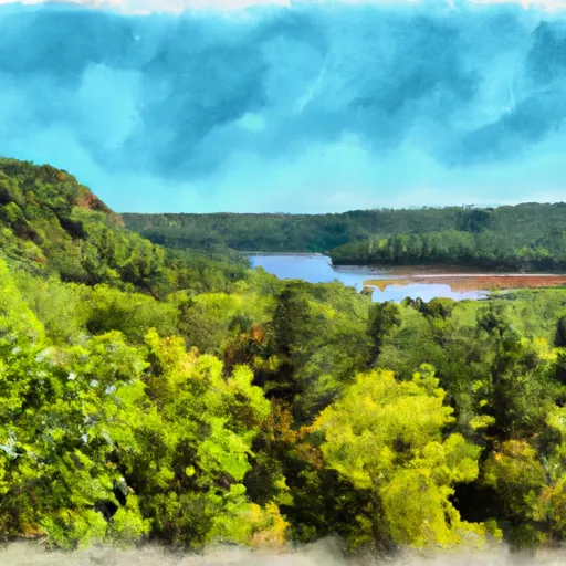
Kelso is situated near the Mississippi River, which provides a prominent hydrological feature to the area. The river allows for various water activities such as boating, fishing, and swimming. Additionally, the region is dotted with several small lakes and ponds that offer additional recreational opportunities for water enthusiasts.

Outdoor recreation in Kelso extends beyond water-related activities. The town is surrounded by picturesque nature reserves and parks, allowing for hiking, camping, and wildlife observation. The nearby Trail of Tears State Park offers scenic trails, picnic areas, and camping facilities. Additionally, the region is known for its excellent hunting opportunities, with deer, turkey, and waterfowl being popular game species.

In conclusion, Kelso, Missouri, provides a pleasant climate suitable for outdoor activities year-round. With its proximity to the Mississippi River and surrounding natural areas, residents and visitors can enjoy a wide range of outdoor recreation opportunities.

What is the Eden Index?

The Snoflo Eden Index serves as a comprehensive rating system for regions, evaluating their desirability through a holistic assessment of climate health, outdoor recreation opportunities, and natural disaster risk, acknowledging the profound impact of these factors on livability and well-being.


Climate Health Indicator (CHI): 8.1


Kelso receives approximately 1205mm of rain per year, with humidity levels near 81% and air temperatures averaging around 14°C. Kelso has a plant hardyness factor of 6, meaning plants and agriculture in this region thrive during a short period during spring and early summer. Most plants will die off during the colder winter months. By considering the ideal temperature range, reliable water supplies, clean air, and stable seasonal rain or snowpacks, the Climate Health Indicator (CHI) underscores the significance of a healthy climate as the foundation for quality living.

A healthy climate is paramount for ensuring a high quality of life and livability in a region, fostering both physical well-being and environmental harmony. This can be characterized by ideal temperatures, reliable access to water supplies, clean air, and consistent seasonal rain or snowpacks.


Weather Forecast


Streamflow Conditions

Upper Mississippi-Meramec

Area Rivers

Upper Mississippi-Meramec


Snowpack Depths

Upper Mississippi-Meramec


Reservoir Storage Capacity

Upper Mississippi-Meramec


Groundwater Levels


Recreational Opportunity Index (ROI): 3.1


The Recreational Opportunity Index (ROI) recognizes the value of outdoor recreational options, such as parks, hiking trails, camping sites, and fishing spots, while acknowledging that climate plays a pivotal role in ensuring the comfort and consistency of these experiences. Access to outdoor recreational opportunities, encompassing activities such as parks, hiking, camping, and fishing, is crucial for overall well-being, and the climate plays a pivotal role in enabling and enhancing these experiences, ensuring that individuals can engage in nature-based activities comfortably and consistently.


Camping Areas

Campground Campsites Reservations Toilets Showers Elevation
McLeod Water Park None 22 ft
Marathon Lake 71 481 ft
Roosevelt State Park None 562 ft
Ontonagon County Park 43 1,301 ft
Lake Lou Yaeger None 691 ft
Bergland Town Park 15 1,320 ft
Langford Lake 11 1,681 ft
Trail of Tears State Park None 441 ft
Lake Mike Conner 20 314 ft
Council Grounds State Park 55 1,300 ft
Collins Park 25 1,212 ft
Carl Spindler None 456 ft
North Graysport - Grenada Lake 51 279 ft
Buccaneer State Park 276 5 ft
Low Head Dam None 310 ft
Woodford State Conservation Area None 472 ft
Green River State Wildlife Area 50 677 ft
Hennepin Canal Parkway State Park None 667 ft
Lake Gogebic County Park None 1,296 ft
Pomeroy Lake 17 1,643 ft
Marathon Park None 1,268 ft
Dry Creek Water Park None 514 ft
Otter Lake 25 1,643 ft
Trail of Tears State Forest None 525 ft
Skuna/Turkey Creek - Grenada Lake None 246 ft
Riverside/Fern's Edge - Kakabeka Falls Provincial Park 75 859 ft
Rib Mountain State Park 30 1,850 ft
Lake Ross Barnett 22 402 ft
Choctaw - Grenada Lake 5 289 ft
Dells of the Eau Claire Park - Wausau 27 1,408 ft
Washington County Lake State Conservation Area 150 503 ft
Little Black Creek Waterpark None 296 ft
General Watkins Conservation Area - MDC 5 466 ft
Sangchris Lake State Park 185 586 ft
Devils Backbone Park 20 362 ft
Jamison Town Park 18 823 ft
Old Fort - Grenada Lake 21 279 ft
Lake Gogebic State Park 165 1,304 ft
Sara Park None 1,443 ft
Dam West - Lake Carlyle 110 453 ft
Shockaloe Base Camp I 10 578 ft
Okatoma Water Park None 396 ft
Bryant - Grenada Lake 6 210 ft
Pyramid State Park 80 475 ft
Veterans Memorial Field - Portage None 784 ft
Hugh White State Park None 310 ft
Sherwood Forest None 625 ft
Whispering Hills - Kakabeka Falls Provincial Park 94 991 ft
Turkey Bayou None 371 ft
Lake Murphysboro State Park 75 403 ft
Pine Hills 13 460 ft
Lake Columbia 12 212 ft
Leake County Water Park None 324 ft
Johnson Creek 20 644 ft

Catastrophe Safeguard Index (CSI):


The Catastrophe Safeguard Index (CSI) recognizes that natural disaster risk, encompassing floods, fires, hurricanes, and tornadoes, can drastically affect safety and the overall appeal of an area. The level of natural disaster risk in a region significantly affects safety and the overall livability, with climate change amplifying these risks by potentially increasing the frequency and intensity of events like floods, fires, hurricanes, and tornadoes, thereby posing substantial challenges to community resilience and well-being.


Community Resilience Indicator (CRI): 3.1


The Community Resilience Indicator (CRI) recognizes that education, healthcare, and socioeconomics are crucial to the well-being of a region. The CRI acknowledges the profound impact of these elements on residents' overall quality of life. By evaluating educational resources, healthcare accessibility, and economic inclusivity, the index captures the essential aspects that contribute to a thriving community, fostering resident satisfaction, equity, and social cohesion.


Log Your Visit

When was your last visit to ?

Add a Photo

How was it? How were conditions?

Rate the


Submit

Leave A Review


Submit

Upload an Image


Favorite Limit Reached