Kirksville

Climate Recreation Community Catastrophe

Kirksville
Eden Index

Climate 8.1 Recreation 2.5 Community 2.4 Safeguard

4.7/10

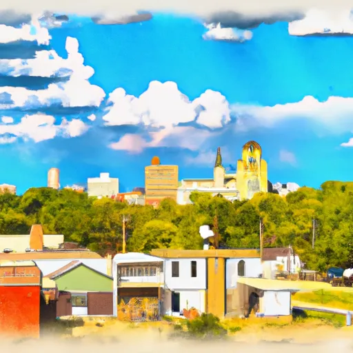
Kirksville, Missouri is a vibrant city located in the northeastern part of the state. The area experiences a humid continental climate, characterized by hot and humid summers, cold winters, and moderate rainfall throughout the year. Summers are often sunny and can reach temperatures in the 80s°F (27-32°C), while winters are cold with temperatures dropping below freezing, and occasional snowfall.

Hydrologically, Kirksville is situated near the Chariton River and features several small lakes and ponds. Outdoor enthusiasts can enjoy various water activities like fishing, boating, and kayaking in these serene water bodies.

The city offers a range of outdoor recreational opportunities for nature lovers. Thousand Hills State Park, just a few miles away, is a popular destination for hiking, camping, and wildlife watching. The park features scenic trails, picnic areas, and a large lake for fishing and boating.

Kirksville is also home to several city parks, providing ample opportunities for walking, biking, and enjoying nature. These parks often host community events and offer facilities for sports like basketball, soccer, and tennis.

Overall, Kirksville, Missouri, with its pleasant climate, proximity to water bodies, and diverse outdoor recreational offerings, is an ideal destination for nature enthusiasts and those seeking an active lifestyle.

What is the Eden Index?

The Snoflo Eden Index serves as a comprehensive rating system for regions, evaluating their desirability through a holistic assessment of climate health, outdoor recreation opportunities, and natural disaster risk, acknowledging the profound impact of these factors on livability and well-being.


Climate Health Indicator (CHI): 8.1


Kirksville receives approximately 990mm of rain per year, with humidity levels near 82% and air temperatures averaging around 11°C. Kirksville has a plant hardyness factor of 5, meaning plants and agriculture in this region thrive during a short period during spring and early summer. Most plants will die off during the colder winter months. By considering the ideal temperature range, reliable water supplies, clean air, and stable seasonal rain or snowpacks, the Climate Health Indicator (CHI) underscores the significance of a healthy climate as the foundation for quality living.

A healthy climate is paramount for ensuring a high quality of life and livability in a region, fostering both physical well-being and environmental harmony. This can be characterized by ideal temperatures, reliable access to water supplies, clean air, and consistent seasonal rain or snowpacks.


Weather Forecast


Streamflow Conditions

Upper Mississippi-Salt

Area Rivers

Upper Mississippi-Salt


Snowpack Depths

Upper Mississippi-Salt


Reservoir Storage Capacity

Upper Mississippi-Salt


Groundwater Levels


Recreational Opportunity Index (ROI): 2.5


The Recreational Opportunity Index (ROI) recognizes the value of outdoor recreational options, such as parks, hiking trails, camping sites, and fishing spots, while acknowledging that climate plays a pivotal role in ensuring the comfort and consistency of these experiences. Access to outdoor recreational opportunities, encompassing activities such as parks, hiking, camping, and fishing, is crucial for overall well-being, and the climate plays a pivotal role in enabling and enhancing these experiences, ensuring that individuals can engage in nature-based activities comfortably and consistently.


Camping Areas

Campground Campsites Reservations Toilets Showers Elevation
Lake Keomah State Park 65 810 ft
Cedar Bend Park 40 975 ft
Thunder Woman Park 190 878 ft
McGowen Rec Area 12 857 ft
Lake of the Ozarks State Park 183 773 ft
Buffalo Point - Buffalo National River None 535 ft
Wolf Creek Rec Area 22 963 ft
Rush Landing - Buffalo National River None 451 ft
Thousand Hills State Park None 862 ft
Glendale Access None 696 ft
George Wyth State Park 70 849 ft
Afton State Park 25 970 ft
Eveland Access 26 679 ft
Lake Fisher 6 840 ft
Buck Creek - Bull Shoals Lake None 724 ft
Salisbury City Park None 714 ft
T. F. Clark Co Park 13 891 ft
St. Croix Bluffs Regional Park 70 869 ft
Katy Roundhouse Campground None 601 ft
Diamond Lake County Park 100 910 ft
Lake of the Ozarks Military None 768 ft
Hoffman City Park None 920 ft
Bull Shoals State Park None 516 ft
Lake Wapello State Park 80 803 ft
Point Return City Park 22 716 ft
Drakesville City Park 6 886 ft
Bay City 25 676 ft
Lakeview - Bull Shoals Lake None 757 ft
Black Hawk County Park None 858 ft
Rippee Conserrvation Area - MDC None 793 ft
Ozark Isle - Bull Shoals Lake None 689 ft
Pontiac None 796 ft
Long Branch State Park None 841 ft
Union Grove State Park 26 1,022 ft
Shell Rock Rec Area 40 899 ft
Big Woods Lake None 859 ft
Theodosia None 691 ft
Rothwell Park None 858 ft
Quercus Wilderness Area 5 670 ft
Thomas Hill Reservoir - Hwy T Campground - MDC 10 753 ft
Otter Creek Lake and Park 83 933 ft
Dam Site - Bull Shoals Lake None 681 ft
Twin Ponds Co Park - West None 1,070 ft
Tyler Bend - Buffalo National River None 614 ft
Robertson Access None 758 ft
Twin Ponds Co Park - East None 1,053 ft
Oakland - Bull Shoals Lake None 722 ft
Macon Co Park None 873 ft
North Cedar Park 40 935 ft
Union Mills Access None 762 ft
Roadman Roadside Park None 956 ft
Highway 125 - Bull Shoals Lake None 707 ft

Catastrophe Safeguard Index (CSI):


The Catastrophe Safeguard Index (CSI) recognizes that natural disaster risk, encompassing floods, fires, hurricanes, and tornadoes, can drastically affect safety and the overall appeal of an area. The level of natural disaster risk in a region significantly affects safety and the overall livability, with climate change amplifying these risks by potentially increasing the frequency and intensity of events like floods, fires, hurricanes, and tornadoes, thereby posing substantial challenges to community resilience and well-being.


Community Resilience Indicator (CRI): 2.4


The Community Resilience Indicator (CRI) recognizes that education, healthcare, and socioeconomics are crucial to the well-being of a region. The CRI acknowledges the profound impact of these elements on residents' overall quality of life. By evaluating educational resources, healthcare accessibility, and economic inclusivity, the index captures the essential aspects that contribute to a thriving community, fostering resident satisfaction, equity, and social cohesion.


Log Your Visit

When was your last visit to ?

Add a Photo

How was it? How were conditions?

Rate the


Submit

Leave A Review


Submit

Upload an Image


Favorite Limit Reached