Tyler Bend - Buffalo National River Campground
Community Reviews
Been here? Share the conditions.
Reviews, ratings & photos are added in the free Snoflo iOS app — rate a spot, tag the conditions, and your visit is verified by location. Add or manage your reviews from the app.
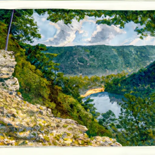
Tyler Bend - Buffalo National River
The campground amenities include picnic tables, fire rings, and access to potable water and flush toilets. The camping area operates on a first-come-first-serve basis, with 31 campsites available for visitors.
An interesting fact about the area is that it was once used as a Confederate encampment during the Civil War. Visitors can still see remnants of the Confederate earthworks that were used to defend the area.
The best time to visit Tyler Bend is during the fall season, from September to November, when the weather is mild with average temperatures ranging from 50 to 70 degrees Fahrenheit. Visitors can enjoy the fall foliage and participate in outdoor activities such as hiking and fishing.
Overall, the Tyler Bend Buffalo National River camping area is a great destination for nature lovers who want to experience the beauty of the Ozarks and enjoy outdoor activities.
What's on-site at Tyler Bend - Buffalo National River
Key facilities Snoflo tracks for this campground. Confirm with the operator before booking -- amenities can change seasonally.
Plan your trip down to the hour
Same weather feed Snoflo's iOS app uses -- updated continuously from NOAA / yr.no.
Next 5 days, hour by hour
Temperature line with weather symbols on top, snow + rain accumulation as columns, humidity as a dotted line.
5-day forecast table
Every 3 hours, broken out across temperature, snow, rain, humidity, and wind. Each cell is colour-coded relative to the column min/max so trends jump out at a glance.
| Time | Condition | Temp (°F) | Snow (in) | Rain (in) | Humidity (%) | Wind (mps) | Wind dir |
|---|---|---|---|---|---|---|---|
| Loading detailed forecast… | |||||||
15-day temperature & precipitation
Daily temperatures, snow, and rain projected over the next two weeks. Hover any point for the full breakdown.
Other campgrounds in the area
Snoflo-tracked campsites within driving distance of Tyler Bend - Buffalo National River, with reservations status.
| Campground | Reservations | Toilets | View |
|---|---|---|---|
| Tyler Bend Drive-In Campsites | ✗ | ✗ | → |
| Tyler Bend Group Campsites | ✗ | ✗ | → |
| Tyler Bend Walk-In Tent Sites | ✗ | ✗ | → |
| Woolum | ✗ | ✗ | → |
| South Maumee | ✗ | ✗ | → |
Nearby streamflow
USGS streamgauges within reach of Tyler Bend - Buffalo National River -- pulled live from the National Water Information System.
| Streamgauge | Discharge | View |
|---|---|---|
| Buffalo River Near St. Joe | 192 cfs | → |
| Bear Creek Near Silver Hill | 16 cfs | → |
| Buffalo River Near Harriet | 237 cfs | → |
| Richland Creek Near Witts Spring | 44 cfs | → |
| White River Near Norfork | 13,400 cfs | → |
| North Sylamore Creek Near Fifty Six | 8 cfs | → |
Nearby snow depths
NRCS SNOTEL stations within reach of Tyler Bend - Buffalo National River -- relevant when planning a shoulder-season or alpine trip.
| SNOTEL station | Snowpack | 24h Snowfall | View |
|---|---|---|---|
| Gilbert | 0.0 in | 0.0 in | → |
| Jasper | 0.0 in | 0.0 in | → |
| Jordan 3nnw | 0.0 in | 0.0 in | → |
| Damascus 2 Nne | 0.0 in | 0.0 in | → |
| Metalton 3.5 W | 0.0 in | 0.0 in | → |
Plan a longer trip
The closest parks, lakes, boat launches, and paddle runs so a camping night can grow into a full weekend.
Parks
- Loafer's Glory Wildlife Management Area
- Gene Rush Wildlife Management Area
- Buffalo River State Park
- State Conservation Area Kelly's Slab
- Lower Buffalo Wilderness Area
- Wilderness Leatherwood
Boat launches
Fishing spots
- Bull Shoals Tailwater
- Gunner Creek
- Little North Fork White River
- Bull Shoals Lake
- Trimble Creek
- Big Piney Creek
Camping essentials & Leave No Trace
- Pack it in, pack it out
- Take all trash, food scraps, and gear back with you to keep campsites clean and protect wildlife.
- Respect wildlife
- Observe animals from a distance, store food securely, and never feed wildlife to maintain natural behavior and safety.
- Know before you go
- Check weather, fire restrictions, trail conditions, and permit requirements to ensure a safe and well-planned trip.
- Minimize campfire impact
- Use established fire rings, keep fires small, fully extinguish them, or opt for a camp stove when fires are restricted.
- Leave what you find
- Preserve natural and cultural features by avoiding removal of plants, rocks, artifacts, or other elements of the environment.
Set push alerts in the Snoflo app
Save Tyler Bend - Buffalo National River as a favorite, set a custom threshold (precipitation, snowpack, freezing temperatures), and the iOS app will push the moment conditions cross.
About Tyler Bend - Buffalo National River
Can I make reservations at Tyler Bend - Buffalo National River?
Yes -- this campground accepts reservations. Snoflo recommends booking early for peak season; check the operator (Recreation.gov / state park system / private operator) for the booking window and cancellation policy.
How fresh is the weather data on this page?
The hourly forecast updates throughout the day from the NOAA / yr.no public feeds. Streamflow data is pulled live from USGS streamgauges and snowpack from the NRCS SNOTEL network.
What's the best time of year to visit?
Use the 15-day temperature & precipitation outlook on this page to plan -- pick a window with comfortable temperatures and low precipitation. For longer trips, the 5-day hourly meteogram shows snow + rain accumulation hour-by-hour.
How do I get to Tyler Bend - Buffalo National River?
Tap Directions in the hero above to open driving directions in Google Maps, or Open in map to center the Snoflo interactive map on the campground.
Can I get alerts when conditions change?
Yes -- alerts are managed through the Snoflo iOS app. Favorite this campground, set a threshold (temperature, snowpack, precipitation), and you'll get a push the moment it crosses.
Other campgrounds near here
Snoflo-tracked campgrounds within driving distance of Tyler Bend - Buffalo National River.