Miami

Climate Recreation Community Catastrophe

Miami
Eden Index

Climate 8.3 Recreation 3.4 Community 0.9 Safeguard

4.7/10

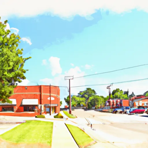
Miami, Missouri is a charming town located in Saline County, in the central part of the state. The town experiences a humid continental climate, characterized by hot and humid summers and cold winters. Summers in Miami are warm, with average temperatures ranging from the mid-80s to low 90s Fahrenheit, while winters are cold, with temperatures dropping to the mid-20s. The area receives moderate rainfall throughout the year.

The town is situated near the Salt Fork and Blackwater rivers, contributing to its hydrology constituents. The rivers provide a scenic backdrop and opportunities for outdoor activities such as fishing, boating, and kayaking. Miami is also home to several parks and nature trails, including the Blackwater State Park, where visitors can explore the natural beauty of the region.

In addition to its natural attractions, Miami hosts various outdoor recreation opportunities such as camping, hiking, and birdwatching. The town's proximity to Mark Twain National Forest and Whiteman Air Force Base further expands the range of outdoor activities available to residents and visitors. Miami, Missouri offers a picturesque setting and numerous outdoor recreation opportunities for nature enthusiasts to enjoy.

What is the Eden Index?

The Snoflo Eden Index serves as a comprehensive rating system for regions, evaluating their desirability through a holistic assessment of climate health, outdoor recreation opportunities, and natural disaster risk, acknowledging the profound impact of these factors on livability and well-being.


Climate Health Indicator (CHI): 8.3


Miami receives approximately 1008mm of rain per year, with humidity levels near 81% and air temperatures averaging around 12°C. Miami has a plant hardyness factor of 6, meaning plants and agriculture in this region thrive during a short period during spring and early summer. Most plants will die off during the colder winter months. By considering the ideal temperature range, reliable water supplies, clean air, and stable seasonal rain or snowpacks, the Climate Health Indicator (CHI) underscores the significance of a healthy climate as the foundation for quality living.

A healthy climate is paramount for ensuring a high quality of life and livability in a region, fostering both physical well-being and environmental harmony. This can be characterized by ideal temperatures, reliable access to water supplies, clean air, and consistent seasonal rain or snowpacks.


Weather Forecast


Streamflow Conditions

Lower Missouri-Blackwater

Area Rivers

Lower Missouri-Blackwater


Snowpack Depths

Lower Missouri-Blackwater


Reservoir Storage Capacity

Lower Missouri-Blackwater


Groundwater Levels


Recreational Opportunity Index (ROI): 3.4


The Recreational Opportunity Index (ROI) recognizes the value of outdoor recreational options, such as parks, hiking trails, camping sites, and fishing spots, while acknowledging that climate plays a pivotal role in ensuring the comfort and consistency of these experiences. Access to outdoor recreational opportunities, encompassing activities such as parks, hiking, camping, and fishing, is crucial for overall well-being, and the climate plays a pivotal role in enabling and enhancing these experiences, ensuring that individuals can engage in nature-based activities comfortably and consistently.


Camping Areas

Campground Campsites Reservations Toilets Showers Elevation
Pomme de Terre State Park None 923 ft
Lincoln City Park 4 955 ft
Shadow Rock Park None 676 ft
Pershing State Park None 691 ft
Lightfoot Landing - Pomme de Terre Lake None 870 ft
Whitebreast - Red Rock Lake 130 828 ft
Outlet Area - Pomme de Terre Lake None 776 ft
Steel Creek - Buffalo National River None 977 ft
Long Pool 77 615 ft
Van Meter State Park None 662 ft
Brookfield City Park 15 788 ft
Long Creek - Table Rock Lake None 1,001 ft
Unionville City RV Park 45 1,065 ft
Damsite - Pomme de Terre Lake None 862 ft
Ashton Wildwood Park None 942 ft
Cricket Creek None 1,156 ft
Haw Creek Falls 9 791 ft
Nemo Landing - Pomme de Terre Lake None 912 ft
Herring Memorial Park - Brunswick None 761 ft
Erbie - Buffalo National River None 847 ft
Cobb Ridge 19 1,360 ft
River Run None 701 ft
Old Highway 86 - Table Rock Lake None 914 ft
Ozark - Buffalo National River None 865 ft
Roberts Creek Park None 803 ft
Thibaut Point - Harry S. Truman Lake None 731 ft
Indian Point - Table Rock Lake None 1,040 ft
Grammer Grove Wildlife Area None 930 ft
Wheatland - Pomme de Terre Lake None 905 ft
Lost Valley - Buffalo National River None 1,096 ft
Mill Creek - Table Rock Lake None 950 ft
Osage Bluff - Harry S. Truman Lake None 807 ft
Camp Ridge 91 1,347 ft
Shawnee Bend - Harry S Truman Lake None 772 ft
Elk Rock State Park 75 843 ft
Carver - Buffalo National River None 710 ft
Drury-Mincy Conservation Area - MDC 4 976 ft
Branson City Campground None 704 ft
Pittsburg Park - Pomme de Terre Lake None 871 ft

Catastrophe Safeguard Index (CSI):


The Catastrophe Safeguard Index (CSI) recognizes that natural disaster risk, encompassing floods, fires, hurricanes, and tornadoes, can drastically affect safety and the overall appeal of an area. The level of natural disaster risk in a region significantly affects safety and the overall livability, with climate change amplifying these risks by potentially increasing the frequency and intensity of events like floods, fires, hurricanes, and tornadoes, thereby posing substantial challenges to community resilience and well-being.


Community Resilience Indicator (CRI): 0.9


The Community Resilience Indicator (CRI) recognizes that education, healthcare, and socioeconomics are crucial to the well-being of a region. The CRI acknowledges the profound impact of these elements on residents' overall quality of life. By evaluating educational resources, healthcare accessibility, and economic inclusivity, the index captures the essential aspects that contribute to a thriving community, fostering resident satisfaction, equity, and social cohesion.


Log Your Visit

When was your last visit to ?

Add a Photo

How was it? How were conditions?

Rate the


Submit

Leave A Review


Submit

Upload an Image


Favorite Limit Reached