-
Snoflo Premium
Get unlimited access to all our content
With no Ad interruptions! - Start Your Free Trial Login with existing account
Millwood
Eden Index
Climate
8.3
•
Recreation
5.0
•
Community
1.6
•
Safeguard
5.4/10
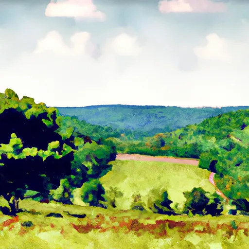
Millwood, Virginia, located in Clarke County, offers a pleasant climate with four distinct seasons. Summers are warm and humid, with temperatures averaging around 85°F (29°C). Winters are mild, with temperatures averaging around 40°F (4°C), and occasional snowfall. Spring and fall showcase beautiful foliage and moderate temperatures.
The hydrology constituents in Millwood are diverse and abundant. The area is dotted with numerous streams and creeks, including the Shenandoah River, which flows nearby. The region also boasts several ponds and small lakes that provide opportunities for fishing, boating, and other water activities.
Outdoor enthusiasts will find plenty of recreational opportunities in Millwood. The Clarke County Conservation Easement Authority preserves over 1,000 acres of land, offering hiking, bird-watching, and wildlife viewing. For those interested in history, the Burwell-Morgan Mill, a working gristmill from the 18th century, is a popular attraction. Additionally, nearby Sky Meadows State Park provides opportunities for camping, picnicking, horseback riding, and hiking along its scenic trails.
In summary, Millwood, Virginia, offers a pleasant climate with distinct seasons, diverse hydrology constituents, and a variety of outdoor recreation opportunities, making it an attractive destination for nature lovers and history enthusiasts alike.
What is the Eden Index?
The Snoflo Eden Index serves as a comprehensive rating system for regions, evaluating their desirability through a holistic assessment of climate health, outdoor recreation opportunities, and natural disaster risk, acknowledging the profound impact of these factors on livability and well-being.
Climate Health Indicator (CHI): 8.3
Millwood receives approximately
996mm of rain per year,
with humidity levels near 80%
and air temperatures averaging around
13°C.
Millwood has a plant hardyness factor of
6, meaning
plants and agriculture in this region thrive during a short period during spring and early summer. Most
plants will die off during the colder winter months.
By considering the ideal temperature range, reliable water supplies, clean air, and stable seasonal rain or snowpacks, the Climate Health Indicator (CHI) underscores the significance of a healthy climate as the foundation for quality living.
A healthy climate is paramount for ensuring a high quality of life and livability in a region, fostering both physical well-being and environmental harmony. This can be characterized by ideal temperatures, reliable access to water supplies, clean air, and consistent seasonal rain or snowpacks.
Weather Forecast
Streamflow Conditions
Potomac
Area Rivers
Potomac
Snowpack Depths
Potomac
Reservoir Storage Capacity
Potomac
Groundwater Levels
Recreational Opportunity Index (ROI): 5.0
The Recreational Opportunity Index (ROI) recognizes the value of outdoor recreational options, such as parks, hiking trails, camping sites, and fishing spots, while acknowledging that climate plays a pivotal role in ensuring the comfort and consistency of these experiences.
Access to outdoor recreational opportunities, encompassing activities such as parks, hiking, camping, and fishing, is crucial for overall well-being, and the climate plays a pivotal role in enabling and enhancing these experiences, ensuring that individuals can engage in nature-based activities comfortably and consistently.
Camping Areas
Campground | Campsites | Reservations | Toilets | Showers | Elevation |
---|---|---|---|---|---|
McCoys Ferry - C and O Canal National Park | 14 | 377 ft | |||
Sleepy Creek WMA | 75 | 1,157 ft | |||
Lake Anna State Park | None | 366 ft | |||
Fort Frederick State Park | 29 | 386 ft | |||
Cowans Gap State Park | None | 1,223 ft |
Nearby Fishing
Nearby Ski Areas
Catastrophe Safeguard Index (CSI):
The Catastrophe Safeguard Index (CSI) recognizes that natural disaster risk, encompassing floods, fires, hurricanes, and tornadoes, can drastically affect safety and the overall appeal of an area.
The level of natural disaster risk in a region significantly affects safety and the overall livability, with climate change amplifying these risks by potentially increasing the frequency and intensity of events like floods, fires, hurricanes, and tornadoes, thereby posing substantial challenges to community resilience and well-being.
Community Resilience Indicator (CRI): 1.6
The Community Resilience Indicator (CRI) recognizes that education, healthcare, and socioeconomics are crucial to the well-being of a region. The CRI acknowledges the profound impact of these elements on residents' overall quality of life. By evaluating educational resources, healthcare accessibility, and economic inclusivity, the index captures the essential aspects that contribute to a thriving community, fostering resident satisfaction, equity, and social cohesion.