

-
 Snoflo Premium
Get unlimited access to all our content
With no Ad interruptions! - Start Your Free Trial Login with existing account
Moab
Eden Index
Climate
8.7
•
Recreation
8.2
•
Community
0.9
•
Safeguard
6.6/10
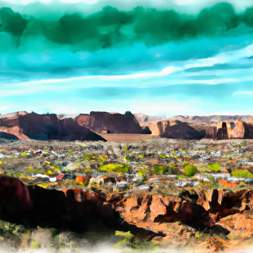
Moab, Utah is a scenic destination renowned for its unique geological formations and diverse outdoor recreation opportunities. Situated in the southwestern region of the state, Moab experiences a semi-arid climate characterized by hot summers and cold winters. Summer temperatures can soar above 100°F (38°C), while winter temperatures average around 30-40°F (-1 to 4°C). Precipitation is generally low, with most rainfall occurring during spring and fall.
The hydrology of Moab is dominated by the Colorado River, which flows through the city and offers various recreational activities such as whitewater rafting and kayaking. Additionally, the region is home to numerous canyons, including the famous Canyonlands National Park and Arches National Park, both showcasing stunning landscapes sculpted by water erosion. These parks offer hiking, camping, rock climbing, and photography opportunities.
Moab's outdoor recreation opportunities extend beyond its national parks, with popular activities like mountain biking, off-roading, and canyoneering. The area boasts an extensive network of trails, including the renowned Slickrock Bike Trail and the challenging Porcupine Rim Trail. With its striking landscapes, mild winters, and abundance of recreational opportunities, Moab is a paradise for nature lovers and adventure seekers alike.
What is the Eden Index?
The Snoflo Eden Index serves as a comprehensive rating system for regions, evaluating their desirability through a holistic assessment of climate health, outdoor recreation opportunities, and natural disaster risk, acknowledging the profound impact of these factors on livability and well-being.
Climate Health Indicator (CHI): 8.7
Moab receives approximately
272mm of rain per year,
with humidity levels near 46%
and air temperatures averaging around
12°C.
Moab has a plant hardyness factor of
7, meaning
plants and agriculture in this region tend to thrive during the non-winter months.
By considering the ideal temperature range, reliable water supplies, clean air, and stable seasonal rain or snowpacks, the Climate Health Indicator (CHI) underscores the significance of a healthy climate as the foundation for quality living.
A healthy climate is paramount for ensuring a high quality of life and livability in a region, fostering both physical well-being and environmental harmony. This can be characterized by ideal temperatures, reliable access to water supplies, clean air, and consistent seasonal rain or snowpacks.
Weather Forecast
Streamflow Conditions
Upper Colorado-Dolores
Area Rivers
Upper Colorado-Dolores
Snowpack Depths
Upper Colorado-Dolores
Reservoir Storage Capacity
Upper Colorado-Dolores
Groundwater Levels
Recreational Opportunity Index (ROI): 8.2
The Recreational Opportunity Index (ROI) recognizes the value of outdoor recreational options, such as parks, hiking trails, camping sites, and fishing spots, while acknowledging that climate plays a pivotal role in ensuring the comfort and consistency of these experiences.
Access to outdoor recreational opportunities, encompassing activities such as parks, hiking, camping, and fishing, is crucial for overall well-being, and the climate plays a pivotal role in enabling and enhancing these experiences, ensuring that individuals can engage in nature-based activities comfortably and consistently.
Camping Areas
| Campground | Campsites | Reservations | Toilets | Showers | Elevation |
|---|---|---|---|---|---|
| Fisher Towers | 5 | 4,718 ft | |||
| Granstaff | 16 | 3,971 ft | |||
| Sand Flats | 120 | 4,699 ft | |||
| Upper Big Bend | 8 | 4,001 ft | |||
| Dewey Bridge | 7 | 4,105 ft | |||
| Willow Springs Trail Dispersed | None | 4,343 ft | |||
| Devils Garden - Arches National Park | 52 | 5,179 ft | |||
| Hal Canyon | 11 | 3,980 ft | |||
| Hittle Bottom | 12 | 4,085 ft | |||
| Drinks Canyon | 17 | 4,001 ft |
Catastrophe Safeguard Index (CSI):
The Catastrophe Safeguard Index (CSI) recognizes that natural disaster risk, encompassing floods, fires, hurricanes, and tornadoes, can drastically affect safety and the overall appeal of an area.
The level of natural disaster risk in a region significantly affects safety and the overall livability, with climate change amplifying these risks by potentially increasing the frequency and intensity of events like floods, fires, hurricanes, and tornadoes, thereby posing substantial challenges to community resilience and well-being.
Community Resilience Indicator (CRI): 0.9
The Community Resilience Indicator (CRI) recognizes that education, healthcare, and socioeconomics are crucial to the well-being of a region. The CRI acknowledges the profound impact of these elements on residents' overall quality of life. By evaluating educational resources, healthcare accessibility, and economic inclusivity, the index captures the essential aspects that contribute to a thriving community, fostering resident satisfaction, equity, and social cohesion.