Morrisville

Climate Recreation Community Catastrophe

Morrisville
Eden Index

Climate 8.3 Recreation 1.5 Community 2.2 Safeguard

4.4/10

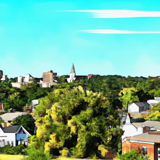
Morrisville, Missouri is a small town located in Polk County, in the southwestern part of the state. The climate in Morrisville is characterized as humid subtropical, with hot and humid summers and mild winters. Average temperatures range from the low 30s (°F) in winter to the mid-90s in summer. The region experiences moderate precipitation throughout the year.

Morrisville benefits from its proximity to the Pomme de Terre River, which flows through the town. The river provides a source of recreational activities such as fishing, boating, and swimming. The hydrology constituents of the Pomme de Terre River include various fish species like bass, crappie, and catfish, making it a popular destination for anglers.

Outdoor enthusiasts will also find numerous opportunities for recreation in and around Morrisville. The area is home to several parks and conservation areas, offering hiking trails, camping sites, and wildlife viewing. Nearby Stockton Lake provides additional opportunities for water-based activities, including sailing, water skiing, and kayaking.

In conclusion, Morrisville, Missouri offers a humid subtropical climate, access to the Pomme de Terre River, and various outdoor recreation opportunities, making it an appealing destination for nature lovers and outdoor enthusiasts.

What is the Eden Index?

The Snoflo Eden Index serves as a comprehensive rating system for regions, evaluating their desirability through a holistic assessment of climate health, outdoor recreation opportunities, and natural disaster risk, acknowledging the profound impact of these factors on livability and well-being.


Climate Health Indicator (CHI): 8.3


Morrisville receives approximately 1127mm of rain per year, with humidity levels near 82% and air temperatures averaging around 14°C. Morrisville has a plant hardyness factor of 6, meaning plants and agriculture in this region thrive during a short period during spring and early summer. Most plants will die off during the colder winter months. By considering the ideal temperature range, reliable water supplies, clean air, and stable seasonal rain or snowpacks, the Climate Health Indicator (CHI) underscores the significance of a healthy climate as the foundation for quality living.

A healthy climate is paramount for ensuring a high quality of life and livability in a region, fostering both physical well-being and environmental harmony. This can be characterized by ideal temperatures, reliable access to water supplies, clean air, and consistent seasonal rain or snowpacks.


Weather Forecast


Streamflow Conditions

Osage

Area Rivers

Osage


Snowpack Depths

Osage


Reservoir Storage Capacity

Osage


Groundwater Levels


Recreational Opportunity Index (ROI): 1.5


The Recreational Opportunity Index (ROI) recognizes the value of outdoor recreational options, such as parks, hiking trails, camping sites, and fishing spots, while acknowledging that climate plays a pivotal role in ensuring the comfort and consistency of these experiences. Access to outdoor recreational opportunities, encompassing activities such as parks, hiking, camping, and fishing, is crucial for overall well-being, and the climate plays a pivotal role in enabling and enhancing these experiences, ensuring that individuals can engage in nature-based activities comfortably and consistently.


Camping Areas

Campground Campsites Reservations Toilets Showers Elevation
Windsor Crossing - Harry S Truman Lake 47 745 ft
Alpine Ridge - De Gray Lake 49 473 ft
Cricket Creek None 1,156 ft
Lost Valley - Buffalo National River None 1,096 ft
Cedar Fourche - Lake Ouachita None 587 ft
Weaubleau City Park None 988 ft
Joe Bald - Table Rock Lake None 948 ft
Buckville - Lake Ouachita None 610 ft
Charlton 58 725 ft
Shouse Ford - De Gray Lake 99 401 ft
Nemo Landing - Pomme de Terre Lake None 912 ft
Viola - Table Rock Lake None 1,017 ft
Spadra - Lake Dardanelle None 360 ft
Ozone 28 1,825 ft
Indian Point - Table Rock Lake None 1,040 ft
Pershing State Park None 691 ft
Cove Lake Complex 96 1,034 ft
Brady Mountain - Lake Ouachita 74 616 ft
Mount Nebo State Park None 1,404 ft
Big Bay - Table Rock Lake 61 1,022 ft
Mill Creek - Table Rock Lake None 950 ft
Avant - Lake Ouachita 25 589 ft
Washita - Lake Ouachita None 600 ft
Harry S Truman State Park None 864 ft
Farrington City Park None 859 ft
Spring Lake 53 522 ft
Cape Fair - Table Rock Lake None 966 ft
Carrollton City Park None 709 ft
Mount Magazine State Park None 2,429 ft
Big Fir 50 617 ft
Lightfoot Landing - Pomme de Terre Lake None 870 ft
Pomme de Terre State Park None 923 ft
Shoal Bay - Lake Dardanelle None 375 ft
Steel Creek - Buffalo National River None 977 ft
Knob Noster State Park None 833 ft
Baxter - Table Rock Lake None 941 ft
Lincoln City Park 4 955 ft
Rabbit Tail - Lake Ouachita None 652 ft
Shawnee Bend - Harry S Truman Lake None 772 ft
Little Fir - Lake Ouachita 29 602 ft
Berryville RV Park 18 1,169 ft
Crystal 9 972 ft
Haw Creek Falls 9 791 ft
Highway 27 - Lake Ouachita None 593 ft
Damsite - Pomme de Terre Lake None 862 ft
Irons Fork - Lake Ouachita 12 586 ft
Van Meter State Park None 662 ft
Tompkins Bend - Lake Ouachita 77 603 ft
Lena Landing - Lake Ouachita 10 599 ft
Horsehead Lake 80 692 ft
Long Shoal - Harry S. Truman Lake None 783 ft
Aunts Creek - Table Rock Lake None 998 ft
Wheatland - Pomme de Terre Lake None 905 ft
Long Creek - Table Rock Lake None 1,001 ft
Wolf Pen 21 905 ft
Branson City Campground None 704 ft
Carter Cove None 358 ft
Crystal Springs - Lake Ouachita 74 623 ft
Joplin - Lake Ouachita 64 592 ft
Twin Creek - Lake Ouachita 15 590 ft
Old Highway 86 - Table Rock Lake None 914 ft
Outlet Area - Pomme de Terre Lake None 776 ft
Point Cedar - De Gray Lake 62 417 ft
Bogard City Park 26 859 ft
Pittsburg Park - Pomme de Terre Lake None 871 ft
Thibaut Point - Harry S. Truman Lake None 731 ft
Lake Dardanelle State Park None 344 ft
Cane Creek - Lake Dardanelle 16 344 ft
Dragover 7 741 ft
Campbell Point - Table Rock Lake None 999 ft
Berry Bend - Harry S. Truman Lake None 850 ft
Piney Bay - Lake Dardanelle None 365 ft
Osage Bluff - Harry S. Truman Lake None 807 ft
Denby Point - Lake Ouachita 67 655 ft
Bucksaw - Harry S. Truman Lake None 738 ft
Talley Bend - Harry S. Truman Lake None 822 ft
River Bluff 5 616 ft

Catastrophe Safeguard Index (CSI):


The Catastrophe Safeguard Index (CSI) recognizes that natural disaster risk, encompassing floods, fires, hurricanes, and tornadoes, can drastically affect safety and the overall appeal of an area. The level of natural disaster risk in a region significantly affects safety and the overall livability, with climate change amplifying these risks by potentially increasing the frequency and intensity of events like floods, fires, hurricanes, and tornadoes, thereby posing substantial challenges to community resilience and well-being.


Community Resilience Indicator (CRI): 2.2


The Community Resilience Indicator (CRI) recognizes that education, healthcare, and socioeconomics are crucial to the well-being of a region. The CRI acknowledges the profound impact of these elements on residents' overall quality of life. By evaluating educational resources, healthcare accessibility, and economic inclusivity, the index captures the essential aspects that contribute to a thriving community, fostering resident satisfaction, equity, and social cohesion.


Log Your Visit

When was your last visit to ?

Add a Photo

How was it? How were conditions?

Rate the


Submit

Leave A Review


Submit

Upload an Image


Favorite Limit Reached