River-Falls

Climate Recreation Community Catastrophe

River-Falls
Eden Index

Climate 6.4 Recreation 4.4 Community 3.9 Safeguard

5.1/10

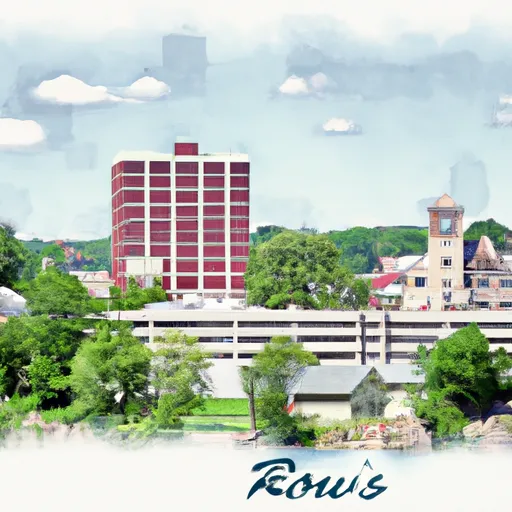
River Falls is a charming city located in Pierce and St. Croix counties, Wisconsin. The climate in River Falls is characterized as a humid continental climate, with warm summers and cold winters. Summers are moderate, with temperatures averaging around 75°F (24°C), while winters can be quite cold, with temperatures averaging around 20°F (-7°C). Precipitation is evenly distributed throughout the year.

The city is situated along the Kinnickinnic River, which is a major hydrological feature in the area. The river is known for its excellent water quality and is a popular destination for recreational activities such as kayaking, canoeing, and fishing. The Kinnickinnic River is home to numerous fish species, including trout, bass, and panfish.

In addition to the Kinnickinnic River, River Falls offers a variety of outdoor recreation opportunities. With its beautiful parks, hiking trails, and bike paths, residents and visitors can enjoy activities such as hiking, biking, picnicking, and birdwatching. Glen Park, in particular, is a popular spot with its scenic waterfall, picnic areas, and playgrounds.

Overall, River Falls provides a pleasant climate, a diverse hydrological environment, and numerous outdoor recreation opportunities, making it an ideal destination for nature enthusiasts.

What is the Eden Index?

The Snoflo Eden Index serves as a comprehensive rating system for regions, evaluating their desirability through a holistic assessment of climate health, outdoor recreation opportunities, and natural disaster risk, acknowledging the profound impact of these factors on livability and well-being.


Climate Health Indicator (CHI): 6.4


River-Falls receives approximately 795mm of rain per year, with humidity levels near 83% and air temperatures averaging around 7°C. River-Falls has a plant hardyness factor of 4, meaning plants and agriculture in this region thrive during a short period during spring and early summer. Most plants will die off during the colder winter months. By considering the ideal temperature range, reliable water supplies, clean air, and stable seasonal rain or snowpacks, the Climate Health Indicator (CHI) underscores the significance of a healthy climate as the foundation for quality living.

A healthy climate is paramount for ensuring a high quality of life and livability in a region, fostering both physical well-being and environmental harmony. This can be characterized by ideal temperatures, reliable access to water supplies, clean air, and consistent seasonal rain or snowpacks.


Weather Forecast


Streamflow Conditions

St. Croix

Area Rivers

St. Croix


Snowpack Depths

St. Croix


Reservoir Storage Capacity

St. Croix


Groundwater Levels


Recreational Opportunity Index (ROI): 4.4


The Recreational Opportunity Index (ROI) recognizes the value of outdoor recreational options, such as parks, hiking trails, camping sites, and fishing spots, while acknowledging that climate plays a pivotal role in ensuring the comfort and consistency of these experiences. Access to outdoor recreational opportunities, encompassing activities such as parks, hiking, camping, and fishing, is crucial for overall well-being, and the climate plays a pivotal role in enabling and enhancing these experiences, ensuring that individuals can engage in nature-based activities comfortably and consistently.


Camping Areas

Campground Campsites Reservations Toilets Showers Elevation
Nelsons Landing - St. Croix National Scenic River None 868 ft
James N McNally City Campground 38 891 ft
Otter Creek Lake and Park 83 933 ft
Snake River - Chengwatana State Forest 28 828 ft
Quercus Wilderness Area 5 670 ft
Interstate State Park 85 977 ft
Boulder - St Croix State Forest 21 999 ft
Wild River State Park 100 934 ft
Lake Keomah State Park 65 810 ft
Garfvert - Nemadji State Forest 18 1,162 ft
Anderson - Berger Park None 1,143 ft
Wakemup Bay - Kabetogama State Forest 22 1,368 ft
William OBrien State Park 125 797 ft
Riverview - St. Croix State Park 211 905 ft
T. F. Clark Co Park 13 891 ft
Shell Rock Rec Area 40 899 ft
St. Croix Bluffs Regional Park 70 869 ft
Stubler Beach 8 1,511 ft
Diamond Lake County Park 100 910 ft
Willow River - Gen Andrews State Forest 38 1,048 ft
Union Grove State Park 26 1,022 ft
Union Mills Access None 762 ft
Balsam Lake Pine Park - Town 15 1,144 ft
Lake Wapello State Park 80 803 ft
Sherwood Forest City Campground 57 1,505 ft
Eveland Access 26 679 ft
Norway Point Landing - St. Croix National Scenic River None 861 ft
Cedar Bend Park 40 975 ft
Hatfield City Park 10 995 ft
Moose Lake City Park 82 1,053 ft
Willow River State Park 78 832 ft
Big Rice Lake 15 1,452 ft
Hoffman City Park None 920 ft
North Cedar Park 40 935 ft
Lake Fisher 6 840 ft
Thousand Hills State Park None 862 ft
Paint Rock Springs - St. Croix State Park 210 915 ft
Drakesville City Park 6 886 ft
Big Woods Lake None 859 ft
Pfeiffer Lake 16 1,470 ft
St. Croix - Governor Knowles State Forest 30 814 ft
Buhl RV Park 10 1,521 ft
Barnum City Park 12 1,089 ft
Afton State Park 25 970 ft
Glendale Access None 696 ft
Thunder Woman Park 190 878 ft
Roadman Roadside Park None 956 ft
Sandrock Cliffs - St. Croix National Scenic River None 891 ft
Echo Lake 24 1,275 ft
Wolf Creek Rec Area 22 963 ft
Robertson Access None 758 ft
West Two River 49 1,422 ft
Black Hawk County Park None 858 ft
Ash River - Kabetogama State Forest 8 1,130 ft
Bay City 25 676 ft
Moose Lake State Park 35 1,115 ft

Catastrophe Safeguard Index (CSI):


The Catastrophe Safeguard Index (CSI) recognizes that natural disaster risk, encompassing floods, fires, hurricanes, and tornadoes, can drastically affect safety and the overall appeal of an area. The level of natural disaster risk in a region significantly affects safety and the overall livability, with climate change amplifying these risks by potentially increasing the frequency and intensity of events like floods, fires, hurricanes, and tornadoes, thereby posing substantial challenges to community resilience and well-being.


Community Resilience Indicator (CRI): 3.9


The Community Resilience Indicator (CRI) recognizes that education, healthcare, and socioeconomics are crucial to the well-being of a region. The CRI acknowledges the profound impact of these elements on residents' overall quality of life. By evaluating educational resources, healthcare accessibility, and economic inclusivity, the index captures the essential aspects that contribute to a thriving community, fostering resident satisfaction, equity, and social cohesion.


Log Your Visit

When was your last visit to ?

Add a Photo

How was it? How were conditions?

Rate the


Submit

Leave A Review


Submit

Upload an Image


Favorite Limit Reached