Shaw

Climate Recreation Community Catastrophe

Shaw
Eden Index

Climate 7.7 Recreation 1.1 Community 0.8 Safeguard

3.7/10

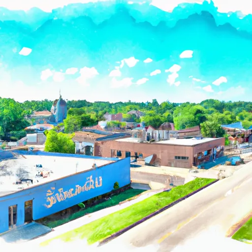
Shaw, Mississippi is a small town located in Bolivar County in the Mississippi Delta region. The town experiences a humid subtropical climate with hot, humid summers and mild winters. Average temperatures range from the mid-90s Fahrenheit in summer to the mid-40s in winter. Shaw receives an average annual precipitation of around 55 inches, with rainfall distributed throughout the year.

Being situated in the Mississippi Delta, Shaw is surrounded by fertile soil and abundant hydrology constituents. The town is bordered by the Sunflower River, which not only adds to the scenic beauty of the area but also provides ample opportunities for water-based activities such as boating, fishing, and kayaking. The river is home to various fish species including bass, catfish, and crappie, attracting fishing enthusiasts.

Outdoor recreation opportunities in Shaw extend beyond water activities. The surrounding countryside offers opportunities for hiking, bird-watching, and wildlife observation. The lush landscape and fertile farmlands also make Shaw a great destination for nature photography and scenic drives.

In conclusion, Shaw, Mississippi offers a humid subtropical climate, abundant hydrology constituents, and a range of outdoor recreation opportunities including water-based activities, hiking, bird-watching, fishing, and wildlife observation.

What is the Eden Index?

The Snoflo Eden Index serves as a comprehensive rating system for regions, evaluating their desirability through a holistic assessment of climate health, outdoor recreation opportunities, and natural disaster risk, acknowledging the profound impact of these factors on livability and well-being.


Climate Health Indicator (CHI): 7.7


Shaw receives approximately 1359mm of rain per year, with humidity levels near 87% and air temperatures averaging around 18°C. Shaw has a plant hardyness factor of 8, meaning plants and agriculture in this region tend to thrive here all year round. By considering the ideal temperature range, reliable water supplies, clean air, and stable seasonal rain or snowpacks, the Climate Health Indicator (CHI) underscores the significance of a healthy climate as the foundation for quality living.

A healthy climate is paramount for ensuring a high quality of life and livability in a region, fostering both physical well-being and environmental harmony. This can be characterized by ideal temperatures, reliable access to water supplies, clean air, and consistent seasonal rain or snowpacks.


Weather Forecast


Streamflow Conditions

Yazoo

Area Rivers

Yazoo


Snowpack Depths

Yazoo


Reservoir Storage Capacity

Yazoo


Groundwater Levels


Recreational Opportunity Index (ROI): 1.1


The Recreational Opportunity Index (ROI) recognizes the value of outdoor recreational options, such as parks, hiking trails, camping sites, and fishing spots, while acknowledging that climate plays a pivotal role in ensuring the comfort and consistency of these experiences. Access to outdoor recreational opportunities, encompassing activities such as parks, hiking, camping, and fishing, is crucial for overall well-being, and the climate plays a pivotal role in enabling and enhancing these experiences, ensuring that individuals can engage in nature-based activities comfortably and consistently.


Camping Areas

Campground Campsites Reservations Toilets Showers Elevation
Robb City Park None 700 ft
Clarks Ferry - Mississippi River 45 556 ft
Big River State Forest 100 541 ft
Siloam Springs State Park 180 690 ft
Josie Creek County Park 15 1,250 ft
Temperance River 11 1,524 ft
East Fork - Black River State Forest 24 919 ft
Pine View Military - Fort McCoy None 870 ft
East Twin 10 1,502 ft
Prentice City Park None 599 ft
Float Camp 16 472 ft
Sherman Co Park None 701 ft
Main - Sidie Hollow Park 31 930 ft
Webb Creek - Clearwater Lake None 727 ft
Bankston Park 50 950 ft
Black Lake 29 1,426 ft
Finleys Landing City Park 30 633 ft
Kampsville River Park None 430 ft
St. Peters 370 Lakeside Park 50 426 ft
Baker Lake 5 1,827 ft
Piedmont - Clearwater Lake None 570 ft
Deer Leap 46 338 ft
La Farge City Park 15 846 ft
Henderson County State Conservation 35 554 ft
Rocky Springs - Natchez Trace Pkwy 22 235 ft
Snyder Park 32 1,010 ft
Eden Valley Park None 710 ft
Clear Spgs Rec Area 45 317 ft
Lamar Dixon Expo RV Center 300 11 ft
Fourth Pumping Plant Rec Area 22 531 ft
Delabar State Park 60 575 ft
Miller Riverview City Park None 635 ft
Boat Landing - Sidie Hollow Park 22 939 ft
Fillmore County Rec Area None 835 ft
Hixton Village Campground 20 943 ft
Stock Farm Bridge 8 1,463 ft
Highway K - Clearwater Lake None 600 ft
Esofea - Rentz Memorial Park 27 958 ft
Copper Falls State Park 50 1,122 ft
Dubuque Yacht Basin and RV Park 56 608 ft
Shady Creek - Mississippi River 50 554 ft
Johnsons Shut-Ins State Park None 849 ft
North Rec Composite 15 97 ft
Day Lake 52 1,511 ft
West Arbutus County Park 44 938 ft
Joinerville County Park None 684 ft
Spring Lake Park - Macomb None 680 ft
Russell Memorial Park 230 955 ft
East Arbutus Camp 187 891 ft
Council Bluff - Wild Boar Ridge 100 1,268 ft
Memorial Park - Washburn 51 636 ft
Great River Road Campground None 451 ft
River Road - Clearwater Lake None 471 ft
Tickfaw State Park None 15 ft
Walnut Grove Co Park None 691 ft
Massey Marina 40 631 ft
Toohey Lake 10 1,674 ft
Castle Mound - Black River State Forest 35 855 ft
Cuivre River State Park 94 658 ft
Marian City Park None 1,534 ft
Greenwood Park 14 1,126 ft
Wildcat Mountain State Park 30 1,247 ft
Little Sunflower River None 107 ft
Klondike County Park None 530 ft
Keithsburg Riverside Campground 60 541 ft
Sawbill Lake 50 1,863 ft
Leroy Percy State Park None 108 ft
Pittsfield City Lake None 639 ft
Lake Charlie Capps None 146 ft
Argyle Lake State Park 160 695 ft
South Recreation Composite 100 140 ft
Connors Lake - Flambeau River State Forest 30 1,457 ft
Mud Lake County Park 75 638 ft
Kreher City Park 33 604 ft
Mead Lake Park 71 1,109 ft
Mineral Lake 12 1,442 ft
Weinberg - King State Park 19 590 ft
Lake of the Pines - Flambeau River State Forest 30 1,493 ft
Fairport State Rec Area 40 566 ft
Rock Dam Park 150 1,014 ft
Swiss Valley County Park 100 726 ft
Hawkins Community Park None 1,374 ft
Bennett Park 13 795 ft
Horseshoe Pond 20 675 ft
West End Thompson City Park 51 602 ft
Robertsville State Park 27 502 ft
Wild Rock County Park 30 1,067 ft
Lake Three 8 1,384 ft
Gile Memorial Village 20 932 ft
Crescent Lake 34 1,819 ft
Ridge - Sidie Hollow Park 20 1,209 ft
Bluff View - Clearwater Lake None 572 ft
Pigeon Creek - Black River State Forest 38 945 ft
Anderson Campground - Soldiers Grove 30 725 ft
Maquoketa Caves State Park None 888 ft
Washington State Park None 637 ft
Wildcat Mound County Park None 1,112 ft
Babler Memorial State Park None 733 ft
Beauford T. Anderson Park None 723 ft

Catastrophe Safeguard Index (CSI):


The Catastrophe Safeguard Index (CSI) recognizes that natural disaster risk, encompassing floods, fires, hurricanes, and tornadoes, can drastically affect safety and the overall appeal of an area. The level of natural disaster risk in a region significantly affects safety and the overall livability, with climate change amplifying these risks by potentially increasing the frequency and intensity of events like floods, fires, hurricanes, and tornadoes, thereby posing substantial challenges to community resilience and well-being.


Community Resilience Indicator (CRI): 0.8


The Community Resilience Indicator (CRI) recognizes that education, healthcare, and socioeconomics are crucial to the well-being of a region. The CRI acknowledges the profound impact of these elements on residents' overall quality of life. By evaluating educational resources, healthcare accessibility, and economic inclusivity, the index captures the essential aspects that contribute to a thriving community, fostering resident satisfaction, equity, and social cohesion.


Log Your Visit

When was your last visit to ?

Add a Photo

How was it? How were conditions?

Rate the


Submit

Leave A Review


Submit

Upload an Image


Favorite Limit Reached