-
Snoflo Premium
Get unlimited access to all our content
With no Ad interruptions! - Start Your Free Trial Login with existing account
Shawsville
Eden Index
Climate
8.3
•
Recreation
4.0
•
Community
1.2
•
Safeguard
5.0/10
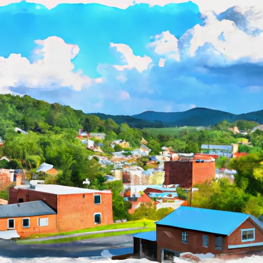
Shawsville, Virginia is a small, picturesque community located in Montgomery County. The climate in Shawsville is characterized by mild to warm summers and cool winters. The area experiences moderate rainfall throughout the year, with occasional snowfall in the winter months. The region is known for its beautiful landscapes, including rolling hills, forests, and nearby mountains.
Shawsville is situated near the Roanoke River, which contributes to its rich hydrology constituents. The river provides opportunities for outdoor activities such as fishing, kayaking, and canoeing. Additionally, the area is dotted with numerous creeks and streams, perfect for exploring and enjoying the natural beauty.
Outdoor recreation enthusiasts will find a variety of activities to engage in around Shawsville. The nearby Jefferson National Forest offers opportunities for hiking, camping, and birdwatching, allowing visitors to immerse themselves in nature. The Appalachian Trail, one of the most famous long-distance hiking trails, also passes through the region, attracting avid hikers from all over the country. Shawsville's scenic surroundings and diverse outdoor recreation options make it an ideal destination for those seeking to connect with nature and explore the great outdoors.
What is the Eden Index?
The Snoflo Eden Index serves as a comprehensive rating system for regions, evaluating their desirability through a holistic assessment of climate health, outdoor recreation opportunities, and natural disaster risk, acknowledging the profound impact of these factors on livability and well-being.
Climate Health Indicator (CHI): 8.3
Shawsville receives approximately
958mm of rain per year,
with humidity levels near 81%
and air temperatures averaging around
13°C.
Shawsville has a plant hardyness factor of
7, meaning
plants and agriculture in this region tend to thrive during the non-winter months.
By considering the ideal temperature range, reliable water supplies, clean air, and stable seasonal rain or snowpacks, the Climate Health Indicator (CHI) underscores the significance of a healthy climate as the foundation for quality living.
A healthy climate is paramount for ensuring a high quality of life and livability in a region, fostering both physical well-being and environmental harmony. This can be characterized by ideal temperatures, reliable access to water supplies, clean air, and consistent seasonal rain or snowpacks.
Weather Forecast
Streamflow Conditions
Roanoke
Area Rivers
Roanoke
Snowpack Depths
Roanoke
Reservoir Storage Capacity
Roanoke
Groundwater Levels
Recreational Opportunity Index (ROI): 4.0
The Recreational Opportunity Index (ROI) recognizes the value of outdoor recreational options, such as parks, hiking trails, camping sites, and fishing spots, while acknowledging that climate plays a pivotal role in ensuring the comfort and consistency of these experiences.
Access to outdoor recreational opportunities, encompassing activities such as parks, hiking, camping, and fishing, is crucial for overall well-being, and the climate plays a pivotal role in enabling and enhancing these experiences, ensuring that individuals can engage in nature-based activities comfortably and consistently.
Camping Areas
Campground | Campsites | Reservations | Toilets | Showers | Elevation |
---|---|---|---|---|---|
Ryans Branch - Philpott Lake | None | 1,154 ft | |||
Blue Bend | 21 | 1,915 ft | |||
Beaver Creek - Watoga State Park | None | 2,547 ft | |||
Jamison Mill Park - Philpott Lake | None | 1,042 ft | |||
Day Run | 12 | 3,104 ft | |||
Fairy Stone State Park | None | 1,032 ft | |||
Goose Point - Philpott Lake | None | 1,155 ft | |||
Moncove Lake State Park | None | 2,527 ft | |||
Riverside - Watoga State Park | None | 2,037 ft | |||
Horseshoe Point - Philpott Lake | None | 1,107 ft | |||
Pilot Mountain State Park | None | 1,267 ft | |||
Tea Creek | 28 | 2,983 ft | |||
Handley WMA | 13 | 3,083 ft | |||
Rocky Knob - Blue Ridge Parkway | None | 3,072 ft | |||
Cranberry | 30 | 2,513 ft | |||
Hanging Rock State Park | None | 1,700 ft | |||
Tanglewood Park | None | 720 ft |
Nearby Ski Areas
Catastrophe Safeguard Index (CSI):
The Catastrophe Safeguard Index (CSI) recognizes that natural disaster risk, encompassing floods, fires, hurricanes, and tornadoes, can drastically affect safety and the overall appeal of an area.
The level of natural disaster risk in a region significantly affects safety and the overall livability, with climate change amplifying these risks by potentially increasing the frequency and intensity of events like floods, fires, hurricanes, and tornadoes, thereby posing substantial challenges to community resilience and well-being.
Community Resilience Indicator (CRI): 1.2
The Community Resilience Indicator (CRI) recognizes that education, healthcare, and socioeconomics are crucial to the well-being of a region. The CRI acknowledges the profound impact of these elements on residents' overall quality of life. By evaluating educational resources, healthcare accessibility, and economic inclusivity, the index captures the essential aspects that contribute to a thriving community, fostering resident satisfaction, equity, and social cohesion.