Shelbyville

Climate Recreation Community Catastrophe

Shelbyville
Eden Index

Climate 7.8 Recreation 2.6 Community Safeguard

4.0/10

Shelbyville, Texas is a small, charming town located in East Texas. The climate in Shelbyville is characterized as humid subtropical, with mild winters and hot, humid summers. Average temperatures range from the 50s in winter to the 90s in summer. The area receives a moderate amount of rainfall throughout the year, with the wettest months being May and October.

Situated in the Deep East Texas Piney Woods, Shelbyville is surrounded by beautiful natural landscapes. The town is known for its proximity to Toledo Bend Reservoir, a sprawling 185,000-acre lake. This makes it an ideal destination for outdoor enthusiasts who enjoy activities such as fishing, boating, and water skiing. The reservoir is abundant with various species of fish, including bass, catfish, and crappie, attracting anglers from near and far.

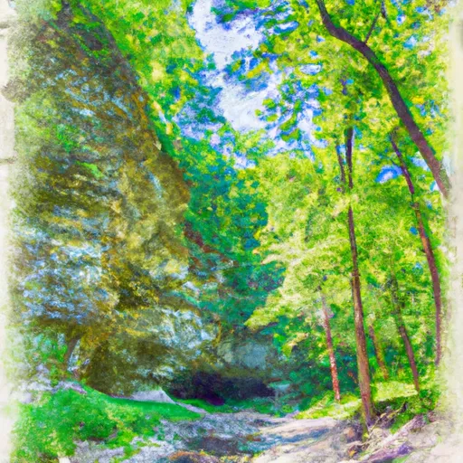
Additionally, hiking and camping opportunities abound in Shelbyville. The nearby Sabine National Forest offers numerous trails that showcase the region's stunning flora and fauna. Nature lovers can explore the forest's dense forests, tranquil streams, and picturesque vistas.

In summary, Shelbyville, Texas offers visitors an enjoyable climate, ample hydrological resources, and plenty of outdoor recreation opportunities. Whether it's fishing on Toledo Bend Reservoir or exploring the natural beauty of the Sabine National Forest, Shelbyville provides a welcoming environment for nature enthusiasts to indulge in their favorite activities.

What is the Eden Index?

The Snoflo Eden Index serves as a comprehensive rating system for regions, evaluating their desirability through a holistic assessment of climate health, outdoor recreation opportunities, and natural disaster risk, acknowledging the profound impact of these factors on livability and well-being.


Climate Health Indicator (CHI): 7.8


Shelbyville receives approximately 1332mm of rain per year, with humidity levels near 89% and air temperatures averaging around 19°C. Shelbyville has a plant hardyness factor of 8, meaning plants and agriculture in this region tend to thrive here all year round. By considering the ideal temperature range, reliable water supplies, clean air, and stable seasonal rain or snowpacks, the Climate Health Indicator (CHI) underscores the significance of a healthy climate as the foundation for quality living.

A healthy climate is paramount for ensuring a high quality of life and livability in a region, fostering both physical well-being and environmental harmony. This can be characterized by ideal temperatures, reliable access to water supplies, clean air, and consistent seasonal rain or snowpacks.


Weather Forecast


Streamflow Conditions

Sabine

Area Rivers

Sabine


Snowpack Depths

Sabine


Reservoir Storage Capacity

Sabine


Groundwater Levels


Recreational Opportunity Index (ROI): 2.6


The Recreational Opportunity Index (ROI) recognizes the value of outdoor recreational options, such as parks, hiking trails, camping sites, and fishing spots, while acknowledging that climate plays a pivotal role in ensuring the comfort and consistency of these experiences. Access to outdoor recreational opportunities, encompassing activities such as parks, hiking, camping, and fishing, is crucial for overall well-being, and the climate plays a pivotal role in enabling and enhancing these experiences, ensuring that individuals can engage in nature-based activities comfortably and consistently.


Camping Areas

Campground Campsites Reservations Toilets Showers Elevation
Jefferson Ridge - Dierks Lake None 589 ft
Red Hills Lake 26 374 ft
Cottonshed Landing - Millwood Lake 46 281 ft
Self Creek - Lake Greeson None 543 ft
Allens Ferry at Little River None 261 ft
Rocky Shoals 5 683 ft
Mill Creek Family Camp None 873 ft
Rayburn - Sam Rayburn Reservoir 70 183 ft
Saratoga Landing - Millwood Lake 17 270 ft
North Toledo Bend State Park None 258 ft
White Cliffs - Millwood Lake 18 270 ft
River Run West - Millwood Lake 4 269 ft
Converse Bay Rec Area - Toledo Bend Lake None 231 ft
Parker Creek - Lake Greeson None 684 ft
Beards Lake - Millwood Lake 5 263 ft
Willow Oak 15 216 ft
Big Brushy 9 938 ft
Dam Area - Lake Greeson None 431 ft
Daisy State Park None 592 ft
San Miguel Park State Rec Area None 228 ft
Shady Lake 66 1,229 ft
Albert Pike 54 904 ft
Claiborne West Park None 16 ft
Mill Creek - Sam Rayburn Reservoir 110 181 ft
Ragtown 25 208 ft
Earl Williamson Park None 175 ft
Horseshoe Bend - Dierks Lake 11 472 ft
Paraloma Landing - Millwood Lake 34 270 ft
Bard Springs 17 1,380 ft
Buckhorn - Lake Greeson 0 583 ft
Four States Fairgrounds RV None 340 ft
Pikeville - Lake Greeson 12 568 ft
Indian Mounds 37 190 ft
Hervey Access Camping None 247 ft
Arrowhead Point 23 582 ft
Shirley Creek 6 763 ft
Rock Creek - Lake Greeson None 560 ft
River Run East - Millwood Lake 8 264 ft
Twin Dikes - Sam Rayburn Reservior 45 198 ft
Millwood State Park None 313 ft
Star of the West - Lake Greeson 21 575 ft
Laurel Creek - Lake Greeson None 582 ft
Alligator Parish Park 15 29 ft
Mission Dolores City RV Park 32 345 ft
Nashville City Park None 456 ft
Oak Ridge None 199 ft
Blue Ridge - Dierks Lake 22 625 ft
Boles Field 20 308 ft
Beards Bluff - Millwood Lake 28 366 ft
San Augustine - Sam Rayburn Reservoir 100 194 ft
Kirby Landing - Lake Greeson None 571 ft

Catastrophe Safeguard Index (CSI):


The Catastrophe Safeguard Index (CSI) recognizes that natural disaster risk, encompassing floods, fires, hurricanes, and tornadoes, can drastically affect safety and the overall appeal of an area. The level of natural disaster risk in a region significantly affects safety and the overall livability, with climate change amplifying these risks by potentially increasing the frequency and intensity of events like floods, fires, hurricanes, and tornadoes, thereby posing substantial challenges to community resilience and well-being.


Community Resilience Indicator (CRI):


The Community Resilience Indicator (CRI) recognizes that education, healthcare, and socioeconomics are crucial to the well-being of a region. The CRI acknowledges the profound impact of these elements on residents' overall quality of life. By evaluating educational resources, healthcare accessibility, and economic inclusivity, the index captures the essential aspects that contribute to a thriving community, fostering resident satisfaction, equity, and social cohesion.


Log Your Visit

When was your last visit to ?

Add a Photo

How was it? How were conditions?

Rate the


Submit

Leave A Review


Submit

Upload an Image


Favorite Limit Reached