Stout

Climate Recreation Community Catastrophe

Stout
Eden Index

Climate 7.1 Recreation 4.0 Community Safeguard

4.2/10

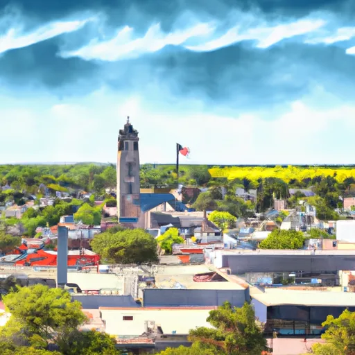
Stout, Iowa is a small town located in Grundy County, in the central part of the state. The climate in Stout is classified as a humid continental climate, with warm summers and cold winters. The average temperature ranges from 14°F (-10°C) in winter to 85°F (29°C) in summer. The area receives about 37 inches (94 cm) of precipitation per year, evenly distributed throughout the seasons.

When it comes to hydrology constituents, Stout is surrounded by fertile farmland and lies close to the Cedar River. The river not only provides a scenic backdrop for the town but also offers recreational opportunities such as fishing, boating, and canoeing. The river is home to various fish species, including catfish, walleye, and smallmouth bass, attracting anglers from the area.

Outdoor enthusiasts can also explore the nearby parks and nature reserves. Jensen Marsh State Game Management Area, located just a short drive from Stout, offers hiking trails and opportunities for birdwatching. George Wyth State Park, about 30 miles south of Stout, provides additional recreational activities such as camping, picnicking, and biking along its picturesque trails.

In summary, Stout, Iowa offers a pleasant climate, a close connection to the Cedar River, and opportunities for outdoor recreation, making it an attractive destination for nature lovers and outdoor enthusiasts.

What is the Eden Index?

The Snoflo Eden Index serves as a comprehensive rating system for regions, evaluating their desirability through a holistic assessment of climate health, outdoor recreation opportunities, and natural disaster risk, acknowledging the profound impact of these factors on livability and well-being.


Climate Health Indicator (CHI): 7.1


Stout receives approximately 905mm of rain per year, with humidity levels near 83% and air temperatures averaging around 9°C. Stout has a plant hardyness factor of 5, meaning plants and agriculture in this region thrive during a short period during spring and early summer. Most plants will die off during the colder winter months. By considering the ideal temperature range, reliable water supplies, clean air, and stable seasonal rain or snowpacks, the Climate Health Indicator (CHI) underscores the significance of a healthy climate as the foundation for quality living.

A healthy climate is paramount for ensuring a high quality of life and livability in a region, fostering both physical well-being and environmental harmony. This can be characterized by ideal temperatures, reliable access to water supplies, clean air, and consistent seasonal rain or snowpacks.


Weather Forecast


Streamflow Conditions

Iowa

Area Rivers

Iowa


Snowpack Depths

Iowa


Reservoir Storage Capacity

Iowa


Groundwater Levels


Recreational Opportunity Index (ROI): 4.0


The Recreational Opportunity Index (ROI) recognizes the value of outdoor recreational options, such as parks, hiking trails, camping sites, and fishing spots, while acknowledging that climate plays a pivotal role in ensuring the comfort and consistency of these experiences. Access to outdoor recreational opportunities, encompassing activities such as parks, hiking, camping, and fishing, is crucial for overall well-being, and the climate plays a pivotal role in enabling and enhancing these experiences, ensuring that individuals can engage in nature-based activities comfortably and consistently.


Camping Areas

Campground Campsites Reservations Toilets Showers Elevation
Quercus Wilderness Area 5 670 ft
Versailles City Park None 990 ft
Lake of the Ozarks State Park 183 773 ft
St. Croix - Governor Knowles State Forest 30 814 ft
Willow River - Gen Andrews State Forest 38 1,048 ft
Stoehr Fishing Area None 1,064 ft
Sandrock Cliffs - St. Croix National Scenic River None 891 ft
Thousand Hills State Park None 862 ft
Robertson Access None 758 ft
Lake Wapello State Park 80 803 ft
James N McNally City Campground 38 891 ft
Pilot Grove City Park None 845 ft
Cedar Creek Access None 704 ft
Moose Lake State Park 35 1,115 ft
Wolf Creek Rec Area 22 963 ft
Sunrise Ferry Landing - St. Croix National Scenic River None 789 ft
Long Branch State Park None 841 ft
Barnum City Park 12 1,089 ft
Union Mills Access None 762 ft
Miami Lake Park None 918 ft
Lake Keomah State Park 65 810 ft
Union Grove State Park 26 1,022 ft
William OBrien State Park 125 797 ft
Paint Rock Springs - St. Croix State Park 210 915 ft
Wild River State Park 100 934 ft
Afton State Park 25 970 ft
Riverview - St. Croix State Park 211 905 ft
Shell Rock Rec Area 40 899 ft
Lake Elmo County Park Preserve 80 908 ft
Norway Point Landing - St. Croix National Scenic River None 861 ft
Katy Roundhouse Campground None 601 ft
Old Railroad Bridge - St. Croix National Scenic River None 782 ft
Lake of the Ozarks Military None 768 ft
Hoffman City Park None 920 ft
County O Landing - St. Croix National Scenic River None 781 ft
North Cedar Park 40 935 ft
St. Croix Bluffs Regional Park 70 869 ft
Anderson - Berger Park None 1,143 ft
Thunder Woman Park 190 878 ft
Hatfield City Park 10 995 ft
Eveland Access 26 679 ft
Otter Creek Lake and Park 83 933 ft
Moose Lake City Park 82 1,053 ft
Willow River State Park 78 832 ft
Diamond Lake County Park 100 910 ft
Roadman Roadside Park None 956 ft
Veterans Campground - Big Marine Lake None 962 ft
Thomas Hill Reservoir - Hwy T Campground - MDC 10 753 ft
Glendale Access None 696 ft
Banning State Park 35 1,118 ft
Snake River - Chengwatana State Forest 28 828 ft
Rock Creek State Park 200 902 ft
Salisbury City Park None 714 ft
Stump Island Park 12 618 ft
Riverview Park - Marshalltown None 868 ft
Interstate State Park 85 977 ft
Nelsons Landing - St. Croix National Scenic River None 868 ft

Catastrophe Safeguard Index (CSI):


The Catastrophe Safeguard Index (CSI) recognizes that natural disaster risk, encompassing floods, fires, hurricanes, and tornadoes, can drastically affect safety and the overall appeal of an area. The level of natural disaster risk in a region significantly affects safety and the overall livability, with climate change amplifying these risks by potentially increasing the frequency and intensity of events like floods, fires, hurricanes, and tornadoes, thereby posing substantial challenges to community resilience and well-being.


Community Resilience Indicator (CRI):


The Community Resilience Indicator (CRI) recognizes that education, healthcare, and socioeconomics are crucial to the well-being of a region. The CRI acknowledges the profound impact of these elements on residents' overall quality of life. By evaluating educational resources, healthcare accessibility, and economic inclusivity, the index captures the essential aspects that contribute to a thriving community, fostering resident satisfaction, equity, and social cohesion.


Log Your Visit

When was your last visit to ?

Add a Photo

How was it? How were conditions?

Rate the


Submit

Leave A Review


Submit

Upload an Image


Favorite Limit Reached