Lake Leelanau Fishing
As of July 21, 2026, the nearest streamgauge to Lake Leelanau — Platte River At Honor — reports 166 cfs. Source: USGS gauge data, refreshed throughout the day.
Community Reviews
Been here? Share the conditions.
Reviews, ratings & photos are added in the free Snoflo iOS app — rate a spot, tag the conditions, and your visit is verified by location. Add or manage your reviews from the app.
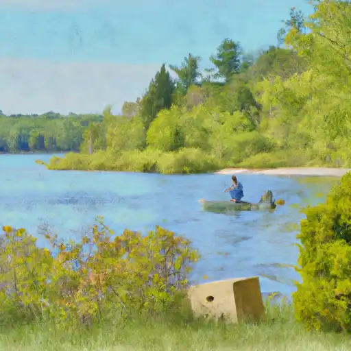
Lake Leelanau
What's biting at Lake Leelanau
Species commonly reported here -- tap any card for techniques, target seasons, and other waters where it's been caught.
Plan your trip down to the hour
Same weather feed Snoflo's iOS app uses -- updated continuously from NOAA / yr.no.
Next 5 days, hour by hour
Temperature line with weather symbols on top, snow + rain accumulation as columns, humidity as a dotted line.
5-day forecast table
Every 3 hours, broken out across temperature, snow, rain, humidity, and wind. Each cell is colour-coded relative to the column min/max so trends jump out at a glance.
| Time | Condition | Temp (°F) | Snow (in) | Rain (in) | Humidity (%) | Wind (mps) | Wind dir |
|---|---|---|---|---|---|---|---|
| Loading detailed forecast… | |||||||
15-day temperature & precipitation
Daily temperatures, snow, and rain projected over the next two weeks. Hover any point for the full breakdown.
Nearby streamflow
USGS streamgauges within reach of Lake Leelanau -- updated continuously from the National Water Information System.
| Streamgauge | Discharge | View |
|---|---|---|
| Platte River At Honor | 166 cfs | → |
| Boardman R Above Brown Bridge Road Nr Mayfield | 200 cfs | → |
| Manistee River Near Sherman | 1,210 cfs | → |
| Manistee River Near Mesick | 1,270 cfs | → |
| Jordan River Near East Jordan | 196 cfs | → |
| Manistee River Near Wellston | 2,030 cfs | → |
Plan a longer trip
The closest campgrounds, parks, boat launches, and reservoirs so a fishing run can grow into a weekend.
Campgrounds
- Garey Lake Trail Camp - State Forest
- Lake Ann State Forest Campground
- Traverse City State Park Campground
- Traverse City State Park
- Lake Dubonnet Trail Camp - State Forest
- Indigo Bluffs Rv Park
Parks
Reservoirs
Boat launches
- East Leelanau Pines Drive 6500, Centerville Township
- Lake Leelanau (East)
- County Road 651 N
- Lake Leelanau (West)
- Cedar Lake Boat Ramp Greilickville
- Greilickville Harbor
Points of interest
- The Cistern
- Perry Hannah House
- South Union Street–Boardman River Bridge
- American Legion Memorial Bridge
- East Philip Street
- World's Largest Cherry Pie - Pan
Paddle runs
- Southeastern Boundary Of Sleeping Bear Dunes National Lakeshore To Northwetern Boundary Of Sleeping Bear Dunes National Lakeshore
- Southern Boundary Of Sleeping Bear Dunes National Lakeshore To Mouth At Lake Michigan
- Kings Road Bridge (2 Miles West Of Town Of Luther In T19n, R12w To Slackwater Of The State Fish Weir In T21n, R16w
Angling safety & ethics
- Know the regulations
- Check local fishing rules, seasons, size limits, and license requirements to ensure legal and sustainable angling.
- Handle fish responsibly
- Use wet hands, minimize air exposure, and release fish gently to improve survival rates when practicing catch-and-release.
- Choose the right gear
- Match your rod, line, and tackle to the species and conditions to increase success and reduce unnecessary harm to fish.
- Respect the waterway
- Avoid disturbing habitat, prevent bank erosion, and keep a safe distance from spawning areas to protect ecosystems.
- Keep it clean
- Pack out all line, hooks, bait containers, and trash. Discarded gear can injure wildlife and degrade waterways.
Set push alerts in the Snoflo app
Save Lake Leelanau as a favorite, set a custom threshold (water temperature, streamflow, snowpack), and the iOS app will push the moment conditions cross.
About Lake Leelanau
What fish species are found at Lake Leelanau?
Snoflo tracks the species commonly reported at Lake Leelanau -- see the Fish Species panel above for the live list with images and links to per-species pages.
How fresh is the weather data on this page?
The hourly forecast updates throughout the day from the NOAA / yr.no public feeds. Streamflow data comes live from USGS streamgauges, also refreshed continuously.
Can I get alerts when conditions change?
Yes -- alerts are managed through the Snoflo iOS app. Favorite this area, set a threshold (water temperature, streamflow, snowpack), and you'll get a push the moment it crosses.
Do I need a fishing license?
Yes. Check your state agency's regulations for license requirements, seasons, size limits, and any waterbody-specific rules before fishing Lake Leelanau.
How do I get to Lake Leelanau?
Tap Open in map in the hero above to center the Snoflo interactive map on this area, or grab the coordinates from the location facts panel.
Other angling spots near here
Snoflo-tracked fishing areas within driving distance of Lake Leelanau.