Billy Lawrence Creek To North Property Boundary Of Ellison Ranch River Run
Community Reviews
Been here? Share the conditions.
Reviews, ratings & photos are added in the free Snoflo iOS app — rate a spot, tag the conditions, and your visit is verified by location. Add or manage your reviews from the app.
Billy Lawrence Creek To North Property Boundary Of Ellison Ranch
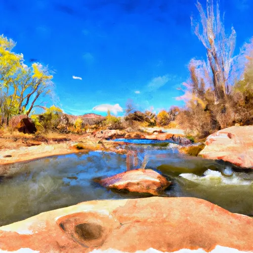
The Billy Lawrence Creek to North Property Boundary of Ellison Ranch stretch of the Whitewater River in Arizona is a Class II-III rapids run. The ideal streamflow range for this section of the river is between 200-500 cfs. This section of the river is approximately 9.3 miles long and includes rapids such as Pinball and Goggs. The run is located in the Apache-Sitgreaves National Forest and there are specific regulations in place to protect the area. These regulations include a permit requirement for all commercial outfitters, a limit on the number of daily launches, and a requirement for all boaters to pack out their trash. Additionally, the use of glass containers is prohibited in the area to reduce the risk of litter and injury. It is important for boaters to be aware of the potential dangers of the river, such as strainers and potential flash floods, and to properly prepare for their trip. Multiple sources, including American Whitewater and the National Wild and Scenic River System, verify this information.
Plan your run down to the hour
Same weather feed Snoflo's iOS app uses -- updated continuously from NOAA / yr.no. Watch the precipitation column on the meteogram; rain ahead of a run typically lifts flows 12-48 hours later depending on the basin.
Next 5 days, hour by hour
Temperature line with weather symbols on top, snow + rain accumulation as columns, humidity as a dotted line.
5-day forecast table
Every 3 hours, broken out across temperature, snow, rain, humidity, and wind. Each cell is colour-coded relative to the column min/max.
| Time | Condition | Temp (°F) | Snow (in) | Rain (in) | Humidity (%) | Wind (mps) | Wind dir |
|---|---|---|---|---|---|---|---|
| Loading detailed forecast… | |||||||
15-day temperature & precipitation
Daily temperatures, snow, and rain projected over the next two weeks -- the upstream story that drives next week's flows.
Regional streamflow levels
USGS streamgauges around Billy Lawrence Creek To North Property Boundary Of Ellison Ranch -- useful for spotting upstream pulses and gauging which tributary is contributing what.
| Streamgauge | Discharge | View |
|---|---|---|
| Cherry Creek Near Globe | 4 cfs | → |
| South Fork Parker Creek Near Roosevelt | 0 cfs | → |
| Salt River Near Roosevelt | 415 cfs | → |
| Cibecue Creek Near Chysotile | 32 cfs | → |
| Pinal Creek At Inspiration Dam | 0 cfs | → |
| Salt River Near Chrysotile | 131 cfs | → |
Plan a longer trip
The closest boat launches, other paddle runs, and campgrounds so a day on the water can grow into a full weekend.
Boat launches
Other river runs
- Workman Falls To Salome Wilderness Boundary
- Rock Springs To Confluence With Cottonwood Wash
- Salome Wilderness Boundary To Confluence With Salome Creek
- Confluence With Turkey Creek To Forest Road 60 Just Above Tin Hat Ranch
- Forest Road 329 To Billy Lawrence Creek
Campgrounds
- Workman Creek Falls
- Falls
- Reynolds Creek Campground
- Reynolds Creek Group Campground
- Sawmill Flats
- Rose Creek
Whitewater safety
- Check the flow before you run
- Use the linked-gauge card and Regional Flow panel above. Class ratings change with flow -- a Class III at low water can become Class IV+ at high water.
- Know your skill ceiling
- Pick runs comfortably below your ceiling. Cold-water and big-water runs raise the consequences of any mistake.
- Wear the right gear
- Helmet, PFD, drysuit / wetsuit when water is below 60°F. Throw bag, knife, and whistle on your person, not in the boat.
- Scout, set safety, and run with a team
- Scout new rapids on foot, set safety with throw bags above the consequence pool, and run with at least one other competent paddler.
- Respect the river
- Strainers, undercuts, low-head dams, and wood can kill at any class rating. When in doubt, portage.
Set push alerts in the Snoflo app
Save Billy Lawrence Creek To North Property Boundary Of Ellison Ranch as a favorite, set a discharge threshold (e.g. "alert me when flow hits 600 cfs"), and the iOS app pushes the moment the linked gauge crosses.
About Billy Lawrence Creek To North Property Boundary Of Ellison Ranch
What's the optimal flow for Billy Lawrence Creek To North Property Boundary Of Ellison Ranch?
The optimal flow depends on the section and the craft. Check the Run Details panel for the linked gauge and current status.
How fresh is the cfs reading on this page?
The linked USGS streamgauge reports continuously (every 15 minutes); Snoflo refreshes throughout the day. Hover the streamflow sparkline to read individual datapoints.
What's the whitewater class?
See the Run Details panel for the class rating Snoflo tracks for this run. Class ratings change with flow -- a Class III at low water can become Class IV in high water.
Where do I put in / take out?
Tap Directions in the hero above to open driving directions to the put-in. For shuttle planning, check the Nearby Boat Launches panel and the river run operator's site.
Can I get alerts when flows hit the optimal range?
Yes -- alerts are managed in the Snoflo iOS app. Favorite this run, set a discharge threshold, and you'll get a push the moment the gauge crosses.
Other runs near here
Snoflo-tracked paddle runs within driving distance of Billy Lawrence Creek To North Property Boundary Of Ellison Ranch.