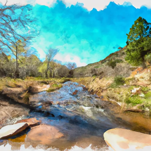
Prescott National Forest Boundary To North Edge Of Private Land In Sec 33, T17n, R3e, Near Clarkdale River Run
Community Reviews
Been here? Share the conditions.
Reviews, ratings & photos are added in the free Snoflo iOS app — rate a spot, tag the conditions, and your visit is verified by location. Add or manage your reviews from the app.
Prescott National Forest Boundary To North Edge Of Private Land In Sec 33, T17n, R3e, Near Clarkdale
Specific rapids and obstacles on this section of the river include House Rock, which is a large boulder in the middle of the river that creates a challenging eddy line, and Tuzigoot Falls, which is a Class IV rapid. Paddlers should also be aware of strainers, which are large debris and vegetation that can trap and capsize boats.
Specific regulations to the area include a permit requirement for commercial outfitters and a limit of 15 people per group for private parties. Paddlers are also required to pack out all trash and abide by Leave No Trace principles. It is important to note that this section of the river can be dangerous and should only be attempted by experienced paddlers with proper safety equipment and training.
Plan your run down to the hour
Same weather feed Snoflo's iOS app uses -- updated continuously from NOAA / yr.no. Watch the precipitation column on the meteogram; rain ahead of a run typically lifts flows 12-48 hours later depending on the basin.
Next 5 days, hour by hour
Temperature line with weather symbols on top, snow + rain accumulation as columns, humidity as a dotted line.
5-day forecast table
Every 3 hours, broken out across temperature, snow, rain, humidity, and wind. Each cell is colour-coded relative to the column min/max.
| Time | Condition | Temp (°F) | Snow (in) | Rain (in) | Humidity (%) | Wind (mps) | Wind dir |
|---|---|---|---|---|---|---|---|
| Loading detailed forecast… | |||||||
15-day temperature & precipitation
Daily temperatures, snow, and rain projected over the next two weeks -- the upstream story that drives next week's flows.
Regional streamflow levels
USGS streamgauges around Prescott National Forest Boundary To North Edge Of Private Land In Sec 33, T17n, R3e, Near Clarkdale -- useful for spotting upstream pulses and gauging which tributary is contributing what.
| Streamgauge | Discharge | View |
|---|---|---|
| Verde River Near Camp Verde | 386 cfs | → |
| West Clear Creek Near Camp Verde | 22 cfs | → |
| Wet Beaver Creek Near Rimrock | 8 cfs | → |
| East Verde River Near Childs | 1 cfs | → |
| Dry Beaver Creek Near Rimrock | · | → |
| Agua Fria River Near Mayer | 9 cfs | → |
Plan a longer trip
The closest boat launches, other paddle runs, and campgrounds so a day on the water can grow into a full weekend.
Boat launches
Other river runs
- White Bridge To Beasley Flat
- Clear Creek Wilderness Boundary To Dispersed Camping Area At Clear Creek Campground
- Sycamore Creek
- Wet Beaver Creek Wilderness Boundary To Private Land In Sec 32, T15n, R6e
- Indian Creek
Campgrounds
- Clear Creek Rv Park
- Clear Creek And Clear Creek Group Campgrounds
- Clear Creek National Forest Campground
- Bull Pen Dispersed Campground
- Distant Drums Rv Resort
- Childs
Fishing spots
- West Clear Creek
- Sheeps Crossing Fishing Site
- Bignotti Picnic Site
- Black Canyon Fishing Site
- Prairie Lane Fishing Site
- Skidmore Day Use Fishing Site
Whitewater safety
- Check the flow before you run
- Use the linked-gauge card and Regional Flow panel above. Class ratings change with flow -- a Class III at low water can become Class IV+ at high water.
- Know your skill ceiling
- Pick runs comfortably below your ceiling. Cold-water and big-water runs raise the consequences of any mistake.
- Wear the right gear
- Helmet, PFD, drysuit / wetsuit when water is below 60°F. Throw bag, knife, and whistle on your person, not in the boat.
- Scout, set safety, and run with a team
- Scout new rapids on foot, set safety with throw bags above the consequence pool, and run with at least one other competent paddler.
- Respect the river
- Strainers, undercuts, low-head dams, and wood can kill at any class rating. When in doubt, portage.
Set push alerts in the Snoflo app
Save Prescott National Forest Boundary To North Edge Of Private Land In Sec 33, T17n, R3e, Near Clarkdale as a favorite, set a discharge threshold (e.g. "alert me when flow hits 600 cfs"), and the iOS app pushes the moment the linked gauge crosses.
About Prescott National Forest Boundary To North Edge Of Private Land In Sec 33, T17n, R3e, Near Clarkdale
What's the optimal flow for Prescott National Forest Boundary To North Edge Of Private Land In Sec 33, T17n, R3e, Near Clarkdale?
The optimal flow depends on the section and the craft. Check the Run Details panel for the linked gauge and current status.
How fresh is the cfs reading on this page?
The linked USGS streamgauge reports continuously (every 15 minutes); Snoflo refreshes throughout the day. Hover the streamflow sparkline to read individual datapoints.
What's the whitewater class?
See the Run Details panel for the class rating Snoflo tracks for this run. Class ratings change with flow -- a Class III at low water can become Class IV in high water.
Where do I put in / take out?
Tap Directions in the hero above to open driving directions to the put-in. For shuttle planning, check the Nearby Boat Launches panel and the river run operator's site.
Can I get alerts when flows hit the optimal range?
Yes -- alerts are managed in the Snoflo iOS app. Favorite this run, set a discharge threshold, and you'll get a push the moment the gauge crosses.
Other runs near here
Snoflo-tracked paddle runs within driving distance of Prescott National Forest Boundary To North Edge Of Private Land In Sec 33, T17n, R3e, Near Clarkdale.