Cienega Creek River Run
Community Reviews
Been here? Share the conditions.
Reviews, ratings & photos are added in the free Snoflo iOS app — rate a spot, tag the conditions, and your visit is verified by location. Add or manage your reviews from the app.
Cienega Creek
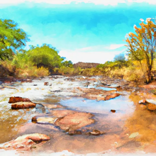
The segment mileage for the Cienega Creek river run is approximately 7.5 miles, starting from the Cienega Creek Natural Preserve and ending at the Douglas Spring Trailhead. The river rapids and obstacles in this stretch include numerous boulder gardens, drops, and ledges that require technical maneuvering and strong paddling skills. The most notable rapids include S-Turn, The Maze, and The Ledge.
To ensure the safety of paddlers and preserve the natural environment, the Cienega Creek river run is subject to specific regulations. These include restrictions on group size, mandatory use of personal floatation devices, and no camping or fires along the riverbanks.
In conclusion, the Cienega Creek whitewater river run offers a challenging and exciting adventure for intermediate and advanced paddlers. It is important for paddlers to check the streamflow conditions and abide by the regulations to ensure a safe and enjoyable experience.
Plan your run down to the hour
Same weather feed Snoflo's iOS app uses -- updated continuously from NOAA / yr.no. Watch the precipitation column on the meteogram; rain ahead of a run typically lifts flows 12-48 hours later depending on the basin.
Next 5 days, hour by hour
Temperature line with weather symbols on top, snow + rain accumulation as columns, humidity as a dotted line.
5-day forecast table
Every 3 hours, broken out across temperature, snow, rain, humidity, and wind. Each cell is colour-coded relative to the column min/max.
| Time | Condition | Temp (°F) | Snow (in) | Rain (in) | Humidity (%) | Wind (mps) | Wind dir |
|---|---|---|---|---|---|---|---|
| Loading detailed forecast… | |||||||
15-day temperature & precipitation
Daily temperatures, snow, and rain projected over the next two weeks -- the upstream story that drives next week's flows.
Regional streamflow levels
USGS streamgauges around Cienega Creek -- useful for spotting upstream pulses and gauging which tributary is contributing what.
| Streamgauge | Discharge | View |
|---|---|---|
| Cienga Creek Near Sonoita | 0 cfs | → |
| Upper Babocomari River Near Huachuca City | · | → |
| Pantano Wash Near Vail | 1 cfs | → |
| Huachuca Canyon Near Fort Huachuca | · | → |
| Babocomari River Near Tombstone | · | → |
| San Pedro River Near Tombstone | 86 cfs | → |
Plan a longer trip
The closest boat launches, other paddle runs, and campgrounds so a day on the water can grow into a full weekend.
Other river runs
- Babocomari River
- San Pedro River
- Wilderness Boundary To Coronado National Forest Boundary
- Marshall Gulch Recreation Area To Wilderness Boundary
- Ruby Road (Forest Road 39) To Us/Mexico Border
Campgrounds
- Cieneguita Blm
- Las Cienegas Dispersed
- Road Canyon Camp Area
- Cieneguita Camp Area
- Airstrip Group Site
- Oak Tree Canyon Camp Area
Whitewater safety
- Check the flow before you run
- Use the linked-gauge card and Regional Flow panel above. Class ratings change with flow -- a Class III at low water can become Class IV+ at high water.
- Know your skill ceiling
- Pick runs comfortably below your ceiling. Cold-water and big-water runs raise the consequences of any mistake.
- Wear the right gear
- Helmet, PFD, drysuit / wetsuit when water is below 60°F. Throw bag, knife, and whistle on your person, not in the boat.
- Scout, set safety, and run with a team
- Scout new rapids on foot, set safety with throw bags above the consequence pool, and run with at least one other competent paddler.
- Respect the river
- Strainers, undercuts, low-head dams, and wood can kill at any class rating. When in doubt, portage.
Set push alerts in the Snoflo app
Save Cienega Creek as a favorite, set a discharge threshold (e.g. "alert me when flow hits 600 cfs"), and the iOS app pushes the moment the linked gauge crosses.
About Cienega Creek
What's the optimal flow for Cienega Creek?
The optimal flow depends on the section and the craft. Check the Run Details panel for the linked gauge and current status.
How fresh is the cfs reading on this page?
The linked USGS streamgauge reports continuously (every 15 minutes); Snoflo refreshes throughout the day. Hover the streamflow sparkline to read individual datapoints.
What's the whitewater class?
See the Run Details panel for the class rating Snoflo tracks for this run. Class ratings change with flow -- a Class III at low water can become Class IV in high water.
Where do I put in / take out?
Tap Directions in the hero above to open driving directions to the put-in. For shuttle planning, check the Nearby Boat Launches panel and the river run operator's site.
Can I get alerts when flows hit the optimal range?
Yes -- alerts are managed in the Snoflo iOS app. Favorite this run, set a discharge threshold, and you'll get a push the moment the gauge crosses.
Other runs near here
Snoflo-tracked paddle runs within driving distance of Cienega Creek.