Rock Creek Dam To Cresta Reservoir River Run
Community Reviews
Been here? Share the conditions.
Reviews, ratings & photos are added in the free Snoflo iOS app — rate a spot, tag the conditions, and your visit is verified by location. Add or manage your reviews from the app.
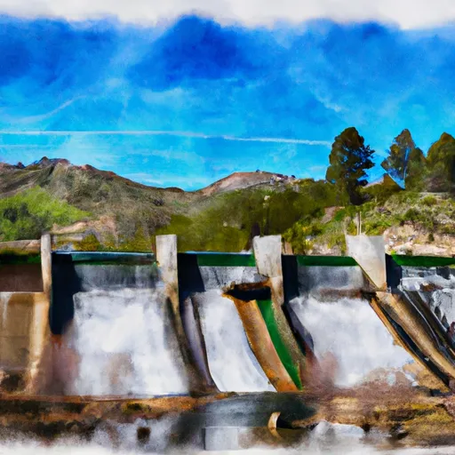
Rock Creek Dam To Cresta Reservoir
The segment mileage is approximately 8.5 miles, which takes approximately 4-5 hours to complete. There are several specific river rapids and obstacles throughout the segment, including the Meatgrinder, the Chute, and the Pipeline. The Meatgrinder is a challenging rapid with a technical entrance, while the Chute is a narrow channel with a steep drop. The Pipeline is a series of small drops and waves that require precise maneuvering.
Some specific regulations to the area include the requirement of a permit to access the river, which can be obtained through the Plumas National Forest website. Additionally, all rafters must wear a personal flotation device (PFD) and helmets are highly recommended. The use of alcohol or drugs is strictly prohibited on the river, and rafters are responsible for leaving no trace and preserving the natural beauty of the area.
Plan your run down to the hour
Same weather feed Snoflo's iOS app uses -- updated continuously from NOAA / yr.no. Watch the precipitation column on the meteogram; rain ahead of a run typically lifts flows 12-48 hours later depending on the basin.
Next 5 days, hour by hour
Temperature line with weather symbols on top, snow + rain accumulation as columns, humidity as a dotted line.
5-day forecast table
Every 3 hours, broken out across temperature, snow, rain, humidity, and wind. Each cell is colour-coded relative to the column min/max.
| Time | Condition | Temp (°F) | Snow (in) | Rain (in) | Humidity (%) | Wind (mps) | Wind dir |
|---|---|---|---|---|---|---|---|
| Loading detailed forecast… | |||||||
15-day temperature & precipitation
Daily temperatures, snow, and rain projected over the next two weeks -- the upstream story that drives next week's flows.
Regional streamflow levels
USGS streamgauges around Rock Creek Dam To Cresta Reservoir -- useful for spotting upstream pulses and gauging which tributary is contributing what.
| Streamgauge | Discharge | View |
|---|---|---|
| Butte C Nr Chico Ca | 161 cfs | → |
| Spanish C A Quincy Ca | 16 cfs | → |
| Spanish C Ab Blackhawk C At Keddie Ca | 37 cfs | → |
| Deer C Nr Vina Ca | 101 cfs | → |
| N Yuba R Bl Goodyears Bar Ca | 170 cfs | → |
| Mill C Nr Los Molinos Ca | 140 cfs | → |
Plan a longer trip
The closest boat launches, other paddle runs, and campgrounds so a day on the water can grow into a full weekend.
Boat launches
- Plumas County
- Haskins Valley P.G. & E. Campground
- Oroville-Quincy Road 17000-17046, Meadow Valley
- Bucks Lake Marina
- Bucks Lakeshore Resort
- Lake Oroville State Recreation Area - Lime Saddle
Other river runs
- Cresta Dam To Poe Reservoir (Camp Creek)
- Poe Dam To Highway 70 Crossing
- Headwaters To Bucks Lake
- Nf Boundary To Confluence With North Fork Feather River
- Headwaters To Bear Gulch
Campgrounds
- Rogers Cow Camp (Family )
- Rogers Cow Camp
- Lower Bucks
- Lower Bucks Campground
- Little North Fork
- Grizzly Creek Campground
Fishing spots
Whitewater safety
- Check the flow before you run
- Use the linked-gauge card and Regional Flow panel above. Class ratings change with flow -- a Class III at low water can become Class IV+ at high water.
- Know your skill ceiling
- Pick runs comfortably below your ceiling. Cold-water and big-water runs raise the consequences of any mistake.
- Wear the right gear
- Helmet, PFD, drysuit / wetsuit when water is below 60°F. Throw bag, knife, and whistle on your person, not in the boat.
- Scout, set safety, and run with a team
- Scout new rapids on foot, set safety with throw bags above the consequence pool, and run with at least one other competent paddler.
- Respect the river
- Strainers, undercuts, low-head dams, and wood can kill at any class rating. When in doubt, portage.
Set push alerts in the Snoflo app
Save Rock Creek Dam To Cresta Reservoir as a favorite, set a discharge threshold (e.g. "alert me when flow hits 600 cfs"), and the iOS app pushes the moment the linked gauge crosses.
About Rock Creek Dam To Cresta Reservoir
What's the optimal flow for Rock Creek Dam To Cresta Reservoir?
The optimal flow depends on the section and the craft. Check the Run Details panel for the linked gauge and current status.
How fresh is the cfs reading on this page?
The linked USGS streamgauge reports continuously (every 15 minutes); Snoflo refreshes throughout the day. Hover the streamflow sparkline to read individual datapoints.
What's the whitewater class?
See the Run Details panel for the class rating Snoflo tracks for this run. Class ratings change with flow -- a Class III at low water can become Class IV in high water.
Where do I put in / take out?
Tap Directions in the hero above to open driving directions to the put-in. For shuttle planning, check the Nearby Boat Launches panel and the river run operator's site.
Can I get alerts when flows hit the optimal range?
Yes -- alerts are managed in the Snoflo iOS app. Favorite this run, set a discharge threshold, and you'll get a push the moment the gauge crosses.
Other runs near here
Snoflo-tracked paddle runs within driving distance of Rock Creek Dam To Cresta Reservoir.