Big Bear Dam To Private Land In Sec 19, T1n, R1w River Run
Community Reviews
Been here? Share the conditions.
Reviews, ratings & photos are added in the free Snoflo iOS app — rate a spot, tag the conditions, and your visit is verified by location. Add or manage your reviews from the app.
Big Bear Dam To Private Land In Sec 19, T1n, R1w
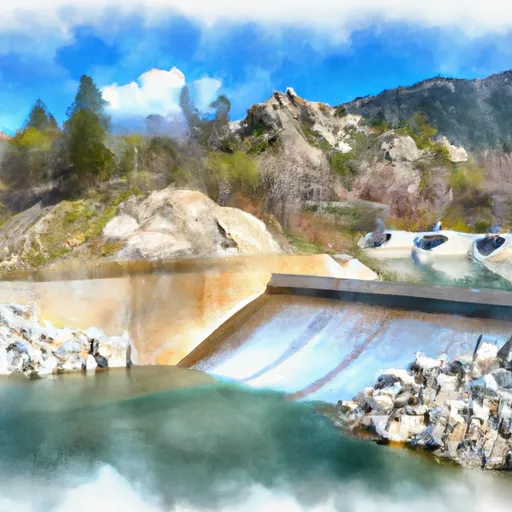
Some of the specific rapids/obstacles include "Upper Hot Springs," "Lower Hot Springs," and "Staircase." These rapids feature steep drops, tight turns, and technical maneuvers that can challenge even experienced paddlers.
There are specific regulations to the area that rafters must adhere to. For instance, all rafters must wear a properly fitting lifejacket and helmet while on the river. Alcoholic beverages are also prohibited during the trip. Additionally, all rafting companies must hold a valid permit to operate on the river.
In conclusion, the Whitewater River run from Big Bear Dam to Private Land in Sec 19, T1N, R1W in California is a thrilling adventure for experienced whitewater rafters. With ideal streamflow, a segment mileage of 12 miles, and Class III-IV rapids featuring specific challenges, rafters must adhere to specific regulations to ensure a safe and enjoyable experience.
Plan your run down to the hour
Same weather feed Snoflo's iOS app uses -- updated continuously from NOAA / yr.no. Watch the precipitation column on the meteogram; rain ahead of a run typically lifts flows 12-48 hours later depending on the basin.
Next 5 days, hour by hour
Temperature line with weather symbols on top, snow + rain accumulation as columns, humidity as a dotted line.
5-day forecast table
Every 3 hours, broken out across temperature, snow, rain, humidity, and wind. Each cell is colour-coded relative to the column min/max.
| Time | Condition | Temp (°F) | Snow (in) | Rain (in) | Humidity (%) | Wind (mps) | Wind dir |
|---|---|---|---|---|---|---|---|
| Loading detailed forecast… | |||||||
15-day temperature & precipitation
Daily temperatures, snow, and rain projected over the next two weeks -- the upstream story that drives next week's flows.
Regional streamflow levels
USGS streamgauges around Big Bear Dam To Private Land In Sec 19, T1n, R1w -- useful for spotting upstream pulses and gauging which tributary is contributing what.
| Streamgauge | Discharge | View |
|---|---|---|
| Sar Supp Gage Nr Mentone Ca | 23 cfs | → |
| Santa Ana R Nr Mentone (River Only) Ca | 37 cfs | → |
| Plunge C Nr East Highlands Ca | 2 cfs | → |
| City C Nr Highland Ca | 0 cfs | → |
| Sand Canyon C Nr Highland Ca | 1 cfs | → |
| E Twin C Nr Arrowhead Springs Ca | 0 cfs | → |
Plan a longer trip
The closest boat launches, other paddle runs, and campgrounds so a day on the water can grow into a full weekend.
Boat launches
- Pleasure Point Landing
- Holloway's Marina, Inc.
- Duane Boyer (West)
- Big Bear Marina
- Pine Knot Landing
- Carol Morrison (East)
Other river runs
- Filaree Flat To Confluence With Bear Creek
- Big Meadows To Filaree Flat
- Bluff Lake To Confluence With Bear Creek
- Below Deep Creek Lake To Below 2w01 Crossing
- Nfsr 3n16 To Confluence With Deep Creek
Campgrounds
- Siberia Creek Trail Camp
- Keller Peak Yellow Post #9
- Shady Cove Group Campground
- Yellow Post #28
- Keller Peak Yellow Post #8
- Yellow Post #29
Fishing spots
Whitewater safety
- Check the flow before you run
- Use the linked-gauge card and Regional Flow panel above. Class ratings change with flow -- a Class III at low water can become Class IV+ at high water.
- Know your skill ceiling
- Pick runs comfortably below your ceiling. Cold-water and big-water runs raise the consequences of any mistake.
- Wear the right gear
- Helmet, PFD, drysuit / wetsuit when water is below 60°F. Throw bag, knife, and whistle on your person, not in the boat.
- Scout, set safety, and run with a team
- Scout new rapids on foot, set safety with throw bags above the consequence pool, and run with at least one other competent paddler.
- Respect the river
- Strainers, undercuts, low-head dams, and wood can kill at any class rating. When in doubt, portage.
Set push alerts in the Snoflo app
Save Big Bear Dam To Private Land In Sec 19, T1n, R1w as a favorite, set a discharge threshold (e.g. "alert me when flow hits 600 cfs"), and the iOS app pushes the moment the linked gauge crosses.
About Big Bear Dam To Private Land In Sec 19, T1n, R1w
What's the optimal flow for Big Bear Dam To Private Land In Sec 19, T1n, R1w?
The optimal flow depends on the section and the craft. Check the Run Details panel for the linked gauge and current status.
How fresh is the cfs reading on this page?
The linked USGS streamgauge reports continuously (every 15 minutes); Snoflo refreshes throughout the day. Hover the streamflow sparkline to read individual datapoints.
What's the whitewater class?
See the Run Details panel for the class rating Snoflo tracks for this run. Class ratings change with flow -- a Class III at low water can become Class IV in high water.
Where do I put in / take out?
Tap Directions in the hero above to open driving directions to the put-in. For shuttle planning, check the Nearby Boat Launches panel and the river run operator's site.
Can I get alerts when flows hit the optimal range?
Yes -- alerts are managed in the Snoflo iOS app. Favorite this run, set a discharge threshold, and you'll get a push the moment the gauge crosses.
Other runs near here
Snoflo-tracked paddle runs within driving distance of Big Bear Dam To Private Land In Sec 19, T1n, R1w.