Chili Bar
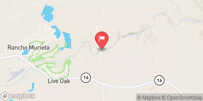
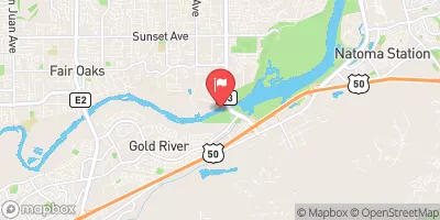
Class III-IV- run on the S. Fork American River. This is a very fun intermediate run that sees a lot of use. Chili Bar and the Gorge farther downstream could be the most popular river run in America thanks to a healthy commercial outfitter community and highly populated areas close by (Sacramento). Despite being in California this area still has a nice, remote, rural feel to it. The water runs all year long thanks to dam controlled releases but you want to catch the release bubbles for the best run. The water is typically clear and not too cold (especially in the hot summer time heat of CA). Join the other thousands and thousands that have boated this area and give it a try. For kayakers this is a good run to get some surfing in and for rafters this is just a good run without a lot of consequences.
Suggested river levels for paddling this section of the American River, South Fork are between a bare minimum of 800cfs and a high of 4,000cfs.
River conditions sourced from USGS 11427000, the Nf American R A North Fork Dam Ca
Remember only watercraft are permitted
at Chili Bar.
Run Stats
Status | Too Low |
Class Level | III to IV |
Elevation | 717 ft |
Run Length | 8.0 Mi |
Gradient | 26 FPM |
Streamflow Discharge | 718 cfs |
Gage Height | 1.3 ft |
Air Temperature | 78° |
River | American River, South Fork |
Reporting Streamgage |
Nf American R A North Fork Dam Ca
USGS 11427000 |
Chili Bar Hole
Class III- to III |
Meatgrinder (Quarter Mile) Rapid
Class III to III+ |
Racehorse Bend (Sluice Box) Rapid
Class III- to III+ |
Maya (Traffic Light) Rapid
Class II+ to III |
Rock Garden Rapid
Class II to II+ |
African Queen Rapid
Class III to IV |
First Threat Rapid
Class III to III+ |
Second Threat Rapid
Class II to II+ |
Third Threat Rapid
Class II to III |
Unnamed Rapid
Class II to II+ |
Mini Gorge Rapid
Class II to II+ |
Troublemaker (S-Turn) Rapid
Class III to IV |
Old Scary Rapid
Class II |
Gauge | Streamflow | Stage |
---|---|---|
American R A Fair Oaks Ca
USGS 11446500 |
2,030 cfs | 7.7 ft |
Bear R Nr Wheatland Ca
USGS 11424000 |
26 cfs | 0.0 ft |
Deer C Nr Cameron Park Ca
USGS 11335655 |
8 cfs | 3.6 ft |
Pilot C Ab Stumpy Meadows Res Ca
USGS 11431800 |
3 cfs | 4.1 ft |
Sagehen C Nr Truckee Ca
USGS 10343500 |
10 cfs | 1.9 ft |
Hutchinson C Bl Doolittle Dr Nr Marysville Ca
USGS 11424550 |
5 cfs | 0.0 ft |
Donner C A Donner Lk Nr Truckee Ca
USGS 10338500 |
3 cfs | 2.9 ft |
Cosumnes R A Michigan Bar Ca
USGS 11335000 |
237 cfs | 3.6 ft |
Unnamed Trib Bl Gavin Mandry Dr Nr Marysville Ca
USGS 11424546 |
8 cfs | 0.0 ft |
Donner C At Hwy 89 Nr Truckee Ca
USGS 10338700 |
48 cfs | 3.2 ft |
Snotel Site | Snowpack | 24hr Change |
---|---|---|
black springs
SNOTEL BLSC1 |
46.1" | -0.82" |
Independence Lake
SNOTEL 541 |
59" | -1" |
alpine meadows-base
SNOTEL AMBC1 |
50.61" | -1.69" |
Ward Creek #3
SNOTEL 848 |
43" | -3" |
Css Lab
SNOTEL 428 |
34" | -2" |
Squaw Valley G.C.
SNOTEL 784 |
40" | -2" |
blue canyon alert
SNOTEL BLUC1 |
0.03" | -2.8" |
Independence Camp
SNOTEL 539 |
12" | -3" |
soda springs 1.5 ssw, ca
SNOTEL CA-PC-1 |
29.26" | -1.72" |
alpha
SNOTEL ALPHA_MADIS |
162.2" | 0" |
Independence Creek
SNOTEL 540 |
3" | -3" |
Campground | Campsites | Reservations | Toilets | Showers | Elevation |
---|---|---|---|---|---|
Rucky A Chucky - Auburn State Rec Area | 5 | 723 ft | |||
Dru Barner | 47 | 3,237 ft | |||
Finnon Lake | 14 | 2,427 ft |
Ski Area | Snowpack | Air Temperature | 5 Day Forecast |
---|
River Run | Streamflow | Length | Class |
---|---|---|---|
Coloma to Greenwood - (C to G) | 718.0cfs | 5.0 Mi | II to III- |
Greenwood to Mammoth Bar | 718.0cfs | 7.0 Mi | II to II+ |
Generation and Giant Gaps (Tadpole to Colfax-Iowa Hill Road) | 718.0cfs | 26.8 Mi | IV to IV+ |
Yankee Jim Road to Ponderosa Way (Shirttail) | 718.0cfs | 5.0 Mi | II to III |
Tunnel Run (Ralston Powerhouse to Greenwood) | 718.0cfs | 16.5 Mi | IV- to IV |
Chili Bar | 718.0cfs | 8.0 Mi | III to IV |