Headwaters To Flat Tops Wilderness Boundary River Run
Community Reviews
Been here? Share the conditions.
Reviews, ratings & photos are added in the free Snoflo iOS app — rate a spot, tag the conditions, and your visit is verified by location. Add or manage your reviews from the app.
Headwaters To Flat Tops Wilderness Boundary
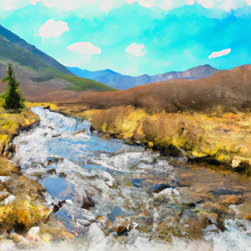
There are several notable rapids and obstacles to contend with along the way, including Cross Mountain, Devil's Slide, and Funnel Falls. These rapids are known for their technical challenges and high adrenaline rushes. It is important to note that the Whitewater River Run is located within the White River National Forest, and there are specific regulations in place to protect the natural environment. These regulations include restrictions on camping and fires, as well as guidelines for proper waste disposal and wildlife preservation.
In summary, the Whitewater River Run is an exciting and challenging destination for experienced kayakers and rafters in Colorado. With ideal streamflow ranges between 500-1,500 cfs, Class III/IV ratings, and roughly 10 miles of paddling, this run offers plenty of thrills and adventure. However, it is important to adhere to the specific regulations in place to protect the natural environment and preserve this beautiful wilderness area for future generations.
Plan your run down to the hour
Same weather feed Snoflo's iOS app uses -- updated continuously from NOAA / yr.no. Watch the precipitation column on the meteogram; rain ahead of a run typically lifts flows 12-48 hours later depending on the basin.
Next 5 days, hour by hour
Temperature line with weather symbols on top, snow + rain accumulation as columns, humidity as a dotted line.
5-day forecast table
Every 3 hours, broken out across temperature, snow, rain, humidity, and wind. Each cell is colour-coded relative to the column min/max.
| Time | Condition | Temp (°F) | Snow (in) | Rain (in) | Humidity (%) | Wind (mps) | Wind dir |
|---|---|---|---|---|---|---|---|
| Loading detailed forecast… | |||||||
15-day temperature & precipitation
Daily temperatures, snow, and rain projected over the next two weeks -- the upstream story that drives next week's flows.
Regional streamflow levels
USGS streamgauges around Headwaters To Flat Tops Wilderness Boundary -- useful for spotting upstream pulses and gauging which tributary is contributing what.
| Streamgauge | Discharge | View |
|---|---|---|
| White River Below North Elk Creek Near Buford | 224 cfs | → |
| White River Above Coal Creek | 107 cfs | → |
| Colorado River Below Glenwood Springs | 1,730 cfs | → |
| White River Near Meeker | 119 cfs | → |
| Roaring Fork River At Glenwood Springs | 454 cfs | → |
| Colorado River Near Dotsero | 1,220 cfs | → |
Plan a longer trip
The closest boat launches, other paddle runs, and campgrounds so a day on the water can grow into a full weekend.
Other river runs
- Flat Tops Wilderness Boundary To Nf Boundary
- Headwaters At Deep Lake Outlet To 1/4 Mile Downstream
- South Canyon To Riverbend (Tibbet's)
Campgrounds
- South Fork Campground & Trailhead
- Meadow Lake Campground
- Meadow Lake
- Meadow Ridge Campground
- Marvine
- Marvine Campground
Whitewater safety
- Check the flow before you run
- Use the linked-gauge card and Regional Flow panel above. Class ratings change with flow -- a Class III at low water can become Class IV+ at high water.
- Know your skill ceiling
- Pick runs comfortably below your ceiling. Cold-water and big-water runs raise the consequences of any mistake.
- Wear the right gear
- Helmet, PFD, drysuit / wetsuit when water is below 60°F. Throw bag, knife, and whistle on your person, not in the boat.
- Scout, set safety, and run with a team
- Scout new rapids on foot, set safety with throw bags above the consequence pool, and run with at least one other competent paddler.
- Respect the river
- Strainers, undercuts, low-head dams, and wood can kill at any class rating. When in doubt, portage.
Set push alerts in the Snoflo app
Save Headwaters To Flat Tops Wilderness Boundary as a favorite, set a discharge threshold (e.g. "alert me when flow hits 600 cfs"), and the iOS app pushes the moment the linked gauge crosses.
About Headwaters To Flat Tops Wilderness Boundary
What's the optimal flow for Headwaters To Flat Tops Wilderness Boundary?
The optimal flow depends on the section and the craft. Check the Run Details panel for the linked gauge and current status.
How fresh is the cfs reading on this page?
The linked USGS streamgauge reports continuously (every 15 minutes); Snoflo refreshes throughout the day. Hover the streamflow sparkline to read individual datapoints.
What's the whitewater class?
See the Run Details panel for the class rating Snoflo tracks for this run. Class ratings change with flow -- a Class III at low water can become Class IV in high water.
Where do I put in / take out?
Tap Directions in the hero above to open driving directions to the put-in. For shuttle planning, check the Nearby Boat Launches panel and the river run operator's site.
Can I get alerts when flows hit the optimal range?
Yes -- alerts are managed in the Snoflo iOS app. Favorite this run, set a discharge threshold, and you'll get a push the moment the gauge crosses.
Other runs near here
Snoflo-tracked paddle runs within driving distance of Headwaters To Flat Tops Wilderness Boundary.