San Juan River River Run
Community Reviews
Been here? Share the conditions.
Reviews, ratings & photos are added in the free Snoflo iOS app — rate a spot, tag the conditions, and your visit is verified by location. Add or manage your reviews from the app.
San Juan River
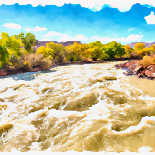
The San Juan River can be broken down into two main segments. The upper segment spans from Pagosa Springs to the town of Arboles, covering a distance of approximately 30 miles. This segment is known for its scenic beauty, with towering cliffs and beautiful rock formations. The lower segment spans from Arboles to the town of Navajo Dam, covering a distance of approximately 26 miles. This segment features more challenging rapids, including several Class III rapids.
One of the most notable rapids on the San Juan River is the "Razor Blade" rapid, located in the lower segment. This Class III rapid features a narrow channel with sharp rocks and challenging maneuvering. Other notable rapids on the San Juan River include "Rock Garden," "Hippie Hole," and "Pine Tree."
There are specific regulations in place for the San Juan River. All rafters must obtain a permit from the Bureau of Land Management (BLM) before embarking on their trip. Additionally, all rafters must follow Leave No Trace principles and pack out all trash and waste. Camping is only allowed in designated campsites along the river.
Overall, the San Juan River offers a thrilling whitewater experience for intermediate level rafters. With its beautiful scenery and challenging rapids, it is a must-visit destination for any whitewater enthusiast visiting Colorado.
Plan your run down to the hour
Same weather feed Snoflo's iOS app uses -- updated continuously from NOAA / yr.no. Watch the precipitation column on the meteogram; rain ahead of a run typically lifts flows 12-48 hours later depending on the basin.
Next 5 days, hour by hour
Temperature line with weather symbols on top, snow + rain accumulation as columns, humidity as a dotted line.
5-day forecast table
Every 3 hours, broken out across temperature, snow, rain, humidity, and wind. Each cell is colour-coded relative to the column min/max.
| Time | Condition | Temp (°F) | Snow (in) | Rain (in) | Humidity (%) | Wind (mps) | Wind dir |
|---|---|---|---|---|---|---|---|
| Loading detailed forecast… | |||||||
15-day temperature & precipitation
Daily temperatures, snow, and rain projected over the next two weeks -- the upstream story that drives next week's flows.
Regional streamflow levels
USGS streamgauges around San Juan River -- useful for spotting upstream pulses and gauging which tributary is contributing what.
| Streamgauge | Discharge | View |
|---|---|---|
| Mcelmo Creek Near Colorado-Utah State Line | 10 cfs | → |
| San Juan River At Four Corners | 2,070 cfs | → |
| San Juan River Near Bluff | 1,440 cfs | → |
| Chinle Creek Near Mexican Water | 17 cfs | → |
| Recapture Creek Near Blanding | · | → |
| Mcelmo Creek Above Trail Canyon Near Cortez | 31 cfs | → |
Plan a longer trip
The closest boat launches, other paddle runs, and campgrounds so a day on the water can grow into a full weekend.
Whitewater safety
- Check the flow before you run
- Use the linked-gauge card and Regional Flow panel above. Class ratings change with flow -- a Class III at low water can become Class IV+ at high water.
- Know your skill ceiling
- Pick runs comfortably below your ceiling. Cold-water and big-water runs raise the consequences of any mistake.
- Wear the right gear
- Helmet, PFD, drysuit / wetsuit when water is below 60°F. Throw bag, knife, and whistle on your person, not in the boat.
- Scout, set safety, and run with a team
- Scout new rapids on foot, set safety with throw bags above the consequence pool, and run with at least one other competent paddler.
- Respect the river
- Strainers, undercuts, low-head dams, and wood can kill at any class rating. When in doubt, portage.
Set push alerts in the Snoflo app
Save San Juan River as a favorite, set a discharge threshold (e.g. "alert me when flow hits 600 cfs"), and the iOS app pushes the moment the linked gauge crosses.
About San Juan River
What's the optimal flow for San Juan River?
The optimal flow depends on the section and the craft. Check the Run Details panel for the linked gauge and current status.
How fresh is the cfs reading on this page?
The linked USGS streamgauge reports continuously (every 15 minutes); Snoflo refreshes throughout the day. Hover the streamflow sparkline to read individual datapoints.
What's the whitewater class?
See the Run Details panel for the class rating Snoflo tracks for this run. Class ratings change with flow -- a Class III at low water can become Class IV in high water.
Where do I put in / take out?
Tap Directions in the hero above to open driving directions to the put-in. For shuttle planning, check the Nearby Boat Launches panel and the river run operator's site.
Can I get alerts when flows hit the optimal range?
Yes -- alerts are managed in the Snoflo iOS app. Favorite this run, set a discharge threshold, and you'll get a push the moment the gauge crosses.
Other runs near here
Snoflo-tracked paddle runs within driving distance of San Juan River.