Lower (Bottom Four)
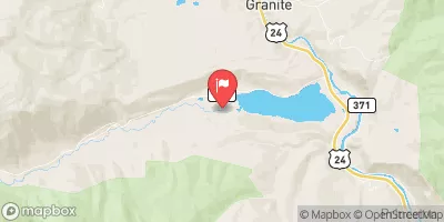
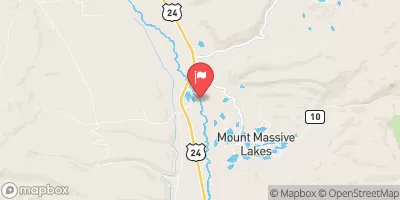
This short section of Lake Creek flows through a mini gorge that contain 4 class V drops. This is dangerous kayaking and if you attempt it you should be an expert. Always scout thoroughly checking for wood and other hazards as conditions change often here.
Suggested river levels for paddling this section of the Lake Creek are between a bare minimum of 150cfs and a high of 700cfs.
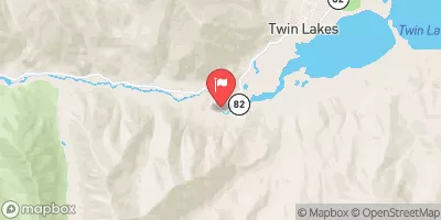
River conditions sourced from USGS 07084500, the Lake Creek Above Twin Lakes Reservoir
Remember only watercraft are permitted
at Lower (Bottom Four).
Run Stats
Status | Too Low |
Class Level | V to V+ |
Elevation | 9,315 ft |
Run Length | 1.0 Mi |
Streamflow Discharge | 36.4 cfs |
Gage Height | 2.3 ft |
Air Temperature | 32° |
River | Lake Creek |
Reporting Streamgage |
Lake Creek Above Twin Lakes Reservoir
USGS 07084500 |
Cauldron
Class V to V+ |
Paralyzer
Class V to V+ |
Kiss the Wall
Class V to V+ |
The Brain
Class V to V+ |
Gauge | Streamflow | Stage |
---|---|---|
Tarryall Creek At Upper Station
USGS 06696980 |
1 cfs | 4.7 ft |
Piney River Near State Bridge
USGS 09059500 |
16 cfs | 3.2 ft |
Bemrose-Hoosier Diversion Near Hoosier Pass
USGS 09044300 |
0 cfs | 0.0 ft |
South Fork Of Williams Fork Near Leal
USGS 09035900 |
12 cfs | 2.3 ft |
Piney River Below Piney Lake
USGS 09058500 |
1 cfs | 3.0 ft |
Kerber Cr Abv Little Kerber Cr Nr Villa Grove
USGS 08224500 |
9 cfs | 0.7 ft |
Monte Cristo Diversion Near Hoosier Pass
USGS 09041900 |
0 cfs | 0.0 ft |
Hunter Creek Near Aspen
USGS 09074000 |
8 cfs | 1.1 ft |
Williams Fork Below Williams Fork Reservoir
USGS 09038500 |
179 cfs | 1.9 ft |
Homestake Creek At Gold Park
USGS 09064000 |
5 cfs | 4.0 ft |
Snotel Site | Snowpack | 24hr Change |
---|---|---|
Phantom Valley
SNOTEL 688 |
20" | 3" |
Wolf Creek Summit
SNOTEL 874 |
70" | 0" |
Moon Pass
SNOTEL 1124 |
15" | 0" |
Never Summer
SNOTEL 1031 |
49" | 7" |
buena vista,co
SNOTEL BNVC2 |
1.88" | -0.11" |
Elliot Ridge
SNOTEL 1120 |
49" | 4" |
Summit Ranch
SNOTEL 802 |
17" | 2" |
south platte river
SNOTEL ANTC2 |
2.42" | -0.32" |
gothic
SNOTEL GTHC2 |
36.32" | -0.38" |
Chapman Tunnel
SNOTEL 1101 |
30" | 1" |
Beaver Ck Village
SNOTEL 1041 |
17" | 2" |
nathrop 1.9 wsw, co
SNOTEL CO-CF-54 |
1.28" | -0.1" |
co st forest st park
SNOTEL CSFC2 |
2.29" | 2.25" |
nathrop 3.3 wsw, co
SNOTEL CO-CF-19 |
1.31" | -0.06" |
Hoosier Pass
SNOTEL 531 |
46" | 1" |
Vail Mountain
SNOTEL 842 |
28" | 1" |
Jackwhacker Gulch
SNOTEL 935 |
39" | 3" |
Buckskin Joe
SNOTEL 938 |
33" | -1" |
Jones Pass
SNOTEL 970 |
39" | 6" |
Ivanhoe
SNOTEL 547 |
48" | 4" |
fairplay 2.7 wnw, co
SNOTEL CO-PK-15 |
26.53" | 1.43" |
Independence Pass
SNOTEL 542 |
40" | 4" |
Dry Lake
SNOTEL 457 |
31" | 9" |
Michigan Creek
SNOTEL 937 |
36" | 0" |
Bear River
SNOTEL 1061 |
29" | 4" |
crested butte 6.2 n, co
SNOTEL CO-GN-18 |
29.46" | -0.07" |
Butte
SNOTEL 380 |
23" | 1" |
yampa 5.1 s, co
SNOTEL CO-RT-26 |
5.42" | 2.55" |
tabernash 2.7 nw, co
SNOTEL CO-GR-68 |
0.36" | 0" |
Tower
SNOTEL 825 |
91" | 12" |
Crosho
SNOTEL 426 |
20" | 5" |
Grayback
SNOTEL 1058 |
8" | 0" |
Hayden Pass
SNOTEL 1102 |
33" | -3" |
Brumley
SNOTEL 369 |
33" | 2" |
Lily Pond
SNOTEL 580 |
23" | 0" |
Loveland Basin
SNOTEL 602 |
60" | 5" |
Rawah
SNOTEL 1032 |
23" | 6" |
Sargents Mesa
SNOTEL 1128 |
35" | 0" |
Buffalo Park
SNOTEL 913 |
38" | 4" |
Park Cone
SNOTEL 680 |
24" | 0" |
Upper San Juan
SNOTEL 840 |
56" | 1" |
vail 3.5 e, co
SNOTEL CO-EG-53 |
16.4" | 0.01" |
Fremont Pass
SNOTEL 485 |
48" | 2" |
silverthorne 21 nw, co
SNOTEL CO-SU-35 |
0.37" | 0" |
silverthorne 2.1 wsw, co
SNOTEL CO-SU-6 |
13.4" | 0.36" |
climax coop
SNOTEL CLXC2 |
36.92" | 0.39" |
Lynx Pass
SNOTEL 607 |
14" | 1" |
Arapaho Ridge
SNOTEL 1030 |
57" | 6" |
Kiln
SNOTEL 556 |
24" | 3" |
Upper Taylor
SNOTEL 1141 |
25" | 0" |
Rabbit Ears
SNOTEL 709 |
40" | 8" |
Saint Elmo
SNOTEL 1100 |
26" | 0" |
Middle Creek
SNOTEL 624 |
44" | 0" |
Campground | Campsites | Reservations | Toilets | Showers | Elevation |
---|---|---|---|---|---|
Belle of Colorado | 19 | 9,924 ft | |||
North Fork Reservoir | 9 | 11,459 ft | |||
Dexter | 24 | 9,271 ft | |||
Tigiwon | 9 | 9,994 ft | |||
Mayqueen | 27 | 9,884 ft | |||
Cottonwood Lake | 24 | 9,586 ft | |||
Lakeview - Twin Lakes | 27 | 9,511 ft | |||
Father Dyer | 26 | 9,953 ft | |||
Pitkin | 22 | 9,362 ft | |||
Collegiate Peaks | 56 | 9,837 ft | |||
Halfmoon East | 6 | 9,923 ft | |||
Twin Peaks | 37 | 9,615 ft | |||
Parry Peak | 26 | 9,430 ft | |||
Blodgett | 6 | 8,836 ft | |||
Mirror Lake - Almont | 10 | 11,007 ft | |||
Molly Brown | 49 | 9,897 ft | |||
Iron City | 15 | 9,928 ft | |||
Halfmoon | 7 | 10,294 ft | |||
Camp Hale Memorial | 21 | 9,318 ft | |||
Quartz | 10 | 9,849 ft | |||
Hornsilver | 7 | 8,843 ft | |||
Middle Quartz | 7 | 10,230 ft | |||
Baby Doe | 50 | 9,913 ft | |||
Silver Dollar | 43 | 9,905 ft | |||
Gold Park | 11 | 9,246 ft | |||
Matchless | 17 | 9,903 ft | |||
Halfmoon West | 16 | 9,932 ft | |||
Rivers End | 15 | 9,356 ft | |||
Elbert Creek | 17 | 10,095 ft | |||
White Star | 66 | 9,256 ft | |||
Tabor | 44 | 9,897 ft |
Ski Area | Snowpack | Air Temperature | 5 Day Forecast |
---|---|---|---|
Ski Cooper | 33" | 27° | 10.52" |
Monarch Ski & Snowboard Area | 32" | 27° | 8" |
Vail | 28" | 31° | 7.52" |
Copper Mountain Resort | 29" | 34° | 10.28" |
Beaver Creek Resort | 18" | 42° | 6.58" |
River Run | Streamflow | Length | Class |
---|---|---|---|
State Bridge to Burns | 739.0cfs | 20.0 Mi | I to II+ |
Upper Ten Mile | 42.9cfs | 2.0 Mi | IV+ to V |
Lower Ten Mile | 41.7cfs | 3.0 Mi | II to III |
Lower Eagle (Edwards Water Plant to Eagle) | 134.0cfs | 17.0 Mi | III- to III+ |
Upper Gore Creek | 57.6cfs | 4.0 Mi | II+ to III |
Pine Creek (Granite to Numbers) | 233.0cfs | 6.0 Mi | III+ to V- |
Dowd Chute | 65.5cfs | 1.0 Mi | III+ to IV+ |
Browns Canyon (Fisherman's Bridge to Stone Bridge) | 221.0cfs | 13.0 Mi | III to IV- |
Upper Gore Creek | 57.6cfs | 4.0 Mi | II+ to III |
Upper Blue (Blue River CG to Columbine Landing) | 246.0cfs | 3.0 Mi | III to IV- |
Lower (Bottom Four) | 36.4cfs | 1.0 Mi | V to V+ |
Milk Run | 233.0cfs | 4.0 Mi | II+ to III- |
Buena Vista Whitewater Park | 221.0cfs | 1.0 Mi | II+ to III+ |
Numbers | 233.0cfs | 4.9 Mi | III+ to IV+ |
Lower Eagle (Edwards Water Plant to Eagle) | 134.0cfs | 17.0 Mi | III- to III+ |
Upper-Upper Ten Mile | 42.9cfs | 3.0 Mi | III+ to IV- |
Clear Creek of the Arkansas | 12.2cfs | 2.5 Mi | IV+ to V- |
Middle Ten Mile | 42.9cfs | 3.0 Mi | III+ to IV |
Fractions | 221.0cfs | 7.0 Mi | III to III+ |
The Upper | 16.9cfs | 8.0 Mi | V to V+ |